
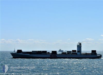
OOCL NORFOLK
Container Ship
Current Trip
| Trip Time | 2 days |
|---|---|
| Trip Distance | 1146.11 nm |
| AVG Speed | 15.3 Knots |
| MAX Speed | 19.8 Knots |
| Draught | 10.6 m |
| AVG Wind | 16.7 knots |
| MAX Wind | 28.8 knots |
| MIN Temp | 3.1°C / 37.58°F |
| MAX Temp | 22.4°C / 72.32°F |
| Position Received | 2 m ago |
Current Position
| Longitude | --- |
|---|---|
| Latitude | --- |
| Status | Moored |
| Speed | |
| Course | 323° |
| Area | South China Sea |
| Station | T-AIS |
| Position Received | 2 m ago |
Info
Information
The current position of OOCL NORFOLK is in South China Sea with coordinates 22.57139° / 120.30960° as reported on 2025-12-06 09:03 by AIS to our vessel tracker app. The vessel's current speed is 0 Knots and is currently inside the port of KAOHSIUNG.
The vessel OOCL NORFOLK (IMO: 9440045, MMSI: 477189700) is a Container Ship that was built in 2009 ( 16 years old ). It's sailing under the flag of [HK] Hong Kong.
In this page you can find informations about the vessels current position, last detected port calls, and current voyage information. If the vessels is not in coverage by AIS you will find the latest position.
The current position of OOCL NORFOLK is detected by our AIS receivers and we are not responsible for the reliability of the data. The last position was recorded while the vessel was in Coverage by the Ais receivers of our vessel tracking app.
The current draught of OOCL NORFOLK as reported by AIS is 10.6 meters
Weather
| Temperature | 23°C / 73.4°F |
|---|---|
| Wind Speed | 7 knots |
| Direction | 297° WNW |
| Pressure | 1016.3 hPa |
| Humidity | 66.6 % |
| Cloud Coverage | 3 % |
Featured Company
Last Port Calls
| Port | Arrival | Departure | Time In Port |
|---|---|---|---|
| 2025-12-06 14:41 | |||
| 2025-12-03 07:17 | 2025-12-03 19:53 | 12 h | |
| 2025-12-02 07:45 | 2025-12-02 16:25 | 8 h | |
| 2025-12-01 18:09 | 2025-12-02 06:53 | 12 h | |
| 2025-11-29 13:42 | 2025-12-01 01:29 | 1 d | |
| 2025-11-25 17:09 | 2025-11-26 02:21 | 9 h | |
| 2025-11-23 21:20 | 2025-11-24 18:01 | 20 h | |
| 2025-11-16 08:43 | 2025-11-18 07:19 | 1 d | |
| 2025-11-14 06:57 | 2025-11-15 00:19 | 17 h | |
| 2025-11-09 09:35 | 2025-11-10 05:51 | 20 h |
Last Trips
| Origin | Departure | Destination | Arrival | Distance | |
|---|---|---|---|---|---|
| 2025-12-03 19:53 | 2025-12-06 14:41 | 1146.11 nm | |||
| 2025-12-02 16:25 | 2025-12-03 07:17 | 238.34 nm | |||
| 2025-12-02 06:53 | 2025-12-02 07:45 | 8.02 nm | |||
| 2025-12-01 01:29 | 2025-12-01 18:09 | 216.73 nm | |||
| 2025-11-26 02:21 | 2025-11-29 13:42 | 1369.11 nm | |||
| 2025-11-24 18:01 | 2025-11-25 17:09 | 375.56 nm | |||
| 2025-11-18 07:19 | 2025-11-23 21:20 | 1915.56 nm | |||
| 2025-11-15 00:19 | 2025-11-16 08:43 | 569.58 nm | |||
| 2025-11-10 05:51 | 2025-11-14 06:57 | 1472.92 nm | |||
| 2025-11-08 08:45 | 2025-11-09 09:35 | 374.50 nm |
Events
| Time | Event | Details | Position / Dest | Info |
|---|---|---|---|---|
| 2025-12-06 08:21 | Status Changed | Moored Default |
22.57113 / 120.30960
[TW] KAOHSIUNG
|
Speed: Course: 322° |
| 2025-12-06 08:09 | Status Changed | Default Moored |
22.57110 / 120.30963
[TW] KAOHSIUNG
|
Speed: Course: 322° |
| 2025-12-06 07:24 | Status Changed | Moored Under way using engine |
22.57114 / 120.30961
[TW] KAOHSIUNG
|
Speed: 0.2 kn Course: 322° |
| 2025-12-06 07:18 | STOP Moving |
22.57069 / 120.30953
[TW] KAOHSIUNG
|
Speed: 0.3 kn Course: 321° |
|
| 2025-12-06 06:41 | PORT ARRIVAL |
|
22.54433 / 120.28315
[TW] KAOHSIUNG
|
Speed: 10.5 kn Course: 73.2° |
| 2025-12-06 05:08 | Draught Changed | 10.6 10.7 |
22.66777 / 120.10206
TW KHH
|
Speed: 10.6 kn Course: 149.6° |
| 2025-12-06 03:36 | Change Sea Area | Taiwanese part of the South China Sea Taiwanese part of the Eastern China Sea |
22.93714 / 119.96279
South China Sea
TW KHH
|
Speed: 16.6 kn Course: 159.9° |
| 2025-12-06 03:36 | Status Changed | Under way using engine Default |
22.93809 / 119.96242
TW KHH
|
Speed: 16.5 kn Course: 160° |
| 2025-12-06 03:28 | IN Coverage |
22.93714 / 119.96279
South China Sea
TW KHH
|
Speed: 16.6 kn Course: 159.9° |
|
| 2025-12-05 14:55 | OUT of Coverage |
25.46525 / 121.19197
Eastern China Sea
TW KHH
|
Speed: 16.3 kn Course: 230.3° |