
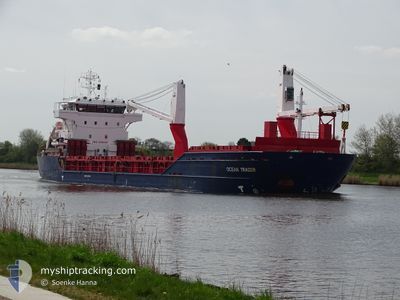
OCEAN TRADER
General Cargo
Current Trip
| Time Travelled | 2 days |
|---|---|
| Remaining Time | 5 days |
| Distance Travelled | 518.33 nm |
| Remaining Distance | 1181.86 nm |
| AVG Speed | 8.9 Knots |
| MAX Speed | 14.2 Knots |
| AVG Wind | 10.9 knots |
| MAX Wind | 14.5 knots |
| MIN Temp | 1.6°C / 34.88°F |
| MAX Temp | 8.9°C / 48.02°F |
| Draught | 8.2 m |
| Position Received | Now |
Current Position
| Longitude | --- |
|---|---|
| Latitude | --- |
| Status | Under way using engine |
| Speed | 7.7 Knots |
| Course | 258.1° |
| Area | English Channel |
| Station | T-AIS |
| Position Received | Now |
Info
Information
The current position of OCEAN TRADER is in English Channel with coordinates 50.29784° / -1.10799° as reported on 2025-03-05 12:14 by AIS to our vessel tracker app. The vessel's current speed is 7.7 Knots and is heading at the port of CASABLANCA. The estimated time of arrival as calculated by MyShipTracking vessel tracking app is 2025-03-11 08:19 LT
The vessel OCEAN TRADER (IMO: 9349461, MMSI: 255805916) is a General Cargo that was built in 2011 ( 14 years old ). It's sailing under the flag of [PT] Portugal.
In this page you can find informations about the vessels current position, last detected port calls, and current voyage information. If the vessels is not in coverage by AIS you will find the latest position.
The current position of OCEAN TRADER is detected by our AIS receivers and we are not responsible for the reliability of the data. The last position was recorded while the vessel was in Coverage by the Ais receivers of our vessel tracking app.
The current draught of OCEAN TRADER as reported by AIS is 8.2 meters
Weather
| Temperature | 8.8°C / 47.84°F |
|---|---|
| Wind Speed | 9 knots |
| Direction | 173° S |
| Pressure | 1022.9 hPa |
| Humidity | 78.3 % |
| Cloud Coverage | --- |
Featured Company
Last Port Calls
| Port | Arrival | Departure | Time In Port |
|---|---|---|---|
| 2025-03-03 02:46 | 2025-03-03 03:54 | 1 h | |
| 2025-02-24 10:57 | 2025-02-26 18:34 | 2 d | |
| 2025-02-22 04:09 | 2025-02-22 18:13 | 14 h | |
| 2025-02-18 13:53 | 2025-02-19 11:36 | 21 h | |
| 2025-01-31 16:14 | 2025-02-02 22:44 | 2 d | |
| 2025-01-24 10:19 | 2025-01-31 03:13 | 6 d | |
| 2025-01-07 20:57 | 2025-01-10 03:37 | 2 d | |
| 2025-01-01 03:35 | 2025-01-03 03:48 | 2 d |
Last Trips
| Origin | Departure | Destination | Arrival | Distance | |
|---|---|---|---|---|---|
| 2025-02-26 20:34 | 2025-03-03 03:46 | 954.82 nm | |||
| 2025-02-22 20:13 | 2025-02-24 12:57 | 259.07 nm | |||
| 2025-02-19 12:36 | 2025-02-22 06:09 | 742.86 nm | |||
| 2025-02-02 23:44 | 2025-02-18 14:53 | 2907.14 nm | |||
| 2025-01-31 04:13 | 2025-01-31 17:14 | 148.58 nm | |||
| 2025-01-10 05:37 | 2025-01-24 11:19 | 2988.52 nm | |||
| 2025-01-03 04:48 | 2025-01-07 22:57 | 1015.49 nm | |||
| 2024-12-19 07:45 | 2025-01-01 04:35 | 2990.40 nm |
Events
| Time | Event | Details | Position / Dest | Info |
|---|---|---|---|---|
| 2025-03-05 01:41 | Change Sea Area | United Kingdom part of the English Channel United Kingdom part of the North Sea |
51.07334 / 1.47120
English Channel
MACAS
|
Speed: 11 kn Course: 235.8° |
| 2025-03-04 20:53 | Change Sea Area | United Kingdom part of the North Sea Belgian part of the North Sea |
51.84717 / 2.51863
North Sea
MACAS
|
Speed: 11.1 kn Course: 220.9° |
| 2025-03-04 20:47 | Detected in Sea | Belgian part of the North Sea |
51.86083 / 2.53763
North Sea
MACAS
|
Speed: 10.9 kn Course: 218.3° |
| 2025-03-04 18:10 | Status Changed | Under way using engine Default |
52.19791 / 2.98100
MACAS
|
Speed: 9 kn Course: 216° |
| 2025-03-04 18:06 | Status Changed | Default Under way using engine |
52.20572 / 2.99034
MACAS
|
Speed: 9 kn Course: 216.6° |
| 2025-03-04 17:59 | Status Changed | Under way using engine Default |
52.21950 / 3.00694
MACAS
|
Speed: 9 kn Course: 217° |
| 2025-03-04 17:58 | Status Changed | Default Under way using engine |
52.22188 / 3.00982
MACAS
|
Speed: 9 kn Course: 215.7° |
| 2025-03-04 13:26 | Status Changed | Under way using engine Default |
52.84347 / 3.77862
MACAS
|
Speed: 11.9 kn Course: 213° |
| 2025-03-04 13:16 | Status Changed | Default Under way using engine |
52.87209 / 3.81040
MACAS
|
Speed: 12 kn Course: 214.2° |
| 2025-03-04 13:10 | Status Changed | Under way using engine Default |
52.88640 / 3.82635
MACAS
|
Speed: 11.9 kn Course: 214° |