
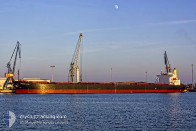
OCEAN LION
Bulk Carrier
Current Trip
| Time Travelled | 42 days |
|---|---|
| Remaining Time | --- |
| Distance Travelled | 9678.36 nm |
| Remaining Distance | --- |
| AVG Speed | 9.7 Knots |
| MAX Speed | 12.3 Knots |
| AVG Wind | 12.3 knots |
| MAX Wind | 26 knots |
| MIN Temp | 16°C / 60.8°F |
| MAX Temp | 30.6°C / 87.08°F |
| Draught | 12.9 m |
| Position Received | 4 d ago |
Current Position
| Longitude | 104.21860° |
|---|---|
| Latitude | 1.26593° |
| Status | Under way using engine |
| Speed | 8.4 Knots |
| Course | 89° |
| Area | Singapore Strait |
| Station | T-AIS |
| Position Received | 4 d ago |
Info
Information
The current position of OCEAN LION is in Singapore Strait with coordinates 1.26593° / 104.21860° as reported on 2024-05-05 13:09 by AIS to our vessel tracker app. The vessel's current speed is 8.4 Knots and is heading at the port of LIANYUNGANG. The estimated time of arrival as calculated by MyShipTracking vessel tracking app is 2024-05-14 15:00 LT
The vessel OCEAN LION (IMO: 9296248, MMSI: 636014514) is a Bulk Carrier that was built in 2005 ( 19 years old ). It's sailing under the flag of [LR] Liberia.
In this page you can find informations about the vessels current position, last detected port calls, and current voyage information. If the vessels is not in coverage by AIS you will find the latest position.
The current position of OCEAN LION is detected by our AIS receivers and we are not responsible for the reliability of the data. The last position was recorded while the vessel was in Coverage by the Ais receivers of our vessel tracking app.
The current draught of OCEAN LION as reported by AIS is 12.9 meters
Weather
| Temperature | 29°C / 84.2°F |
|---|---|
| Wind Speed | 9 knots |
| Direction | 67° ENE |
| Pressure | 1010.6 hPa |
| Humidity | 78.4 % |
| Cloud Coverage | 6 % |
Featured Company
Events
| Time | Event | Details | Position / Dest | Info |
|---|---|---|---|---|
| 2024-05-05 13:16 | Status Changed | Default Under way using engine |
1.26810 / 104.23663
LIANYUNGANG
|
Speed: 8.4 kn Course: 89° |
| 2024-05-05 13:09 | OUT of Coverage |
1.26593 / 104.21860
Singapore Strait
LIANYUNGANG
|
Speed: 8.4 kn Course: 89° |
|
| 2024-05-05 13:05 | Status Changed | Under way using engine Default |
1.26548 / 104.21090
LIANYUNGANG
|
Speed: 8.2 kn Course: 80° |
| 2024-05-05 12:52 | Status Changed | Default Under way using engine |
1.26173 / 104.18147
LIANYUNGANG
|
Speed: 8.4 kn Course: 82° |
| 2024-05-05 12:40 | Change Sea Area | Malaysian part of the Singapore Strait Indonesian part of the Singapore Strait |
1.25842 / 104.15340
Singapore Strait
LIANYUNGANG
|
Speed: 8.5 kn Course: 83° |
| 2024-05-05 10:50 | Change Sea Area | Indonesian part of the Singapore Strait Singaporean part of the Singapore Strait |
1.21802 / 103.91245
Singapore Strait
LIANYUNGANG
|
Speed: 6.5 kn Course: 140° |
| 2024-05-05 10:22 | START Moving | 2.71 nm, East of SINGAPORE |
1.24818 / 103.89873
LIANYUNGANG
|
Speed: 3.1 kn Course: 120° |
| 2024-05-05 10:14 | Draught Changed | 12.9 12.8 |
1.25167 / 103.89452
LIANYUNGANG
|
Speed: 1.9 kn Course: 122° |
| 2024-05-05 10:14 | Destination Changed | LIANYUNGANG SGSIN |
1.25167 / 103.89452
LIANYUNGANG
|
Speed: 1.9 kn Course: 122° |
| 2024-05-05 10:14 | ETA Changed | 2024/05/14 15:00 2024/05/04 17:45 |
1.25167 / 103.89452
LIANYUNGANG
|
Speed: 1.9 kn Course: 122° |