
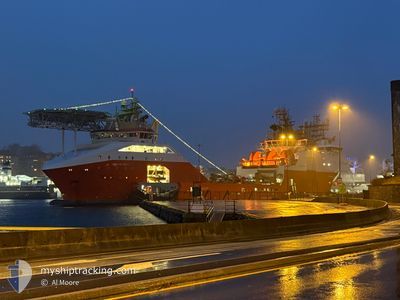
NORMAND DROTT
Anchor Handling Vessel
Current Position
| Longitude | --- |
|---|---|
| Latitude | --- |
| Status | Under way using engine |
| Speed | |
| Course | 198° |
| Area | North Sea |
| Station | T-AIS |
| Position Received | 1 m ago |
Info
Information
The current position of NORMAND DROTT is in North Sea with coordinates 60.83579° / 5.08630° as reported on 2025-12-24 01:23 by AIS to our vessel tracker app. The vessel's current speed is 0 Knots and is currently inside the port of SLOVAG.
The vessel NORMAND DROTT (IMO: 9447964, MMSI: 257468000) is a Anchor Handling Vessel that was built in 2010 ( 15 years old ). It's sailing under the flag of [NO] Norway.
In this page you can find informations about the vessels current position, last detected port calls, and current voyage information. If the vessels is not in coverage by AIS you will find the latest position.
The current position of NORMAND DROTT is detected by our AIS receivers and we are not responsible for the reliability of the data. The last position was recorded while the vessel was in Coverage by the Ais receivers of our vessel tracking app.
The current draught of NORMAND DROTT as reported by AIS is 7.4 meters
Weather
| Temperature | 5.1°C / 41.18°F |
|---|---|
| Wind Speed | 7 knots |
| Direction | 165° SSE |
| Pressure | 1040.1 hPa |
| Humidity | 73.5 % |
| Cloud Coverage | 100 % |
Featured Company
Last Port Calls
| Port | Arrival | Departure | Time In Port |
|---|---|---|---|
| 2025-12-23 09:19 | |||
| 2025-12-23 07:48 | 2025-12-23 09:07 | 1 h | |
| 2025-12-22 11:07 | 2025-12-22 11:23 | 16 m | |
| 2025-12-18 09:30 | 2025-12-18 13:21 | 3 h | |
| 2025-12-18 04:50 | 2025-12-18 09:05 | 4 h | |
| 2025-12-16 15:57 | 2025-12-17 23:47 | 1 d | |
| 2025-12-13 19:05 | 2025-12-14 14:08 | 19 h | |
| 2025-12-13 06:19 | 2025-12-13 14:03 | 7 h | |
| 2025-12-13 00:35 | 2025-12-13 06:13 | 5 h | |
| 2025-12-12 21:31 | 2025-12-13 00:31 | 3 h |
Last Trips
| Origin | Departure | Destination | Arrival | Distance | |
|---|---|---|---|---|---|
| 2025-12-23 09:07 | 2025-12-23 09:19 | 0.27 nm | |||
| 2025-12-22 11:23 | 2025-12-23 07:48 | 218.89 nm | |||
| 2025-12-18 13:21 | 2025-12-22 11:07 | 575.71 nm | |||
| 2025-12-18 09:05 | 2025-12-18 09:30 | 2.38 nm | |||
| 2025-12-17 23:47 | 2025-12-18 04:50 | 46.08 nm | |||
| 2025-12-14 14:08 | 2025-12-16 15:57 | 317.57 nm | |||
| 2025-12-13 14:03 | 2025-12-13 19:05 | 45.75 nm | |||
| 2025-12-13 06:13 | 2025-12-13 06:19 | 0.24 nm | |||
| 2025-12-13 00:31 | 2025-12-13 00:35 | 0.41 nm | |||
| 2025-12-11 20:02 | 2025-12-12 21:31 | 217.59 nm |
Events
| Time | Event | Details | Position / Dest | Info |
|---|---|---|---|---|
| 2025-12-23 08:24 | STOP Moving |
60.83556 / 5.08678
[NO] SLOVAG
|
Speed: 0.3 kn Course: 196° |
|
| 2025-12-23 08:19 | PORT ARRIVAL |
|
60.83470 / 5.08617
[NO] SLOVAG
|
Speed: 0.9 kn Course: 193° |
| 2025-12-23 08:07 | PORT DEPARTURE |
|
60.83430 / 5.07949
SLOVAAG
|
Speed: 3.4 kn Course: 140° |
| 2025-12-23 08:05 | START Moving |
60.83535 / 5.07742
[NO] SLOVAG
|
Speed: 3.4 kn Course: 140° |
|
| 2025-12-23 06:51 | STOP Moving |
60.83862 / 5.07455
[NO] SLOVAG
|
Speed: 0.1 kn Course: 164° |
|
| 2025-12-23 06:48 | PORT ARRIVAL |
|
60.83885 / 5.07184
[NO] SLOVAG
|
Speed: 4.2 kn Course: 86° |
| 2025-12-23 04:58 | Detected in Sea | Norwegian part of the North Sea |
60.99896 / 4.79418
North Sea
SLOVAAG
|
Speed: 10.8 kn Course: 234.2° |
| 2025-12-22 10:51 | Destination Changed | SLOVAAG KRISTIANSUND |
63.13922 / 7.69433
SLOVAAG
|
Speed: 10.6 kn Course: 250.8° |
| 2025-12-22 10:51 | ETA Changed | 2025/12/23 08:00 2025/12/22 11:30 |
63.13922 / 7.69433
SLOVAAG
|
Speed: 10.6 kn Course: 250.8° |
| 2025-12-22 10:23 | PORT DEPARTURE |
|
63.12327 / 7.77172
KRISTIANSUND
|
Speed: 6.4 kn Course: 54° |