
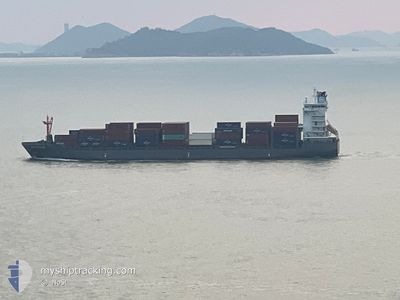
NORDPUMA
Cargo A
Current Trip
| Time Travelled | 6 days |
|---|---|
| Remaining Time | --- |
| Distance Travelled | 1235.69 nm |
| Remaining Distance | 690.90 nm |
| AVG Speed | 10.2 Knots |
| MAX Speed | 16.5 Knots |
| AVG Wind | 9 knots |
| MAX Wind | 20.2 knots |
| MIN Temp | 22.3°C / 72.14°F |
| MAX Temp | 29.6°C / 85.28°F |
| Draught | 8.1 m |
| Position Received | 6 d ago |
Current Position
| Longitude | --- |
|---|---|
| Latitude | --- |
| Status | Under way using engine |
| Speed | 11.5 Knots |
| Course | 266.5° |
| Area | Caribbean Sea |
| Station | T-AIS |
| Position Received | 6 d ago |
Info
Information
The current position of NORDPUMA is in Caribbean Sea with coordinates 10.30159° / -76.00644° as reported on 2025-12-03 19:46 by AIS to our vessel tracker app. The vessel's current speed is 11.5 Knots and is heading at the port of MOIN. The estimated time of arrival as calculated by MyShipTracking vessel tracking app is 2025-12-05 11:00 LT
The vessel NORDPUMA (IMO: 9626259, MMSI: 212289000) is a Cargo A It's sailing under the flag of [CY] Cyprus.
In this page you can find informations about the vessels current position, last detected port calls, and current voyage information. If the vessels is not in coverage by AIS you will find the latest position.
The current position of NORDPUMA is detected by our AIS receivers and we are not responsible for the reliability of the data. The last position was recorded while the vessel was in Coverage by the Ais receivers of our vessel tracking app.
The current draught of NORDPUMA as reported by AIS is 8.1 meters
Weather
| Temperature | 22.4°C / 72.32°F |
|---|---|
| Wind Speed | 2 knots |
| Direction | 246° WSW |
| Pressure | 1014.1 hPa |
| Humidity | 93.2 % |
| Cloud Coverage | 39 % |
Featured Company
Last Port Calls
| Port | Arrival | Departure | Time In Port |
|---|---|---|---|
| 2025-12-02 18:04 | 2025-12-03 12:09 | 18 h | |
| 2025-11-29 15:11 | 2025-11-30 01:15 | 10 h | |
| 2025-11-28 06:55 | 2025-11-29 00:51 | 17 h | |
| 2025-11-19 16:42 | 2025-11-20 10:22 | 17 h | |
| 2025-11-16 11:02 | 2025-11-17 03:26 | 16 h | |
| 2025-11-14 07:15 | 2025-11-14 20:30 | 13 h | |
| 2025-11-04 18:17 | 2025-11-05 17:05 | 22 h | |
| 2025-11-01 02:25 | 2025-11-01 15:30 | 13 h | |
| 2025-10-30 20:42 | 2025-10-31 18:38 | 21 h | |
| 2025-10-21 15:36 | 2025-10-22 13:47 | 22 h |
Most Visited Ports (Last year)
| Port | Arrivals | |
|---|---|---|
| 19 | ||
| 17 | ||
| 16 | ||
| 7 | ||
| 6 | ||
| 5 |
Last Trips
| Origin | Departure | Destination | Arrival | Distance | |
|---|---|---|---|---|---|
| 2025-11-30 01:15 | 2025-12-02 18:04 | 869.53 nm | |||
| 2025-11-29 00:51 | 2025-11-29 15:11 | 74.49 nm | |||
| 2025-11-20 10:22 | 2025-11-28 06:55 | 1252.80 nm | |||
| 2025-11-17 03:26 | 2025-11-19 16:42 | 879.27 nm | |||
| 2025-11-14 20:30 | 2025-11-16 11:02 | 111.03 nm | |||
| 2025-11-05 17:05 | 2025-11-14 07:15 | 1254.25 nm | |||
| 2025-11-01 15:30 | 2025-11-04 18:17 | 874.91 nm | |||
| 2025-10-31 18:38 | 2025-11-01 02:25 | 62.74 nm | |||
| 2025-10-22 13:47 | 2025-10-30 20:42 | 1248.14 nm | |||
| 2025-10-19 04:06 | 2025-10-21 15:36 | 868.77 nm |
Events
| Time | Event | Details | Position / Dest | Info |
|---|---|---|---|---|
| 2025-12-09 00:35 | STOP Moving | 6.64 nm, North of PUERTO BARRIOS |
15.84720 / -88.61314
CR MOB
|
Speed: 0.1 kn Course: 74° |
| 2025-12-06 03:30 | START Moving | 1.06 nm, West of MOIN |
10.00833 / -83.09666
CR MOB
|
Speed: 4 kn Course: -1° |
| 2025-12-05 20:08 | STOP Moving | 1.27 nm, West of MOIN |
10.01121 / -83.09991
CR MOB
|
Speed: Course: 106° |
| 2025-12-05 19:12 | START Moving | 2.17 nm, North East of MOIN |
10.03333 / -83.05334
CR MOB
|
Speed: 5 kn Course: 264° |
| 2025-12-05 16:59 | STOP Moving | 3.41 nm, North East of MOIN |
10.05584 / -83.04862
CR MOB
|
Speed: 0.3 kn Course: 319° |
| 2025-12-03 19:51 | Status Changed | Default Under way using engine |
10.30066 / -76.02044
CR MOB
|
Speed: 11.5 kn Course: 266.5° |
| 2025-12-03 19:46 | OUT of Coverage |
10.30159 / -76.00644
Caribbean Sea
CR MOB
|
Speed: 11.5 kn Course: 266.5° |
|
| 2025-12-03 17:54 | Draught Changed | 8.1 8.4 |
10.31404 / -75.63720
CR MOB
|
Speed: 11 kn Course: 266.5° |
| 2025-12-03 17:54 | Destination Changed | CR MOB CO CTG |
10.31404 / -75.63720
CR MOB
|
Speed: 11 kn Course: 266.5° |
| 2025-12-03 17:54 | ETA Changed | 2025/12/05 17:00 2025/12/02 21:30 |
10.31404 / -75.63720
CR MOB
|
Speed: 11 kn Course: 266.5° |