
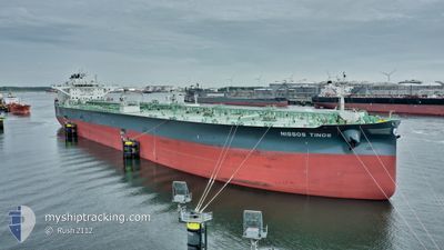
NISSOS TINOS
Tanker
Current Trip
FOR ORDERS
| Time Travelled | 22 h, 34 mins |
|---|---|
| Remaining Time | --- |
| Distance Travelled | 14.25 nm |
| Remaining Distance | --- |
| AVG Speed | 5.5 Knots |
| MAX Speed | 8.1 Knots |
| AVG Wind | 23.9 knots |
| MAX Wind | 32 knots |
| MIN Temp | 4.7°C / 40.46°F |
| MAX Temp | 8.5°C / 47.3°F |
| Draught | 9.3 m |
| Position Received | 2 m ago |
Current Position
| Longitude | --- |
|---|---|
| Latitude | --- |
| Status | At anchor |
| Speed | 1.3 Knots |
| Course | 293° |
| Area | Baltic Sea |
| Station | T-AIS |
| Position Received | 2 m ago |
Info
Information
The current position of NISSOS TINOS is in Baltic Sea with coordinates 54.46156° / 18.87152° as reported on 2024-12-16 02:05 by AIS to our vessel tracker app. The vessel's current speed is 1.3 Knots
The vessel NISSOS TINOS (IMO: 9886782, MMSI: 538008916) is a Tanker It's sailing under the flag of [MH] Marshall Is.
In this page you can find informations about the vessels current position, last detected port calls, and current voyage information. If the vessels is not in coverage by AIS you will find the latest position.
The current position of NISSOS TINOS is detected by our AIS receivers and we are not responsible for the reliability of the data. The last position was recorded while the vessel was in Coverage by the Ais receivers of our vessel tracking app.
The current draught of NISSOS TINOS as reported by AIS is 9.3 meters
Weather
| Temperature | 8.5°C / 47.3°F |
|---|---|
| Wind Speed | 32 knots |
| Direction | 272° W |
| Pressure | 1003.9 hPa |
| Humidity | 87.3 % |
| Cloud Coverage | 100 % |
Featured Company
Events
| Time | Event | Details | Position / Dest | Info |
|---|---|---|---|---|
| 2024-12-15 19:06 | Status Changed | At anchor Default |
54.46117 / 18.87121
FOR ORDERS
|
Speed: 0.5 kn Course: 287° |
| 2024-12-15 19:03 | Status Changed | Default At anchor |
54.46124 / 18.87127
FOR ORDERS
|
Speed: 1 kn Course: 294° |
| 2024-12-15 16:09 | Status Changed | At anchor Default |
54.46018 / 18.87098
FOR ORDERS
|
Speed: 0.2 kn Course: 306° |
| 2024-12-15 16:03 | Status Changed | Default At anchor |
54.46021 / 18.87096
FOR ORDERS
|
Speed: 1.3 kn Course: 307° |
| 2024-12-15 15:51 | Status Changed | At anchor Default |
54.46002 / 18.87094
FOR ORDERS
|
Speed: 0.9 kn Course: 306° |
| 2024-12-15 15:48 | Status Changed | Default At anchor |
54.46009 / 18.87089
FOR ORDERS
|
Speed: 0.2 kn Course: 306° |
| 2024-12-15 08:06 | Status Changed | At anchor Default |
54.46036 / 18.87087
FOR ORDERS
|
Speed: 0.5 kn Course: 275° |
| 2024-12-15 08:03 | Status Changed | Default At anchor |
54.46086 / 18.87139
FOR ORDERS
|
Speed: 0.5 kn Course: 283° |
| 2024-12-15 06:42 | Status Changed | At anchor Default |
54.45982 / 18.87030
FOR ORDERS
|
Speed: 0.5 kn Course: 312° |
| 2024-12-15 06:39 | Status Changed | Default At anchor |
54.45972 / 18.87045
FOR ORDERS
|
Speed: 0.2 kn Course: 292° |