
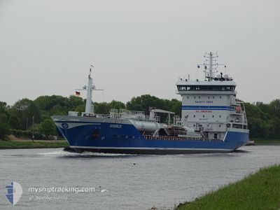
NIMBUS
Oil/Chemical Tanker
Current Trip
| Time Travelled | 2 days |
|---|---|
| Remaining Time | 1 day |
| Distance Travelled | 606.93 nm |
| Remaining Distance | 226.71 nm |
| AVG Speed | 9.4 Knots |
| MAX Speed | 12 Knots |
| AVG Wind | 19.9 knots |
| MAX Wind | 29.7 knots |
| MIN Temp | 3.5°C / 38.3°F |
| MAX Temp | 9.3°C / 48.74°F |
| Draught | 7.1 m |
| Position Received | Now |
Current Position
| Longitude | --- |
|---|---|
| Latitude | --- |
| Status | Under way using engine |
| Speed | 10.9 Knots |
| Course | 305° |
| Area | North Sea |
| Station | T-AIS |
| Position Received | Now |
Info
Information
The current position of NIMBUS is in North Sea with coordinates 57.82355° / 6.59572° as reported on 2025-12-15 15:22 by AIS to our vessel tracker app. The vessel's current speed is 10.9 Knots and is heading at the port of MONGSTAD . The estimated time of arrival as calculated by MyShipTracking vessel tracking app is 2025-12-16 17:26 LT
The vessel NIMBUS (IMO: 9410507, MMSI: 266468000) is a Oil/Chemical Tanker that was built in 2008 ( 17 years old ). It's sailing under the flag of [SE] Sweden.
In this page you can find informations about the vessels current position, last detected port calls, and current voyage information. If the vessels is not in coverage by AIS you will find the latest position.
The current position of NIMBUS is detected by our AIS receivers and we are not responsible for the reliability of the data. The last position was recorded while the vessel was in Coverage by the Ais receivers of our vessel tracking app.
The current draught of NIMBUS as reported by AIS is 7.1 meters
Weather
| Temperature | 9.2°C / 48.56°F |
|---|---|
| Wind Speed | 20 knots |
| Direction | 208° SSW |
| Pressure | 1003.7 hPa |
| Humidity | 93.2 % |
| Cloud Coverage | 100 % |
Featured Company
Last Port Calls
| Port | Arrival | Departure | Time In Port |
|---|---|---|---|
| 2025-12-12 16:28 | 2025-12-13 00:16 | 7 h | |
| 2025-12-09 18:54 | 2025-12-10 10:23 | 15 h | |
| 2025-12-07 11:02 | 2025-12-08 04:22 | 17 h | |
| 2025-12-06 03:27 | 2025-12-06 19:29 | 16 h | |
| 2025-12-04 19:16 | 2025-12-05 17:56 | 22 h | |
| 2025-12-01 03:09 | 2025-12-01 18:14 | 15 h | |
| 2025-11-28 15:07 | 2025-11-29 04:03 | 12 h | |
| 2025-11-26 18:29 | 2025-11-27 09:39 | 15 h | |
| 2025-11-25 11:06 | 2025-11-26 05:47 | 18 h | |
| 2025-11-23 17:29 | 2025-11-24 08:13 | 14 h |
Most Visited Ports (Last year)
| Port | Arrivals | |
|---|---|---|
| 21 | ||
| 10 | ||
| 9 | ||
| 8 | ||
| 7 | ||
| 7 |
Last Trips
| Origin | Departure | Destination | Arrival | Distance | |
|---|---|---|---|---|---|
| 2025-12-10 11:23 | 2025-12-12 18:28 | 205.73 nm | |||
| 2025-12-08 05:22 | 2025-12-09 19:54 | 422.74 nm | |||
| 2025-12-06 20:29 | 2025-12-07 12:02 | 106.46 nm | |||
| 2025-12-05 18:56 | 2025-12-06 04:27 | 100.96 nm | |||
| 2025-12-01 19:14 | 2025-12-04 20:16 | 504.68 nm | |||
| 2025-11-29 05:03 | 2025-12-01 04:09 | 508.68 nm | |||
| 2025-11-27 10:39 | 2025-11-28 16:07 | 138.37 nm | |||
| 2025-11-26 06:47 | 2025-11-26 19:29 | 136.57 nm | |||
| 2025-11-24 09:13 | 2025-11-25 12:06 | 135.93 nm | |||
| 2025-11-23 05:18 | 2025-11-23 18:29 | 139.69 nm |
Events
| Time | Event | Details | Position / Dest | Info |
|---|---|---|---|---|
| 2025-12-15 12:31 | Change Sea Area | Norwegian part of the North Sea Norwegian part of the Skaggerak |
57.77456 / 7.38743
North Sea
NOMON
|
Speed: 8.7 kn Course: 270.8° |
| 2025-12-15 05:18 | Change Sea Area | Norwegian part of the Skaggerak Danish part of the Skaggerak |
57.81457 / 9.08299
Skaggerak
NOMON
|
Speed: 6.4 kn Course: 271° |
| 2025-12-14 20:43 | Change Sea Area | Danish part of the Skaggerak Danish part of the Kattegat |
57.80753 / 10.95898
Skaggerak
NOMON
|
Speed: 10.1 kn Course: 323.7° |
| 2025-12-14 19:37 | Change Sea Area | Danish part of the Kattegat Swedish part of the Kattegat |
57.66007 / 11.19569
Kattegat
NOMON
|
Speed: 11.1 kn Course: 317.8° |
| 2025-12-14 14:39 | Status Changed | Under way using engine Default |
56.93639 / 12.10790
NOMON
|
Speed: 10.3 kn Course: 347° |
| 2025-12-14 14:39 | IN Coverage |
56.93730 / 12.10732
Kattegat
NOMON
|
Speed: 11 kn Course: 336.8° |
|
| 2025-12-14 11:17 | Status Changed | Default Under way using engine |
56.38720 / 12.35510
NOMON
|
Speed: 9.6 kn Course: 346.5° |
| 2025-12-14 11:12 | OUT of Coverage |
56.37445 / 12.36020
Kattegat
NOMON
|
Speed: 9.6 kn Course: 346.5° |
|
| 2025-12-14 11:06 | Status Changed | Under way using engine Default |
56.35843 / 12.36702
NOMON
|
Speed: 9.9 kn Course: 347° |
| 2025-12-14 11:05 | Status Changed | Default Under way using engine |
56.35580 / 12.36818
NOMON
|
Speed: 9.6 kn Course: 346.4° |