
NEW INTELLIGENCE
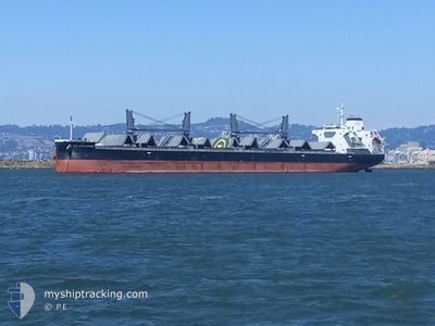
Cargo
Current Trip
| Time Travelled | 4 days |
|---|---|
| Remaining Time | --- |
| Distance Travelled | 994.99 nm |
| Remaining Distance | --- |
| AVG Speed | 11 Knots |
| MAX Speed | 14.7 Knots |
| AVG Wind | 9.5 knots |
| MAX Wind | 30 knots |
| MIN Temp | 6.2°C / 43.16°F |
| MAX Temp | 14.3°C / 57.74°F |
| Draught | 10.1 m |
| Position Received | 3 d ago |
Current Position
| Longitude | --- |
|---|---|
| Latitude | --- |
| Status | Under way using engine |
| Speed | 9.4 Knots |
| Course | 270.1° |
| Area | North Pacific Ocean |
| Station | T-AIS |
| Position Received | 3 d ago |
Info
Information
The current position of NEW INTELLIGENCE is in North Pacific Ocean with coordinates 46.18413° / -125.54006° as reported on 2025-02-27 10:35 by AIS to our vessel tracker app. The vessel's current speed is 9.4 Knots and is heading at the port of BUSAN. The estimated time of arrival as calculated by MyShipTracking vessel tracking app is 2025-03-19 03:00 LT
The vessel NEW INTELLIGENCE (IMO: 9932658, MMSI: 636021335) is a Cargo It's sailing under the flag of [LR] Liberia.
In this page you can find informations about the vessels current position, last detected port calls, and current voyage information. If the vessels is not in coverage by AIS you will find the latest position.
The current position of NEW INTELLIGENCE is detected by our AIS receivers and we are not responsible for the reliability of the data. The last position was recorded while the vessel was in Coverage by the Ais receivers of our vessel tracking app.
The current draught of NEW INTELLIGENCE as reported by AIS is 10.1 meters
Weather
| Temperature | 6.7°C / 44.06°F |
|---|---|
| Wind Speed | 28 knots |
| Direction | 156° SSE |
| Pressure | 1012.1 hPa |
| Humidity | 92.2 % |
| Cloud Coverage | 100 % |
Featured Company
Last Port Calls
| Port | Arrival | Departure | Time In Port |
|---|---|---|---|
| 2025-02-25 06:06 | 2025-02-26 13:15 | 1 d | |
| 2025-02-09 16:38 | 2025-02-10 10:38 | 18 h | |
| 2025-02-07 04:11 | 2025-02-09 03:32 | 1 d | |
| 2025-02-04 07:55 | 2025-02-04 08:39 | 44 m | |
| 2025-01-26 20:59 | 2025-01-28 14:11 | 1 d | |
| 2025-01-24 19:00 | 2025-01-26 17:13 | 1 d | |
| 2025-01-04 17:49 |
Most Visited Ports (Last year)
| Port | Arrivals | |
|---|---|---|
| 4 | ||
| 3 | ||
| 3 | ||
| 2 | ||
| 2 | ||
| 2 |
Last Trips
| Origin | Departure | Destination | Arrival | Distance | |
|---|---|---|---|---|---|
| 2025-02-10 10:38 | 2025-02-25 06:06 | 1185.31 nm | |||
| 2025-02-09 03:32 | 2025-02-09 16:38 | 147.32 nm | |||
| 2025-02-04 08:39 | 2025-02-07 04:11 | 467.96 nm | |||
| 2025-01-28 14:11 | 2025-02-04 07:55 | 766.30 nm | |||
| 2025-01-26 17:13 | 2025-01-26 20:59 | 30.22 nm | |||
| 2025-01-04 17:49 | 2025-01-24 19:00 | 5139.99 nm |
Events
| Time | Event | Details | Position / Dest | Info |
|---|---|---|---|---|
| 2025-02-27 10:39 | Status Changed | Default Under way using engine |
46.18409 / -125.55605
KR PUS
|
Speed: 9.4 kn Course: 270.1° |
| 2025-02-27 10:35 | OUT of Coverage |
46.18413 / -125.54006
North Pacific Ocean
KR PUS
|
Speed: 9.4 kn Course: 270.1° |
|
| 2025-02-27 10:34 | Status Changed | Under way using engine Default |
46.18412 / -125.53872
KR PUS
|
Speed: 10.3 kn Course: 268° |
| 2025-02-27 10:28 | Status Changed | Default Under way using engine |
46.18419 / -125.51260
KR PUS
|
Speed: 10.3 kn Course: 268.4° |
| 2025-02-27 10:17 | Status Changed | Under way using engine Default |
46.18463 / -125.46944
KR PUS
|
Speed: 10.1 kn Course: 271° |
| 2025-02-27 10:13 | Status Changed | Default Under way using engine |
46.18467 / -125.45473
KR PUS
|
Speed: 10.1 kn Course: 268.1° |
| 2025-02-26 22:32 | Status Changed | Under way using engine Default |
45.88857 / -122.80050
KR PUS
|
Speed: 12.4 kn Course: 331° |
| 2025-02-26 22:24 | IN Coverage |
45.90118 / -122.80658
North Pacific Ocean
KR PUS
|
Speed: 13.1 kn Course: 348.8° |
|
| 2025-02-26 21:24 | Status Changed | Default Under way using engine |
45.66167 / -122.76690
KR PUS
|
Speed: 8.9 kn Course: 300.2° |
| 2025-02-26 21:17 | OUT of Coverage |
45.64817 / -122.75029
North Pacific Ocean
KR PUS
|
Speed: 8.9 kn Course: 300.2° |