
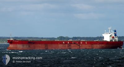
NAVIOS SAGITTARIUS
Bulk Carrier
Current Trip
| Time Travelled | 20 days |
|---|---|
| Remaining Time | --- |
| Distance Travelled | 4140.37 nm |
| Remaining Distance | --- |
| AVG Speed | 8.2 Knots |
| MAX Speed | 11.7 Knots |
| AVG Wind | 18.6 knots |
| MAX Wind | 40.5 knots |
| MIN Temp | 12.8°C / 55.04°F |
| MAX Temp | 26.8°C / 80.24°F |
| Draught | 13.7 m |
| Position Received | Now |
Current Position
| Longitude | 31.37847° |
|---|---|
| Latitude | -31.40295° |
| Status | Under way using engine |
| Speed | 8.2 Knots |
| Course | 53.2° |
| Area | Indian Ocean |
| Station | T-AIS |
| Position Received | Now |
Info
Information
The current position of NAVIOS SAGITTARIUS is in Indian Ocean with coordinates -31.40295° / 31.37847° as reported on 2024-06-05 17:30 by AIS to our vessel tracker app. The vessel's current speed is 8.2 Knots and is heading at the port of JEBEL ALI. The estimated time of arrival as calculated by MyShipTracking vessel tracking app is 2024-06-20 09:00 LT
The vessel NAVIOS SAGITTARIUS (IMO: 9316866, MMSI: 372070000) is a Bulk Carrier that was built in 2006 ( 18 years old ). It's sailing under the flag of [PA] Panama.
In this page you can find informations about the vessels current position, last detected port calls, and current voyage information. If the vessels is not in coverage by AIS you will find the latest position.
The current position of NAVIOS SAGITTARIUS is detected by our AIS receivers and we are not responsible for the reliability of the data. The last position was recorded while the vessel was in Coverage by the Ais receivers of our vessel tracking app.
The current draught of NAVIOS SAGITTARIUS as reported by AIS is 13.7 meters
Weather
| Temperature | 24.1°C / 75.38°F |
|---|---|
| Wind Speed | 4 knots |
| Direction | 255° WSW |
| Pressure | 1010.9 hPa |
| Humidity | 46.8 % |
| Cloud Coverage | --- |
Featured Company
Most Visited Ports (Last year)
| Port | Arrivals | |
|---|---|---|
| 2 | ||
| 2 | ||
| 1 | ||
| 1 | ||
| 1 | ||
| 1 |
Last Trips
| Origin | Departure | Destination | Arrival | Distance | |
|---|---|---|---|---|---|
| 2024-05-03 21:48 | 2024-05-12 17:51 | 288.00 nm | |||
| 2024-03-10 16:11 | 2024-04-27 03:16 | 8642.52 nm |
Events
| Time | Event | Details | Position / Dest | Info |
|---|---|---|---|---|
| 2024-06-05 17:02 | Status Changed | Under way using engine Default |
-31.43894 / 31.31782
AEJEA
|
Speed: 8.5 kn Course: 55° |
| 2024-06-05 16:58 | Status Changed | Default Under way using engine |
-31.44522 / 31.30705
AEJEA
|
Speed: 8.6 kn Course: 58.6° |
| 2024-06-05 16:48 | Status Changed | Under way using engine Default |
-31.45768 / 31.28384
AEJEA
|
Speed: 8.3 kn Course: 56° |
| 2024-06-05 16:06 | Status Changed | Default Under way using engine |
-31.50919 / 31.19081
AEJEA
|
Speed: 7.9 kn Course: 49.8° |
| 2024-06-05 13:40 | Status Changed | Under way using engine Default |
-31.70121 / 30.87632
AEJEA
|
Speed: 7.8 kn Course: 55° |
| 2024-06-05 13:38 | Status Changed | Default Under way using engine |
-31.70393 / 30.87170
AEJEA
|
Speed: 7.7 kn Course: 54.2° |
| 2024-06-05 12:44 | Draught Changed | 13.7 13.8 |
-31.77342 / 30.76115
AEJEA
|
Speed: 7.9 kn Course: 51.5° |
| 2024-06-05 12:44 | Destination Changed | AEJEA JEBEL ALI |
-31.77342 / 30.76115
AEJEA
|
Speed: 7.9 kn Course: 51.5° |
| 2024-06-05 12:44 | ETA Changed | 2024/06/20 05:00 2024/06/16 12:00 |
-31.77342 / 30.76115
AEJEA
|
Speed: 7.9 kn Course: 51.5° |
| 2024-06-05 12:33 | Status Changed | Under way using engine Default |
-31.78708 / 30.74018
JEBEL ALI
|
Speed: 7.7 kn Course: 52° |