
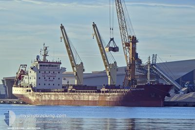
NAVIN VULTURE
Bulk Carrier
Current Trip
GR APL
| Time Travelled | 1 day |
|---|---|
| Remaining Time | --- |
| Distance Travelled | 16.15 nm |
| Remaining Distance | --- |
| AVG Speed | 8.3 Knots |
| MAX Speed | 10 Knots |
| AVG Wind | 3.5 knots |
| MAX Wind | 7 knots |
| MIN Temp | 10.6°C / 51.08°F |
| MAX Temp | 13.1°C / 55.58°F |
| Draught | 7.2 m |
| Position Received | 2 h, 39 m ago |
Current Position
| Longitude | --- |
|---|---|
| Latitude | --- |
| Status | At anchor |
| Speed | 0.1 Knots |
| Course | 357° |
| Area | Aegean Sea |
| Station | T-AIS |
| Position Received | 2 h, 39 m ago |
Info
Information
The current position of NAVIN VULTURE is in Aegean Sea with coordinates 39.33408° / 22.96439° as reported on 2025-12-08 22:23 by AIS to our vessel tracker app. The vessel's current speed is 0.1 Knots
The vessel NAVIN VULTURE (IMO: 9543328, MMSI: 538007988) is a Bulk Carrier that was built in 2009 ( 16 years old ). It's sailing under the flag of [MH] Marshall Is.
In this page you can find informations about the vessels current position, last detected port calls, and current voyage information. If the vessels is not in coverage by AIS you will find the latest position.
The current position of NAVIN VULTURE is detected by our AIS receivers and we are not responsible for the reliability of the data. The last position was recorded while the vessel was in Coverage by the Ais receivers of our vessel tracking app.
The current draught of NAVIN VULTURE as reported by AIS is 7.2 meters
Weather
| Temperature | 12.1°C / 53.78°F |
|---|---|
| Wind Speed | 5 knots |
| Direction | 337° NNW |
| Pressure | 1024.1 hPa |
| Humidity | 75.7 % |
| Cloud Coverage | 92 % |
Featured Company
Last Port Calls
| Port | Arrival | Departure | Time In Port |
|---|---|---|---|
| 2025-12-01 11:37 | 2025-12-07 09:21 | 5 d | |
| 2025-11-20 04:04 | 2025-11-25 22:33 | 5 d | |
| 2025-11-15 18:27 | 2025-11-19 19:55 | 4 d | |
| 2025-11-05 10:59 | 2025-11-09 11:42 | 4 d | |
| 2025-10-22 07:57 | 2025-10-27 09:12 | 5 d | |
| 2025-10-06 10:35 | 2025-10-08 19:50 | 2 d | |
| 2025-10-03 22:21 |
Last Trips
| Origin | Departure | Destination | Arrival | Distance | |
|---|---|---|---|---|---|
| 2025-11-25 22:33 | 2025-12-01 11:37 | 1263.51 nm | |||
| 2025-11-19 19:55 | 2025-11-20 04:04 | 79.93 nm | |||
| 2025-11-09 11:42 | 2025-11-15 18:27 | 1477.82 nm | |||
| 2025-10-27 09:12 | 2025-11-05 10:59 | 1638.11 nm | |||
| 2025-10-08 19:50 | 2025-10-22 07:57 | 1328.48 nm | |||
| 2025-10-03 22:21 | 2025-10-06 10:35 | 615.18 nm |
Events
| Time | Event | Details | Position / Dest | Info |
|---|---|---|---|---|
| 2025-12-08 22:26 | Status Changed | Default At anchor |
39.33408 / 22.96428
GR APL
|
Speed: 0.1 kn Course: 357° |
| 2025-12-08 22:23 | OUT of Coverage |
39.33408 / 22.96439
Aegean Sea
|
Speed: 0.1 kn Course: 242.1° |
|
| 2025-12-08 22:18 | Status Changed | At anchor Default |
39.33408 / 22.96439
GR APL
|
Speed: 0.1 kn Course: 347° |
| 2025-12-08 22:18 | IN Coverage |
39.33408 / 22.96439
Aegean Sea
|
Speed: 0.1 kn Course: 242.1° |
|
| 2025-12-08 17:57 | Status Changed | Default At anchor |
39.33418 / 22.96494
GR APL
|
Speed: 0.1 kn Course: 333° |
| 2025-12-08 17:48 | Status Changed | At anchor Default |
39.33420 / 22.96492
GR APL
|
Speed: Course: 341° |
| 2025-12-08 17:48 | OUT of Coverage |
39.33420 / 22.96492
Aegean Sea
|
Speed: 0.1 kn Course: 76.5° |
|
| 2025-12-08 17:45 | IN Coverage |
39.33420 / 22.96492
Aegean Sea
|
Speed: 0.1 kn Course: 76.5° |
|
| 2025-12-08 15:56 | Status Changed | Default At anchor |
39.33461 / 22.96321
GR APL
|
Speed: 0.5 kn Course: 11° |
| 2025-12-08 15:48 | OUT of Coverage |
39.33415 / 22.96412
Aegean Sea
|
Speed: 0.5 kn Course: 255.1° |