
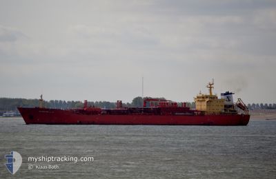
BERTOLLE
Lpg Tanker
Current Trip
| Time Travelled | 23 days |
|---|---|
| Remaining Time | --- |
| Distance Travelled | 4801.26 nm |
| Remaining Distance | --- |
| AVG Speed | 11.1 Knots |
| MAX Speed | 11.1 Knots |
| AVG Wind | 15.2 knots |
| MAX Wind | 31 knots |
| MIN Temp | -4.3°C / 24.26°F |
| MAX Temp | 20.6°C / 69.08°F |
| Draught | 9.7 m |
| Position Received | 46 m ago |
Current Position
| Longitude | 30.37310° |
|---|---|
| Latitude | 34.90357° |
| Status | Under way using engine |
| Speed | 3.3 Knots |
| Course | 269° |
| Area | Mediterranean Sea - Eastern Basin |
| Station | T-AIS |
| Position Received | 46 m ago |
Info
Information
The current position of BERTOLLE is in Mediterranean Sea - Eastern Basin with coordinates 34.90357° / 30.37310° as reported on 2024-04-27 14:01 by AIS to our vessel tracker app. The vessel's current speed is 3.3 Knots and is heading at the port of MERSIN. The estimated time of arrival as calculated by MyShipTracking vessel tracking app is 2024-04-24 15:00 LT
The vessel BERTOLLE (IMO: 9177545, MMSI: 636011282) is a Lpg Tanker that was built in 1999 ( 25 years old ). It's sailing under the flag of [LR] Liberia.
In this page you can find informations about the vessels current position, last detected port calls, and current voyage information. If the vessels is not in coverage by AIS you will find the latest position.
The current position of BERTOLLE is detected by our AIS receivers and we are not responsible for the reliability of the data. The last position was recorded while the vessel was in Coverage by the Ais receivers of our vessel tracking app.
The current draught of BERTOLLE as reported by AIS is 9.7 meters
Weather
| Temperature | 19.4°C / 66.92°F |
|---|---|
| Wind Speed | 13 knots |
| Direction | 284° WNW |
| Pressure | 1010.5 hPa |
| Humidity | 82.4 % |
| Cloud Coverage | 100 % |
Featured Company
Most Visited Ports (Last year)
| Port | Arrivals | |
|---|---|---|
| 8 | ||
| 1 | ||
| 1 | ||
| 1 |
Events
| Time | Event | Details | Position / Dest | Info |
|---|---|---|---|---|
| 2024-04-27 14:24 | STOP Moving |
34.90667 / 30.36500
TRMER
|
Speed: Course: -1° |
|
| 2024-04-27 14:06 | Status Changed | Default Under way using engine |
34.90353 / 30.36777
TRMER
|
Speed: 3.3 kn Course: 269° |
| 2024-04-27 13:59 | Status Changed | Under way using engine Default |
34.90304 / 30.37564
TRMER
|
Speed: 6 kn Course: 298° |
| 2024-04-27 13:00 | Status Changed | Default Under way using engine |
34.87333 / 30.54833
TRMER
|
Speed: 11 kn Course: 172.7° |
| 2024-04-27 11:55 | Change Sea Area | Turkish part of the Mediterranean Sea - Eastern Basin Cypriote part of the Mediterranean Sea - Eastern Basin |
34.89545 / 30.35280
Mediterranean Sea - Eastern Basin
|
Speed: 10.5 kn Course: 349.7° |
| 2024-04-27 11:55 | Status Changed | Under way using engine Default |
34.89545 / 30.35280
TRMER
|
Speed: 10.7 kn Course: 330° |
| 2024-04-27 11:37 | IN Coverage |
34.89545 / 30.35280
Mediterranean Sea - Eastern Basin
|
Speed: 10.5 kn Course: 349.7° |
|
| 2024-04-26 21:35 | Status Changed | Default Not under command |
34.38215 / 30.83559
TRMER
|
Speed: 1.3 kn Course: 22° |
| 2024-04-26 21:20 | Status Changed | Not under command Default |
34.38581 / 30.83112
TRMER
|
Speed: 1 kn Course: 21° |
| 2024-04-26 21:20 | OUT of Coverage |
34.38581 / 30.83112
Mediterranean Sea - Eastern Basin
|
Speed: 1.3 kn Course: 138.5° |