
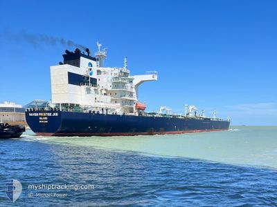
NAVIG8 PRESTIGE JKB
Tanker
Current Trip
| Time Travelled | 22 h, 32 mins |
|---|---|
| Remaining Time | 9 days |
| Distance Travelled | 283.66 nm |
| Remaining Distance | 2712.97 nm |
| AVG Speed | 12.4 Knots |
| MAX Speed | 13.7 Knots |
| AVG Wind | 12.6 knots |
| MAX Wind | 24 knots |
| MIN Temp | 14.7°C / 58.46°F |
| MAX Temp | 16.9°C / 62.42°F |
| Draught | 9.7 m |
| Position Received | 12 h, 28 m ago |
Current Position
| Longitude | -11.44234° |
|---|---|
| Latitude | 38.64257° |
| Status | Under way using engine |
| Speed | 12.8 Knots |
| Course | 290.6° |
| Area | North Atlantic Ocean |
| Station | T-AIS |
| Position Received | 12 h, 28 m ago |
Info
Information
The current position of NAVIG8 PRESTIGE JKB is in North Atlantic Ocean with coordinates 38.64257° / -11.44234° as reported on 2024-05-03 14:54 by AIS to our vessel tracker app. The vessel's current speed is 12.8 Knots and is heading at the port of NEW YORK. The estimated time of arrival as calculated by MyShipTracking vessel tracking app is 2024-05-13 16:46 LT
The vessel NAVIG8 PRESTIGE JKB (IMO: 9831309, MMSI: 538007785) is a Tanker It's sailing under the flag of [MH] Marshall Is.
In this page you can find informations about the vessels current position, last detected port calls, and current voyage information. If the vessels is not in coverage by AIS you will find the latest position.
The current position of NAVIG8 PRESTIGE JKB is detected by our AIS receivers and we are not responsible for the reliability of the data. The last position was recorded while the vessel was in Coverage by the Ais receivers of our vessel tracking app.
The current draught of NAVIG8 PRESTIGE JKB as reported by AIS is 9.7 meters
Weather
| Temperature | 16.9°C / 62.42°F |
|---|---|
| Wind Speed | 23 knots |
| Direction | 232° SW |
| Pressure | 1012.9 hPa |
| Humidity | 92.6 % |
| Cloud Coverage | 99 % |
Featured Company
Last Port Calls
| Port | Arrival | Departure | Time In Port |
|---|---|---|---|
| 2024-05-01 04:11 | 2024-05-03 04:51 | 2 d | |
| 2024-04-22 09:45 | 2024-04-23 19:06 | 1 d | |
| 2024-04-14 11:23 | 2024-04-15 18:54 | 1 d | |
| 2024-04-07 19:08 | 2024-04-09 19:09 | 2 d | |
| 2024-04-02 15:00 | 2024-04-03 17:34 | 1 d | |
| 2024-03-23 03:45 | 2024-03-24 13:25 | 1 d |
Last Trips
| Origin | Departure | Destination | Arrival | Distance | |
|---|---|---|---|---|---|
| 2024-04-23 20:06 | 2024-05-01 05:11 | 951.20 nm | |||
| 2024-04-15 19:54 | 2024-04-22 10:45 | 970.74 nm | |||
| 2024-04-09 21:09 | 2024-04-14 12:23 | 642.41 nm | |||
| 2024-04-03 18:34 | 2024-04-07 21:08 | 536.18 nm | |||
| 2024-03-24 14:25 | 2024-04-02 16:00 | 1834.34 nm | |||
| 2024-02-19 06:09 | 2024-03-23 04:45 | 9060.74 nm |
Events
| Time | Event | Details | Position / Dest | Info |
|---|---|---|---|---|
| 2024-05-03 14:58 | Status Changed | Default Under way using engine |
38.64820 / -11.46156
USNYC
|
Speed: 12.8 kn Course: 290.6° |
| 2024-05-03 14:54 | OUT of Coverage |
38.64257 / -11.44234
North Atlantic Ocean
USNYC
|
Speed: 12.8 kn Course: 290.6° |
|
| 2024-05-03 14:53 | Status Changed | Under way using engine Default |
38.64194 / -11.44019
USNYC
|
Speed: 13 kn Course: 291° |
| 2024-05-03 14:46 | Status Changed | Default Under way using engine |
38.63298 / -11.41111
USNYC
|
Speed: 13 kn Course: 291.8° |
| 2024-05-03 14:46 | Status Changed | Under way using engine Default |
38.63273 / -11.41024
USNYC
|
Speed: 13.1 kn Course: 291° |
| 2024-05-03 14:22 | Status Changed | Default Under way using engine |
38.60086 / -11.30776
USNYC
|
Speed: 12.9 kn Course: 291° |
| 2024-05-03 14:15 | Status Changed | Under way using engine Default |
38.59058 / -11.27439
USNYC
|
Speed: 12 kn Course: 291° |
| 2024-05-03 13:58 | IN Coverage |
38.59187 / -11.27865
North Atlantic Ocean
USNYC
|
Speed: 12.9 kn Course: 291° |
|
| 2024-05-03 12:19 | Status Changed | Default Under way using engine |
38.45500 / -10.78167
USNYC
|
Speed: 12.9 kn Course: 291.2° |
| 2024-05-03 12:03 | OUT of Coverage |
38.42996 / -10.68831
North Atlantic Ocean
USNYC
|
Speed: 12.9 kn Course: 291.2° |