
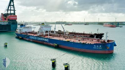
NAN LIN WAN
Tanker
Current Trip
| Time Travelled | 35 days |
|---|---|
| Remaining Time | 6 days |
| Distance Travelled | 8683.89 nm |
| Remaining Distance | 1968.78 nm |
| AVG Speed | 12.1 Knots |
| MAX Speed | 15.8 Knots |
| AVG Wind | 10.6 knots |
| MAX Wind | 36 knots |
| MIN Temp | 18.1°C / 64.58°F |
| MAX Temp | 29.4°C / 84.92°F |
| Draught | 8.6 m |
| Position Received | 13 m ago |
Current Position
| Longitude | --- |
|---|---|
| Latitude | --- |
| Status | Under way using engine |
| Speed | 12.3 Knots |
| Course | 294.8° |
| Area | Laccadive Sea |
| Station | T-AIS |
| Position Received | 13 m ago |
Info
Information
The current position of NAN LIN WAN is in Laccadive Sea with coordinates 7.08014° / 76.73215° as reported on 2025-12-19 13:50 by AIS to our vessel tracker app. The vessel's current speed is 12.3 Knots and is heading at the port of RUWAIS. The estimated time of arrival as calculated by MyShipTracking vessel tracking app is 2025-12-26 05:27 LT
The vessel NAN LIN WAN (IMO: 9783411, MMSI: 563015300) is a Tanker It's sailing under the flag of [SG] Singapore.
In this page you can find informations about the vessels current position, last detected port calls, and current voyage information. If the vessels is not in coverage by AIS you will find the latest position.
The current position of NAN LIN WAN is detected by our AIS receivers and we are not responsible for the reliability of the data. The last position was recorded while the vessel was in Coverage by the Ais receivers of our vessel tracking app.
The current draught of NAN LIN WAN as reported by AIS is 8.6 meters
Weather
| Temperature | 26.9°C / 80.42°F |
|---|---|
| Wind Speed | 20 knots |
| Direction | 64° ENE |
| Pressure | 1009.3 hPa |
| Humidity | 74.3 % |
| Cloud Coverage | 2 % |
Featured Company
Events
| Time | Event | Details | Position / Dest | Info |
|---|---|---|---|---|
| 2025-12-19 13:58 | Status Changed | Default Under way using engine |
7.09329 / 76.70506
RUWAIS
|
Speed: 12.3 kn Course: 294.8° |
| 2025-12-19 13:14 | IN Coverage |
7.03217 / 76.84553
Laccadive Sea
RUWAIS
|
Speed: 12.9 kn Course: 292.2° |
|
| 2025-12-19 10:40 | Status Changed | Default Under way using engine |
6.81157 / 77.35133
RUWAIS
|
Speed: 13 kn Course: 284.3° |
| 2025-12-19 10:22 | OUT of Coverage |
6.78813 / 77.41295
Laccadive Sea
RUWAIS
|
Speed: 13 kn Course: 284.3° |
|
| 2025-12-19 10:17 | Detected in Sea | Indian part of the Laccadive Sea |
6.78234 / 77.42839
Laccadive Sea
RUWAIS
|
Speed: 12.7 kn Course: 288.1° |
| 2025-12-19 10:17 | Status Changed | Under way using engine Default |
6.78234 / 77.42839
RUWAIS
|
Speed: 12.6 kn Course: 290° |
| 2025-12-19 10:17 | IN Coverage |
6.78234 / 77.42839
Laccadive Sea
RUWAIS
|
Speed: 12.7 kn Course: 288.1° |
|
| 2025-12-14 07:00 | Status Changed | Default Under way using engine |
2.13085 / 102.05574
RUWAIS
|
Speed: 12.6 kn Course: 313.8° |
| 2025-12-14 06:56 | OUT of Coverage |
2.11926 / 102.06805
Malacca Strait
RUWAIS
|
Speed: 12.6 kn Course: 313.8° |
|
| 2025-12-14 05:59 | Status Changed | Under way using engine Default |
1.98170 / 102.21957
RUWAIS
|
Speed: 13 kn Course: 312° |