
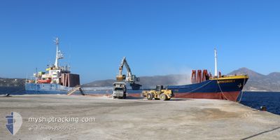
MYKONOS I
General Cargo
Current Trip
| Trip Time | 18 h, 28 mins |
|---|---|
| Trip Distance | 88.68 nm |
| AVG Speed | 9.1 Knots |
| MAX Speed | 9.7 Knots |
| Draught | 5 m |
| AVG Wind | 6.5 knots |
| MAX Wind | 11 knots |
| MIN Temp | 11.3°C / 52.34°F |
| MAX Temp | 17.1°C / 62.78°F |
| Position Received | 2 d ago |
Current Position
| Longitude | --- |
|---|---|
| Latitude | --- |
| Status | Under way using engine |
| Speed | 9.6 Knots |
| Course | 331.6° |
| Area | Aegean Sea |
| Station | T-AIS |
| Position Received | 2 d ago |
Info
Information
The current position of MYKONOS I is in Aegean Sea with coordinates 37.96569° / 24.22459° as reported on 2025-12-03 08:43 by AIS to our vessel tracker app. The vessel's current speed is 9.6 Knots and is currently inside the port of MILAKI.
The vessel MYKONOS I (IMO: 7104336, MMSI: 240524000) is a General Cargo that was built in 1971 ( 54 years old ). It's sailing under the flag of [GR] Greece.
In this page you can find informations about the vessels current position, last detected port calls, and current voyage information. If the vessels is not in coverage by AIS you will find the latest position.
The current position of MYKONOS I is detected by our AIS receivers and we are not responsible for the reliability of the data. The last position was recorded while the vessel was in Coverage by the Ais receivers of our vessel tracking app.
The current draught of MYKONOS I as reported by AIS is 5 meters
Weather
| Temperature | 16.6°C / 61.88°F |
|---|---|
| Wind Speed | 14 knots |
| Direction | 165° SSE |
| Pressure | 1008.2 hPa |
| Humidity | 83.2 % |
| Cloud Coverage | 100 % |
Featured Company
Last Port Calls
| Port | Arrival | Departure | Time In Port |
|---|---|---|---|
| 2025-12-03 22:49 | |||
| 2025-12-02 20:44 | 2025-12-03 04:21 | 7 h | |
| 2025-11-29 21:05 | 2025-12-01 13:37 | 1 d | |
| 2025-11-29 16:38 | |||
| 2025-11-27 17:15 | 2025-11-28 14:25 | 21 h | |
| 2025-11-25 17:13 | 2025-11-26 15:35 | 22 h | |
| 2025-11-24 08:04 | 2025-11-24 18:01 | 9 h | |
| 2025-11-22 07:03 | 2025-11-22 15:03 | 7 h | |
| 2025-11-21 06:54 | 2025-11-21 16:03 | 9 h | |
| 2025-11-19 15:06 | 2025-11-20 12:26 | 21 h |
Last Trips
| Origin | Departure | Destination | Arrival | Distance | |
|---|---|---|---|---|---|
| 2025-12-03 04:21 | 2025-12-03 22:49 | 88.68 nm | |||
| 2025-12-01 13:37 | 2025-12-02 20:44 | 172.79 nm | |||
| 2025-11-29 16:38 | 2025-11-29 21:05 | 37.38 nm | |||
| 2025-11-26 15:35 | 2025-11-27 17:15 | 21.28 nm | |||
| 2025-11-24 18:01 | 2025-11-25 17:13 | 170.13 nm | |||
| 2025-11-22 15:03 | 2025-11-24 08:04 | 172.75 nm | |||
| 2025-11-21 16:03 | 2025-11-22 07:03 | 80.98 nm | |||
| 2025-11-20 12:26 | 2025-11-21 06:54 | 77.36 nm | |||
| 2025-11-19 12:24 | 2025-11-19 15:06 | 18.31 nm | |||
| 2025-11-17 15:00 | 2025-11-19 00:42 | 171.26 nm |
Events
| Time | Event | Details | Position / Dest | Info |
|---|---|---|---|---|
| 2025-12-03 20:49 | PORT ARRIVAL |
|
38.37333 / 24.05500
[GR] MILAKI
|
Speed: 2.7 kn Course: 120° |
| 2025-12-03 08:47 | Status Changed | Default Under way using engine |
37.97364 / 24.21816
GR MYL
|
Speed: 9.6 kn Course: 331.6° |
| 2025-12-03 08:43 | Status Changed | Under way using engine Default |
37.96569 / 24.22459
GR MYL
|
Speed: 9.7 kn Course: 303° |
| 2025-12-03 08:43 | IN Coverage |
37.96569 / 24.22459
Aegean Sea
GR MYL
|
Speed: 9.6 kn Course: 331.6° |
|
| 2025-12-03 08:43 | OUT of Coverage |
37.96569 / 24.22459
Aegean Sea
GR MYL
|
Speed: 9.6 kn Course: 331.6° |
|
| 2025-12-03 05:57 | Status Changed | Default Under way using engine |
37.72891 / 24.68521
GR MYL
|
Speed: 9.6 kn Course: 301.3° |
| 2025-12-03 05:43 | OUT of Coverage |
37.70804 / 24.72571
Aegean Sea
GR MYL
|
Speed: 9.6 kn Course: 301.3° |
|
| 2025-12-03 05:29 | Status Changed | Under way using engine Default |
37.68746 / 24.76657
GR MYL
|
Speed: 9.6 kn Course: 304° |
| 2025-12-03 05:03 | Status Changed | Default Under way using engine |
37.64993 / 24.83953
GR MYL
|
Speed: 9.5 kn Course: 301.1° |
| 2025-12-03 02:44 | Destination Changed | GR MYL GR JMK |
37.48630 / 25.23526
GR MYL
|
Speed: 9.4 kn Course: 288.8° |