
MYKO
Pleasure Craft
Current Trip
Current Position
| Longitude | --- |
|---|---|
| Latitude | --- |
| Status | Moored |
| Speed | |
| Course | 245° |
| Area | Aegean Sea |
| Station | T-AIS |
| Position Received | 2 m ago |
Info
Information
The current position of MYKO is in Aegean Sea with coordinates 37.93214° / 23.65148° as reported on 2024-12-12 15:34 by AIS to our vessel tracker app. The vessel's current speed is 0 Knots and is currently inside the port of ZEA.
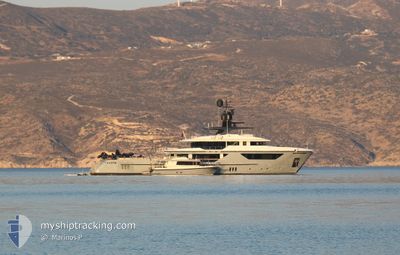
The vessel MYKO (IMO: 9911812, MMSI: 538071749) is a Pleasure Craft It's sailing under the flag of [MH] Marshall Is.
In this page you can find informations about the vessels current position, last detected port calls, and current voyage information. If the vessels is not in coverage by AIS you will find the latest position.
The current position of MYKO is detected by our AIS receivers and we are not responsible for the reliability of the data. The last position was recorded while the vessel was in Coverage by the Ais receivers of our vessel tracking app.
The current draught of MYKO as reported by AIS is 2.8 meters
Weather
| Temperature | 12.9°C / 55.22°F |
|---|---|
| Wind Speed | 2 knots |
| Direction | 195° SSW |
| Pressure | 1023.1 hPa |
| Humidity | 68.3 % |
| Cloud Coverage | 14 % |
Featured Company
Events
| Time | Event | Details | Position / Dest | Info |
|---|---|---|---|---|
| 2024-12-12 15:31 | ETA Changed | 2024/12/03 09:00 2025/01/01 09:00 |
37.93214 / 23.65148
[GR] ZEA
|
Speed: Course: 245° |
| 2024-12-12 15:25 | ETA Changed | 2025/01/01 09:00 2024/12/03 09:00 |
37.93214 / 23.65149
[GR] ZEA
|
Speed: Course: 245° |
| 2024-12-12 14:49 | ETA Changed | 2024/12/03 09:00 2025/01/01 09:00 |
37.93214 / 23.65149
[GR] ZEA
|
Speed: Course: 246° |
| 2024-12-12 14:43 | ETA Changed | 2025/01/01 09:00 2024/12/03 09:00 |
37.93214 / 23.65149
[GR] ZEA
|
Speed: Course: 246° |
| 2024-12-12 13:25 | ETA Changed | 2024/12/03 09:00 2025/01/01 09:00 |
37.93212 / 23.65148
[GR] ZEA
|
Speed: Course: 246° |
| 2024-12-12 13:19 | ETA Changed | 2025/01/01 09:00 2024/12/03 09:00 |
37.93212 / 23.65148
[GR] ZEA
|
Speed: Course: 245° |
| 2024-12-12 11:19 | ETA Changed | 2024/12/03 09:00 2025/01/01 09:00 |
37.93212 / 23.65148
[GR] ZEA
|
Speed: Course: 246° |
| 2024-12-12 11:13 | ETA Changed | 2025/01/01 09:00 2024/12/03 09:00 |
37.93212 / 23.65148
[GR] ZEA
|
Speed: Course: 246° |
| 2024-12-12 10:07 | ETA Changed | 2024/12/03 09:00 2025/01/01 09:00 |
37.93212 / 23.65147
[GR] ZEA
|
Speed: Course: 246° |
| 2024-12-12 10:01 | ETA Changed | 2025/01/01 09:00 2024/12/03 09:00 |
37.93212 / 23.65147
[GR] ZEA
|
Speed: Course: 246° |