
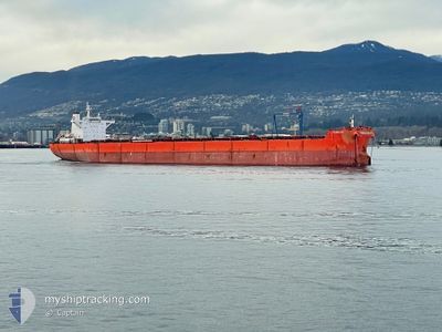
MV FURIOUS
Cargo
Current Trip
| Time Travelled | 3 days |
|---|---|
| Remaining Time | --- |
| Distance Travelled | 813.35 nm |
| Remaining Distance | --- |
| AVG Speed | 10.7 Knots |
| MAX Speed | 15 Knots |
| AVG Wind | 15.9 knots |
| MAX Wind | 25 knots |
| MIN Temp | 10.7°C / 51.26°F |
| MAX Temp | 24.9°C / 76.82°F |
| Draught | 17.8 m |
| Position Received | 12 d ago |
Current Position
| Longitude | --- |
|---|---|
| Latitude | --- |
| Status | Under way using engine |
| Speed | 11.9 Knots |
| Course | 10.4° |
| Area | Eastern China Sea |
| Station | T-AIS |
| Position Received | 12 d ago |
Info
Information
The current position of MV FURIOUS is in Eastern China Sea with coordinates 24.85419° / 122.57223° as reported on 2025-11-30 10:27 by AIS to our vessel tracker app. The vessel's current speed is 11.9 Knots and is heading at the port of NINGBO.
The vessel MV FURIOUS (IMO: 9398735, MMSI: 235074612) is a Cargo It's sailing under the flag of [GB] United Kingdom.
In this page you can find informations about the vessels current position, last detected port calls, and current voyage information. If the vessels is not in coverage by AIS you will find the latest position.
The current position of MV FURIOUS is detected by our AIS receivers and we are not responsible for the reliability of the data. The last position was recorded while the vessel was in Coverage by the Ais receivers of our vessel tracking app.
The current draught of MV FURIOUS as reported by AIS is 17.8 meters
Weather
| Temperature | 25.5°C / 77.9°F |
|---|---|
| Wind Speed | 17 knots |
| Direction | 59° ENE |
| Pressure | 1015.8 hPa |
| Humidity | 70.1 % |
| Cloud Coverage | 1 % |
Featured Company
Last Port Calls
| Port | Arrival | Departure | Time In Port |
|---|---|---|---|
| 2025-12-08 09:01 | 2025-12-09 13:23 | 1 d | |
| 2025-12-04 22:57 | 2025-12-06 10:45 | 1 d | |
| 2025-11-18 11:39 | 2025-11-20 09:26 | 1 d | |
| 2025-10-10 17:32 |
Events
| Time | Event | Details | Position / Dest | Info |
|---|---|---|---|---|
| 2025-12-09 05:23 | START Moving | 1.46 nm, West of JIANGYIN |
31.93173 / 120.14806
BEILUN CHINA
|
Speed: 3.7 kn Course: 68° |
| 2025-12-09 05:23 | PORT DEPARTURE |
|
31.93173 / 120.14806
BEILUN CHINA
|
Speed: 2.3 kn Course: 8° |
| 2025-12-08 01:13 | STOP Moving |
31.92790 / 120.14665
[CN] JIANGYIN
|
Speed: Course: 280° |
|
| 2025-12-08 01:01 | PORT ARRIVAL |
|
31.92914 / 120.14780
[CN] JIANGYIN
|
Speed: 3.2 kn Course: 269° |
| 2025-12-07 10:48 | START Moving |
31.27464 / 122.60455
BEILUN CHINA
|
Speed: 3.9 kn Course: 230° |
|
| 2025-12-06 19:34 | STOP Moving |
31.27713 / 122.61130
BEILUN CHINA
|
Speed: 0.1 kn Course: 282° |
|
| 2025-12-06 02:45 | START Moving | 2.28 nm, East of NINGBO |
29.94023 / 121.89027
BEILUN CHINA
|
Speed: 3.1 kn Course: 60° |
| 2025-12-06 02:45 | PORT DEPARTURE |
|
29.94023 / 121.89027
BEILUN CHINA
|
Speed: 1.2 kn Course: 265° |
| 2025-12-04 14:57 | PORT ARRIVAL |
|
29.93611 / 121.88747
[CN] NINGBO
|
Speed: 0.7 kn Course: 276° |
| 2025-12-04 03:46 | STOP Moving | 2.59 nm, East of NINGBO |
29.94875 / 121.89620
BEILUN CHINA
|
Speed: 0.3 kn Course: 253° |