
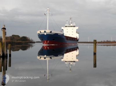
MV AGUIMES
General Cargo
Current Trip
| Time Travelled | 3 days |
|---|---|
| Remaining Time | 1 day |
| Distance Travelled | 773.10 nm |
| Remaining Distance | 378.03 nm |
| AVG Speed | 10.3 Knots |
| MAX Speed | 11.1 Knots |
| AVG Wind | 13.7 knots |
| MAX Wind | 24.8 knots |
| MIN Temp | 3.5°C / 38.3°F |
| MAX Temp | 9.6°C / 49.28°F |
| Draught | 6.1 m |
| Position Received | Now |
Current Position
| Longitude | --- |
|---|---|
| Latitude | --- |
| Status | Under way using engine |
| Speed | 5.9 Knots |
| Course | 245.8° |
| Area | Baltic Sea |
| Station | T-AIS |
| Position Received | Now |
Info
Information
The current position of MV AGUIMES is in Baltic Sea with coordinates 54.50355° / 10.31814° as reported on 2025-12-08 13:16 by AIS to our vessel tracker app. The vessel's current speed is 5.9 Knots and is heading at the port of ROTTERDAM. The estimated time of arrival as calculated by MyShipTracking vessel tracking app is 2025-12-10 03:52 LT
The vessel MV AGUIMES (IMO: 8820107, MMSI: 210223000) is a General Cargo that was built in 1989 ( 36 years old ). It's sailing under the flag of [CY] Cyprus.
In this page you can find informations about the vessels current position, last detected port calls, and current voyage information. If the vessels is not in coverage by AIS you will find the latest position.
The current position of MV AGUIMES is detected by our AIS receivers and we are not responsible for the reliability of the data. The last position was recorded while the vessel was in Coverage by the Ais receivers of our vessel tracking app.
The current draught of MV AGUIMES as reported by AIS is 6.1 meters
Weather
| Temperature | 9.5°C / 49.1°F |
|---|---|
| Wind Speed | 19 knots |
| Direction | 229° SW |
| Pressure | 1007.5 hPa |
| Humidity | 83.3 % |
| Cloud Coverage | 100 % |
Featured Company
Last Port Calls
| Port | Arrival | Departure | Time In Port |
|---|---|---|---|
| 2025-12-04 08:20 | 2025-12-05 12:29 | 1 d | |
| 2025-12-04 06:15 | 2025-12-04 07:14 | 59 m | |
| 2025-12-04 00:19 | 2025-12-04 05:21 | 5 h | |
| 2025-12-03 19:33 | 2025-12-03 22:15 | 2 h | |
| 2025-11-27 18:11 | 2025-11-28 11:09 | 16 h | |
| 2025-11-24 16:08 | 2025-11-27 00:19 | 2 d | |
| 2025-11-19 02:03 | 2025-11-19 11:16 | 9 h | |
| 2025-11-18 06:25 | 2025-11-18 23:59 | 17 h | |
| 2025-11-11 19:54 | 2025-11-12 23:11 | 1 d | |
| 2025-11-10 08:53 | 2025-11-10 21:35 | 12 h |
Most Visited Ports (Last year)
| Port | Arrivals | |
|---|---|---|
| 35 | ||
| 33 | ||
| 14 | ||
| 11 | ||
| 5 | ||
| 4 |
Last Trips
| Origin | Departure | Destination | Arrival | Distance | |
|---|---|---|---|---|---|
| 2025-12-04 07:14 | 2025-12-04 08:20 | 5.05 nm | |||
| 2025-12-04 05:21 | 2025-12-04 06:15 | 21.80 nm | |||
| 2025-12-03 22:15 | 2025-12-04 00:19 | 13.23 nm | |||
| 2025-11-28 11:09 | 2025-12-03 19:33 | 1119.93 nm | |||
| 2025-11-27 00:19 | 2025-11-27 18:11 | 117.61 nm | |||
| 2025-11-19 11:16 | 2025-11-24 16:08 | 1193.34 nm | |||
| 2025-11-18 23:59 | 2025-11-19 02:03 | 7.02 nm | |||
| 2025-11-12 23:11 | 2025-11-18 06:25 | 1182.25 nm | |||
| 2025-11-10 21:35 | 2025-11-11 19:54 | 122.32 nm | |||
| 2025-11-04 00:56 | 2025-11-10 08:53 | 1317.16 nm |
Events
| Time | Event | Details | Position / Dest | Info |
|---|---|---|---|---|
| 2025-12-08 12:50 | Status Changed | Under way using engine Default |
54.53202 / 10.42516
NLRTM
|
Speed: 10 kn Course: 245° |
| 2025-12-08 12:49 | Status Changed | Default Under way using engine |
54.53336 / 10.43004
NLRTM
|
Speed: 10 kn Course: 245.5° |
| 2025-12-08 12:42 | Detected in Sea | German part of the Baltic Sea |
54.54200 / 10.46247
Baltic Sea
NLRTM
|
Speed: 9.9 kn Course: 245° |
| 2025-12-08 12:42 | Status Changed | Under way using engine Default |
54.54200 / 10.46247
NLRTM
|
Speed: 9.8 kn Course: 245° |
| 2025-12-08 12:33 | IN Coverage |
54.54200 / 10.46247
Baltic Sea
NLRTM
|
Speed: 9.9 kn Course: 245° |
|
| 2025-12-08 11:41 | Status Changed | Default Under way using engine |
54.58120 / 10.73477
NLRTM
|
Speed: 9.3 kn Course: 264.3° |
| 2025-12-08 11:35 | Status Changed | Under way using engine Default |
54.58280 / 10.76295
NLRTM
|
Speed: 9.3 kn Course: 264° |
| 2025-12-08 11:35 | OUT of Coverage |
54.58280 / 10.76295
Baltic Sea
NLRTM
|
Speed: 9.3 kn Course: 264.3° |
|
| 2025-12-08 11:33 | Status Changed | Default Under way using engine |
54.58326 / 10.77036
NLRTM
|
Speed: 9.3 kn Course: 263.9° |
| 2025-12-08 11:27 | Detected in Sea | Danish part of the Baltic Sea |
54.58501 / 10.79870
Baltic Sea
NLRTM
|
Speed: 9.7 kn Course: 263.7° |