
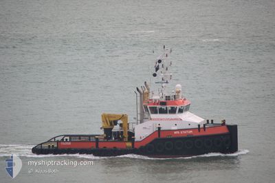
MTS STATUM
Tug
Current Trip
QATIF ANCH
| Time Travelled | 19 days |
|---|---|
| Remaining Time | --- |
| Distance Travelled | 542.94 nm |
| Remaining Distance | --- |
| AVG Speed | 4.3 Knots |
| MAX Speed | 7 Knots |
| AVG Wind | 12.4 knots |
| MAX Wind | 25.7 knots |
| MIN Temp | 19.3°C / 66.74°F |
| MAX Temp | 27.3°C / 81.14°F |
| Draught | 3.3 m |
| Position Received | 4 m ago |
Current Position
| Longitude | --- |
|---|---|
| Latitude | --- |
| Status | Restricted manoeuverability |
| Speed | 1.6 Knots |
| Course | 308° |
| Area | Persian Gulf |
| Station | T-AIS |
| Position Received | 4 m ago |
Info
Information
The current position of MTS STATUM is in Persian Gulf with coordinates 26.95324° / 49.89154° as reported on 2024-12-14 07:28 by AIS to our vessel tracker app. The vessel's current speed is 1.6 Knots
The vessel MTS STATUM (IMO: 9510670, MMSI: 375767000) is a Tug that was built in 2008 ( 16 years old ). It's sailing under the flag of [VC] St Vincent Grenadines.
In this page you can find informations about the vessels current position, last detected port calls, and current voyage information. If the vessels is not in coverage by AIS you will find the latest position.
The current position of MTS STATUM is detected by our AIS receivers and we are not responsible for the reliability of the data. The last position was recorded while the vessel was in Coverage by the Ais receivers of our vessel tracking app.
The current draught of MTS STATUM as reported by AIS is 3.3 meters
Weather
| Temperature | 20.3°C / 68.54°F |
|---|---|
| Wind Speed | 12 knots |
| Direction | 299° WNW |
| Pressure | 1016.8 hPa |
| Humidity | 49.5 % |
| Cloud Coverage | --- |
Featured Company
Most Visited Ports (Last year)
| Port | Arrivals | |
|---|---|---|
| 3 | ||
| 3 | ||
| 1 | ||
| 1 |
Last Trips
| Origin | Departure | Destination | Arrival | Distance | |
|---|---|---|---|---|---|
| 2024-10-30 17:47 | 2024-11-18 08:30 | 547.16 nm | |||
| 2024-07-31 10:44 | 2024-10-15 12:39 | 710.87 nm |
Events
| Time | Event | Details | Position / Dest | Info |
|---|---|---|---|---|
| 2024-12-14 07:22 | Status Changed | Restricted manoeuverability Default |
26.95184 / 49.89415
QATIF ANCH
|
Speed: 1.6 kn Course: 308° |
| 2024-12-14 07:17 | Status Changed | Default Restricted manoeuverability |
26.95053 / 49.89672
QATIF ANCH
|
Speed: 1.6 kn Course: 306° |
| 2024-12-14 05:15 | Destination Changed | QATIF ANCH DELMA 2000 |
26.94957 / 49.96651
QATIF ANCH
|
Speed: 3.5 kn Course: 273° |
| 2024-12-14 05:15 | ETA Changed | 2024/12/14 06:00 2024/12/12 09:00 |
26.94957 / 49.96651
QATIF ANCH
|
Speed: 3.5 kn Course: 273° |
| 2024-12-14 04:01 | START Moving | 16.73 nm, North of RAS TANURA |
26.90629 / 50.03267
DELMA 2000
|
Speed: 3.5 kn Course: 227° |
| 2024-12-13 23:48 | Status Changed | Restricted manoeuverability Default |
26.91107 / 50.03175
DELMA 2000
|
Speed: 0.4 kn Course: 246° |
| 2024-12-13 23:40 | Status Changed | Default Restricted manoeuverability |
26.91109 / 50.03171
DELMA 2000
|
Speed: 0.2 kn Course: 244° |
| 2024-12-13 22:05 | Status Changed | Restricted manoeuverability Default |
26.91094 / 50.03144
DELMA 2000
|
Speed: 0.2 kn Course: 245° |
| 2024-12-13 21:54 | Status Changed | Default Restricted manoeuverability |
26.91095 / 50.03141
DELMA 2000
|
Speed: 0.3 kn Course: 244° |
| 2024-12-13 21:39 | Status Changed | Restricted manoeuverability Default |
26.91090 / 50.03131
DELMA 2000
|
Speed: 0.3 kn Course: 245° |