
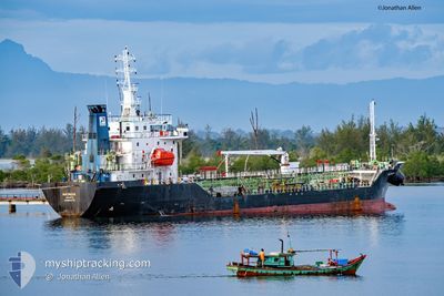
MT.MATINDOK
Oil Products Tanker
Current Trip
SAUMLAKI
| Time Travelled | 3 days |
|---|---|
| Remaining Time | --- |
| Distance Travelled | 274.82 nm |
| Remaining Distance | --- |
| AVG Speed | 6.8 Knots |
| MAX Speed | 8.4 Knots |
| AVG Wind | 6.8 knots |
| MAX Wind | 11.7 knots |
| MIN Temp | 24.7°C / 76.46°F |
| MAX Temp | 28.8°C / 83.84°F |
| Draught | 4.8 m |
| Position Received | 3 d ago |
Current Position
| Longitude | --- |
|---|---|
| Latitude | --- |
| Status | Under way using engine |
| Speed | 7.2 Knots |
| Course | 276.8° |
| Area | South Pacific Ocean |
| Station | T-AIS |
| Position Received | 3 d ago |
Info
Information
The current position of MT.MATINDOK is in South Pacific Ocean with coordinates -0.85360° / 131.17256° as reported on 2025-12-31 13:54 by AIS to our vessel tracker app. The vessel's current speed is 7.2 Knots
The vessel MT.MATINDOK (IMO: 9601716, MMSI: 525008079) is a Oil Products Tanker that was built in 2013 ( 13 years old ). It's sailing under the flag of [ID] Indonesia.
In this page you can find informations about the vessels current position, last detected port calls, and current voyage information. If the vessels is not in coverage by AIS you will find the latest position.
The current position of MT.MATINDOK is detected by our AIS receivers and we are not responsible for the reliability of the data. The last position was recorded while the vessel was in Coverage by the Ais receivers of our vessel tracking app.
The current draught of MT.MATINDOK as reported by AIS is 4.8 meters
Weather
| Temperature | 27.6°C / 81.68°F |
|---|---|
| Wind Speed | 10 knots |
| Direction | 345° NNW |
| Pressure | 1007.7 hPa |
| Humidity | 79.3 % |
| Cloud Coverage | 100 % |
Featured Company
Last Trips
| Origin | Departure | Destination | Arrival | Distance | |
|---|---|---|---|---|---|
| 2025-12-19 12:52 | 2025-12-31 16:54 | 576.83 nm | |||
| 2025-12-07 09:48 | 2025-12-18 08:16 | 590.02 nm | |||
| 2025-11-18 09:00 | 2025-12-05 12:03 | 1207.76 nm | |||
| 2025-11-09 03:58 | 2025-11-17 03:44 | 766.41 nm | |||
| 2025-10-31 12:42 | 2025-11-08 04:09 | 820.93 nm |
Events
| Time | Event | Details | Position / Dest | Info |
|---|---|---|---|---|
| 2026-01-03 08:09 | STOP Moving | 4.6 nm, West of TERNATE |
.75408 / 127.31571
SAUMLAKI
|
Speed: 0.3 kn Course: 270° |
| 2026-01-03 06:33 | START Moving | 0.61 nm, North East of TERNATE |
.78218 / 127.39769
SAUMLAKI
|
Speed: 5 kn Course: 219° |
| 2026-01-02 17:23 | STOP Moving | 0.75 nm, North East of TERNATE |
.78714 / 127.39657
SAUMLAKI
|
Speed: Course: 40° |
| 2026-01-02 16:16 | START Moving | 4.21 nm, South West of TERNATE |
.74887 / 127.32468
SAUMLAKI
|
Speed: 4.2 kn Course: 100° |
| 2026-01-02 14:37 | STOP Moving | 4.35 nm, West of TERNATE |
.75008 / 127.32156
SAUMLAKI
|
Speed: 0.2 kn Course: 85° |
| 2025-12-31 13:54 | OUT of Coverage |
-.85360 / 131.17256
South Pacific Ocean
|
Speed: 7.2 kn Course: 276.8° |
|
| 2025-12-31 13:16 | IN Coverage |
-.87890 / 131.24032
South Pacific Ocean
|
Speed: 4.3 kn Course: 277.9° |
|
| 2025-12-31 13:09 | PORT DEPARTURE |
|
-.87896 / 131.24108
SAUMLAKI
|
Speed: 0.1 kn Course: 287° |
| 2025-12-31 07:54 | OUT of Coverage |
-.87939 / 131.24857
South Pacific Ocean
[ID] SORONG
|
Speed: 0.1 kn Course: 345.1° |
|
| 2025-12-31 07:54 | STOP Moving |
-.87939 / 131.24857
[ID] SORONG
|
Speed: 0.1 kn Course: 287° |