
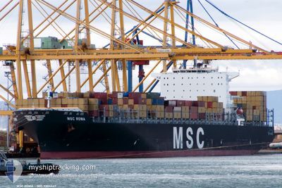
MSC ROMA
Container Ship
Current Trip
| Time Travelled | 3 days |
|---|---|
| Remaining Time | --- |
| Distance Travelled | 1424.13 nm |
| Remaining Distance | --- |
| AVG Speed | 13.6 Knots |
| MAX Speed | 20.7 Knots |
| AVG Wind | 15.5 knots |
| MAX Wind | 28 knots |
| MIN Temp | 7.9°C / 46.22°F |
| MAX Temp | 18.6°C / 65.48°F |
| Draught | 12 m |
| Position Received | 1 d ago |
Current Position
| Longitude | --- |
|---|---|
| Latitude | --- |
| Status | Under way using engine |
| Speed | 17.1 Knots |
| Course | 222.8° |
| Area | North Atlantic Ocean |
| Station | T-AIS |
| Position Received | 1 d ago |
Info
Information
The current position of MSC ROMA is in North Atlantic Ocean with coordinates 35.82487° / -6.11964° as reported on 2025-12-21 05:09 by AIS to our vessel tracker app. The vessel's current speed is 17.1 Knots and is heading at the port of REUNION. The estimated time of arrival as calculated by MyShipTracking vessel tracking app is 2026-01-07 06:30 LT
The vessel MSC ROMA (IMO: 9304447, MMSI: 636018075) is a Container Ship that was built in 2006 ( 19 years old ). It's sailing under the flag of [LR] Liberia.
In this page you can find informations about the vessels current position, last detected port calls, and current voyage information. If the vessels is not in coverage by AIS you will find the latest position.
The current position of MSC ROMA is detected by our AIS receivers and we are not responsible for the reliability of the data. The last position was recorded while the vessel was in Coverage by the Ais receivers of our vessel tracking app.
The current draught of MSC ROMA as reported by AIS is 12 meters
Weather
| Temperature | 18.6°C / 65.48°F |
|---|---|
| Wind Speed | 19 knots |
| Direction | 30° NNE |
| Pressure | 1019 hPa |
| Humidity | 67.1 % |
| Cloud Coverage | --- |
Featured Company
Last Port Calls
| Port | Arrival | Departure | Time In Port |
|---|---|---|---|
| 2025-12-17 04:02 | 2025-12-19 00:43 | 1 d | |
| 2025-12-15 06:17 | 2025-12-16 06:20 | 1 d | |
| 2025-12-05 23:26 | 2025-12-07 06:20 | 1 d | |
| 2025-12-02 19:50 | 2025-12-04 14:54 | 1 d | |
| 2025-12-01 01:33 | 2025-12-02 08:17 | 1 d | |
| 2025-11-28 21:26 | 2025-11-30 03:42 | 1 d | |
| 2025-11-01 03:58 | 2025-11-02 06:06 | 1 d | |
| 2025-10-28 11:22 | 2025-10-29 11:34 | 1 d | |
| 2025-10-20 23:34 | 2025-10-22 20:33 | 1 d | |
| 2025-10-09 15:18 | 2025-10-10 18:45 | 1 d |
Last Trips
| Origin | Departure | Destination | Arrival | Distance | |
|---|---|---|---|---|---|
| 2025-12-16 06:20 | 2025-12-17 04:02 | 256.87 nm | |||
| 2025-12-07 06:20 | 2025-12-15 06:17 | 2329.72 nm | |||
| 2025-12-04 14:54 | 2025-12-05 23:26 | 303.60 nm | |||
| 2025-12-02 08:17 | 2025-12-02 19:50 | 127.32 nm | |||
| 2025-11-30 03:42 | 2025-12-01 01:33 | 165.23 nm | |||
| 2025-11-02 06:06 | 2025-11-28 21:26 | 10742.22 nm | |||
| 2025-10-29 11:34 | 2025-11-01 03:58 | 704.14 nm | |||
| 2025-10-22 20:33 | 2025-10-28 11:22 | 1744.14 nm | |||
| 2025-10-10 18:45 | 2025-10-20 23:34 | 2608.78 nm | |||
| 2025-10-03 15:50 | 2025-10-09 15:18 | 1393.31 nm |
Events
| Time | Event | Details | Position / Dest | Info |
|---|---|---|---|---|
| 2025-12-21 05:17 | Status Changed | Default Under way using engine |
35.79167 / -6.14667
REPDG
|
Speed: 17.1 kn Course: 222.8° |
| 2025-12-21 05:09 | OUT of Coverage |
35.82487 / -6.11964
North Atlantic Ocean
REPDG
|
Speed: 17.1 kn Course: 222.8° |
|
| 2025-12-21 04:42 | Change Sea Area | Moroccan part of the North Atlantic Ocean Moroccan part of the Strait of Gibraltar |
35.90976 / -6.00068
North Atlantic Ocean
REPDG
|
Speed: 16.2 kn Course: 229.8° |
| 2025-12-21 04:16 | Change Sea Area | Moroccan part of the Strait of Gibraltar Spanish part of the Strait of Gibraltar |
35.95026 / -5.87543
Strait of Gibraltar
REPDG
|
Speed: 15.9 kn Course: 269.1° |
| 2025-12-21 02:38 | Change Sea Area | Spanish part of the Strait of Gibraltar Gibraltarian part of the Strait of Gibraltar |
36.04651 / -5.40050
Strait of Gibraltar
REPDG
|
Speed: 16.2 kn Course: 204.9° |
| 2025-12-21 02:14 | Change Sea Area | Gibraltarian part of the Strait of Gibraltar Spanish part of the Strait of Gibraltar |
36.14622 / -5.39198
Strait of Gibraltar
REPDG
|
Speed: 10.1 kn Course: 169.3° |
| 2025-12-21 02:01 | START Moving | 0.54 nm, South of CARTEYA GUADARRANQUE |
36.16903 / -5.40261
REPDG
|
Speed: 5.1 kn Course: 157.7° |
| 2025-12-21 01:47 | Status Changed | Under way using engine At anchor |
36.17215 / -5.40479
REPDG
|
Speed: 0.1 kn Course: 237° |
| 2025-12-21 01:13 | ETA Changed | 2026/01/07 02:30 2025/12/20 15:40 |
36.17258 / -5.40285
REPDG
|
Speed: 0.2 kn Course: 219° |
| 2025-12-21 01:06 | Destination Changed | REPDG ESALG |
36.17252 / -5.40303
REPDG
|
Speed: Course: 223° |