
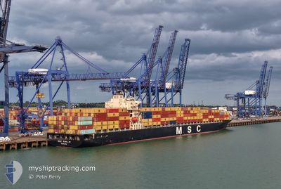
MSC POH LIN
Container Ship
Current Trip
GBLGP
| Time Travelled | 8 h, 1 mins |
|---|---|
| Remaining Time | --- |
| Distance Travelled | 116.69 nm |
| Remaining Distance | --- |
| AVG Speed | 15.9 Knots |
| MAX Speed | 20 Knots |
| AVG Wind | 15.7 knots |
| MAX Wind | 22 knots |
| MIN Temp | 7.1°C / 44.78°F |
| MAX Temp | 11.1°C / 51.98°F |
| Draught | 13.2 m |
| Position Received | 2 h, 52 m ago |
Current Position
| Longitude | --- |
|---|---|
| Latitude | --- |
| Status | Under way using engine |
| Speed | 19.5 Knots |
| Course | 52.4° |
| Area | North Sea |
| Station | T-AIS |
| Position Received | 2 h, 52 m ago |
Info
Information
The current position of MSC POH LIN is in North Sea with coordinates 51.94262° / 2.33420° as reported on 2025-12-14 08:25 by AIS to our vessel tracker app. The vessel's current speed is 19.5 Knots
The vessel MSC POH LIN (IMO: 9279977, MMSI: 357405000) is a Container Ship that was built in 2004 ( 21 years old ). It's sailing under the flag of [PA] Panama.
In this page you can find informations about the vessels current position, last detected port calls, and current voyage information. If the vessels is not in coverage by AIS you will find the latest position.
The current position of MSC POH LIN is detected by our AIS receivers and we are not responsible for the reliability of the data. The last position was recorded while the vessel was in Coverage by the Ais receivers of our vessel tracking app.
The current draught of MSC POH LIN as reported by AIS is 13.2 meters
Weather
| Temperature | 10.6°C / 51.08°F |
|---|---|
| Wind Speed | 23 knots |
| Direction | 215° SW |
| Pressure | 1019.8 hPa |
| Humidity | 86.4 % |
| Cloud Coverage | 73 % |
Featured Company
Last Port Calls
| Port | Arrival | Departure | Time In Port |
|---|---|---|---|
| 2025-12-13 15:18 | 2025-12-14 03:17 | 11 h | |
| 2025-12-12 05:13 | 2025-12-12 21:40 | 16 h | |
| 2025-12-08 04:11 | 2025-12-08 18:31 | 14 h | |
| 2025-12-02 11:53 | 2025-12-03 08:45 | 20 h | |
| 2025-12-01 05:20 | 2025-12-01 19:37 | 14 h | |
| 2025-11-30 06:57 | 2025-11-30 16:40 | 9 h | |
| 2025-11-29 09:18 | 2025-11-30 02:14 | 16 h | |
| 2025-11-27 07:39 | 2025-11-28 08:02 | 1 d | |
| 2025-11-24 17:06 | 2025-11-25 10:30 | 17 h | |
| 2025-11-21 13:42 | 2025-11-22 13:04 | 23 h |
Most Visited Ports (Last year)
| Port | Arrivals | |
|---|---|---|
| 13 | ||
| 13 | ||
| 13 | ||
| 11 | ||
| 9 | ||
| 9 |
Last Trips
| Origin | Departure | Destination | Arrival | Distance | |
|---|---|---|---|---|---|
| 2025-12-12 21:40 | 2025-12-13 15:18 | 262.89 nm | |||
| 2025-12-08 18:31 | 2025-12-12 05:13 | 1030.51 nm | |||
| 2025-12-03 08:45 | 2025-12-08 04:11 | 1922.11 nm | |||
| 2025-12-01 19:37 | 2025-12-02 11:53 | 210.31 nm | |||
| 2025-11-30 16:40 | 2025-12-01 05:20 | 86.20 nm | |||
| 2025-11-30 02:14 | 2025-11-30 06:57 | 48.72 nm | |||
| 2025-11-28 08:02 | 2025-11-29 09:18 | 332.98 nm | |||
| 2025-11-25 10:30 | 2025-11-27 07:39 | 300.14 nm | |||
| 2025-11-22 13:04 | 2025-11-24 17:06 | 564.14 nm | |||
| 2025-11-17 00:50 | 2025-11-21 13:42 | 1355.21 nm |
Events
| Time | Event | Details | Position / Dest | Info |
|---|---|---|---|---|
| 2025-12-14 08:33 | Status Changed | Default Under way using engine |
51.96819 / 2.38818
GBLGP
|
Speed: 19.5 kn Course: 52.4° |
| 2025-12-14 08:25 | OUT of Coverage |
51.94262 / 2.33420
North Sea
|
Speed: 19.5 kn Course: 52.4° |
|
| 2025-12-14 08:23 | Status Changed | Under way using engine Default |
51.93609 / 2.32032
GBLGP
|
Speed: 19.6 kn Course: 63° |
| 2025-12-14 08:21 | Status Changed | Default Under way using engine |
51.92944 / 2.30128
GBLGP
|
Speed: 19.6 kn Course: 63.4° |
| 2025-12-14 08:16 | Status Changed | Under way using engine Default |
51.91725 / 2.26167
GBLGP
|
Speed: 19.7 kn Course: 64° |
| 2025-12-14 08:05 | Status Changed | Default Under way using engine |
51.89071 / 2.17603
GBLGP
|
Speed: 19.4 kn Course: 63.4° |
| 2025-12-14 03:21 | START Moving | 0.58 nm, South West of THAMES |
51.49980 / .49781
GBLGP
|
Speed: 3.1 kn Course: 91° |
| 2025-12-14 03:17 | PORT DEPARTURE |
|
51.50028 / .49278
GBLGP
|
Speed: 1.9 kn Course: 99° |
| 2025-12-14 02:50 | Status Changed | Under way using engine Moored |
51.50262 / .48951
[GB] THAMES
|
Speed: Course: 80° |
| 2025-12-13 15:53 | Status Changed | Moored Constrained by her draught |
51.50259 / .48948
[GB] THAMES
|
Speed: Course: 80° |