
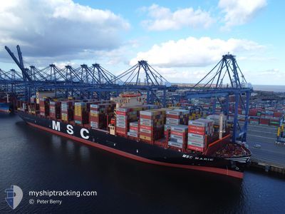
MSC MARIE
Cargo A
Current Trip
| Time Travelled | 3 days |
|---|---|
| Remaining Time | 3 days |
| Distance Travelled | 69.47 nm |
| Remaining Distance | 2050.39 nm |
| AVG Speed | 10.7 Knots |
| MAX Speed | 16.7 Knots |
| AVG Wind | 10.4 knots |
| MAX Wind | 13.7 knots |
| MIN Temp | 26.4°C / 79.52°F |
| MAX Temp | 28.4°C / 83.12°F |
| Draught | 11 m |
| Position Received | 2 d ago |
Current Position
| Longitude | --- |
|---|---|
| Latitude | --- |
| Status | Under way using engine |
| Speed | 13.2 Knots |
| Course | 50.9° |
| Area | Singapore Strait |
| Station | T-AIS |
| Position Received | 2 d ago |
Info
Information
The current position of MSC MARIE is in Singapore Strait with coordinates 1.31241° / 104.35251° as reported on 2024-12-09 00:45 by AIS to our vessel tracker app. The vessel's current speed is 13.2 Knots and is heading at the port of NINGBO. The estimated time of arrival as calculated by MyShipTracking vessel tracking app is 2024-12-15 10:38 LT
The vessel MSC MARIE (IMO: 9962574, MMSI: 636023678) is a Cargo A It's sailing under the flag of [LR] Liberia.
In this page you can find informations about the vessels current position, last detected port calls, and current voyage information. If the vessels is not in coverage by AIS you will find the latest position.
The current position of MSC MARIE is detected by our AIS receivers and we are not responsible for the reliability of the data. The last position was recorded while the vessel was in Coverage by the Ais receivers of our vessel tracking app.
The current draught of MSC MARIE as reported by AIS is 11 meters
Weather
| Temperature | 26.5°C / 79.7°F |
|---|---|
| Wind Speed | 12 knots |
| Direction | 330° NNW |
| Pressure | 1006.9 hPa |
| Humidity | 86.6 % |
| Cloud Coverage | 54 % |
Featured Company
Most Visited Ports (Last year)
| Port | Arrivals | |
|---|---|---|
| 1 | ||
| 1 | ||
| 1 | ||
| 1 | ||
| 1 | ||
| 1 |
Last Trips
| Origin | Departure | Destination | Arrival | Distance | |
|---|---|---|---|---|---|
| 2024-09-22 05:01 | 2024-10-26 12:02 | 3501.57 nm |
Events
| Time | Event | Details | Position / Dest | Info |
|---|---|---|---|---|
| 2024-12-09 00:45 | OUT of Coverage |
1.31241 / 104.35251
Singapore Strait
CNNGB
|
Speed: 13.2 kn Course: 50.9° |
|
| 2024-12-08 23:53 | Change Sea Area | Malaysian part of the Singapore Strait Indonesian part of the Singapore Strait |
1.26032 / 104.15860
Singapore Strait
CNNGB
|
Speed: 14.6 kn Course: 84.2° |
| 2024-12-08 20:23 | Change Sea Area | Indonesian part of the Singapore Strait Malaysian part of the Singapore Strait |
1.13491 / 103.52754
Singapore Strait
CNNGB
|
Speed: 14.3 kn Course: 195.5° |
| 2024-12-08 20:11 | Change Sea Area | Malaysian part of the Singapore Strait Indonesian part of the Singapore Strait |
1.16361 / 103.55899
Singapore Strait
CNNGB
|
Speed: 12 kn Course: 242.9° |
| 2024-12-08 19:23 | Change Sea Area | Indonesian part of the Singapore Strait Singaporean part of the Singapore Strait |
1.19615 / 103.64793
Singapore Strait
CNNGB
|
Speed: 4.7 kn Course: 263° |
| 2024-12-08 18:47 | PORT DEPARTURE |
|
1.25648 / 103.64563
CNNGB
|
Speed: 4.1 kn Course: 108° |
| 2024-12-08 18:45 | START Moving |
1.25683 / 103.64410
[SG] SINGAPORE
|
Speed: 3.1 kn Course: 102° |
|
| 2024-12-08 18:22 | Status Changed | Under way using engine Moored |
1.25429 / 103.63810
[SG] SINGAPORE
|
Speed: Course: 271° |
| 2024-12-08 17:38 | Draught Changed | 11 12.9 |
1.25432 / 103.63810
[SG] SINGAPORE
|
Speed: Course: 271° |
| 2024-12-08 17:06 | ETA Changed | 2024/12/14 04:00 2024/12/07 01:30 |
1.25432 / 103.63810
[SG] SINGAPORE
|
Speed: Course: 271° |