
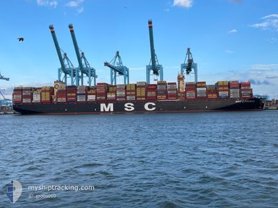
MSC LORENZA
Cargo A
Current Trip
| Time Travelled | 16 h, 57 mins |
|---|---|
| Remaining Time | --- |
| Distance Travelled | 19.75 nm |
| Remaining Distance | --- |
| AVG Speed | 7.2 Knots |
| MAX Speed | 10 Knots |
| AVG Wind | 9.8 knots |
| MAX Wind | 12 knots |
| MIN Temp | 25.6°C / 78.08°F |
| MAX Temp | 29°C / 84.2°F |
| Draught | 16.9 m |
| Position Received | 1 m ago |
Current Position
| Longitude | --- |
|---|---|
| Latitude | --- |
| Status | At anchor |
| Speed | 0.2 Knots |
| Course | 74° |
| Area | Singapore Strait |
| Station | T-AIS |
| Position Received | 1 m ago |
Info
Information
The current position of MSC LORENZA is in Singapore Strait with coordinates 1.23945° / 103.89560° as reported on 2025-03-04 10:46 by AIS to our vessel tracker app. The vessel's current speed is 0.2 Knots and is heading at the port of ABU QIR. The estimated time of arrival as calculated by MyShipTracking vessel tracking app is 2025-04-01 14:00 LT
The vessel MSC LORENZA (IMO: 9962598, MMSI: 636023379) is a Cargo A It's sailing under the flag of [LR] Liberia.
In this page you can find informations about the vessels current position, last detected port calls, and current voyage information. If the vessels is not in coverage by AIS you will find the latest position.
The current position of MSC LORENZA is detected by our AIS receivers and we are not responsible for the reliability of the data. The last position was recorded while the vessel was in Coverage by the Ais receivers of our vessel tracking app.
The current draught of MSC LORENZA as reported by AIS is 16.9 meters
Weather
| Temperature | 28.8°C / 83.84°F |
|---|---|
| Wind Speed | 12 knots |
| Direction | 66° ENE |
| Pressure | 1006 hPa |
| Humidity | 75.1 % |
| Cloud Coverage | 100 % |
Featured Company
Last Port Calls
| Port | Arrival | Departure | Time In Port |
|---|---|---|---|
| 2025-03-02 06:12 | 2025-03-03 17:51 | 1 d | |
| 2025-02-23 03:57 | 2025-02-23 04:56 | 59 m | |
| 2025-02-22 12:09 | |||
| 2025-02-17 06:43 | 2025-02-18 16:49 | 1 d | |
| 2025-02-09 12:01 | 2025-02-10 00:41 | 12 h | |
| 2025-02-06 01:13 | 2025-02-07 00:17 | 23 h | |
| 2025-02-03 12:58 | 2025-02-04 09:38 | 20 h | |
| 2025-01-08 10:19 | 2025-01-17 13:23 | 9 d |
Most Visited Ports (Last year)
| Port | Arrivals | |
|---|---|---|
| 7 | ||
| 4 | ||
| 3 | ||
| 3 | ||
| 2 | ||
| 2 |
Last Trips
| Origin | Departure | Destination | Arrival | Distance | |
|---|---|---|---|---|---|
| 2025-02-23 12:56 | 2025-03-02 14:12 | 2343.57 nm | |||
| 2025-02-19 01:49 | 2025-02-23 11:57 | 671.31 nm | |||
| 2025-02-19 01:49 | 2025-02-22 20:09 | 671.15 nm | |||
| 2025-02-10 08:41 | 2025-02-17 15:43 | 950.32 nm | |||
| 2025-02-07 08:17 | 2025-02-09 20:01 | 773.50 nm | |||
| 2025-02-04 18:38 | 2025-02-06 09:13 | 466.84 nm | |||
| 2025-01-17 05:23 | 2025-02-03 21:58 | 6834.59 nm | |||
| 2024-12-24 22:56 | 2025-01-08 02:19 | 6804.28 nm |
Events
| Time | Event | Details | Position / Dest | Info |
|---|---|---|---|---|
| 2025-03-03 20:43 | Status Changed | At anchor Under way using engine |
1.23830 / 103.89753
EGAKI
|
Speed: 0.3 kn Course: 2° |
| 2025-03-03 20:31 | STOP Moving | 2.76 nm, South East of SINGAPORE |
1.23866 / 103.89640
EGAKI
|
Speed: 0.3 kn Course: 16° |
| 2025-03-03 17:51 | PORT DEPARTURE |
|
1.25628 / 103.64555
EGAKI
|
Speed: 5.7 kn Course: 110° |
| 2025-03-03 17:41 | START Moving |
1.25731 / 103.63089
[SG] SINGAPORE
|
Speed: 3.1 kn Course: 87° |
|
| 2025-03-03 17:11 | Status Changed | Under way using engine Moored |
1.25459 / 103.62665
[SG] SINGAPORE
|
Speed: 0.2 kn Course: 270° |
| 2025-03-03 17:08 | Status Changed | Moored Default |
1.25441 / 103.62664
[SG] SINGAPORE
|
Speed: Course: 269° |
| 2025-03-03 17:05 | Status Changed | Default Moored |
1.25437 / 103.62669
[SG] SINGAPORE
|
Speed: Course: 269° |
| 2025-03-03 16:34 | Draught Changed | 16.9 16.8 |
1.25436 / 103.62668
[SG] SINGAPORE
|
Speed: Course: 269° |
| 2025-03-03 16:30 | Draught Changed | 16.8 14.4 |
1.25436 / 103.62668
[SG] SINGAPORE
|
Speed: Course: 269° |
| 2025-03-03 16:30 | ETA Changed | 2025/04/01 14:00 2025/03/02 05:00 |
1.25436 / 103.62668
[SG] SINGAPORE
|
Speed: Course: 269° |