
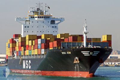
MSC KIM
Container Ship
Current Trip
| Trip Time | 18 days |
|---|---|
| Trip Distance | 5077.34 nm |
| AVG Speed | 16.9 Knots |
| MAX Speed | 20 Knots |
| Draught | 11.7 m |
| AVG Wind | 11.5 knots |
| MAX Wind | 21 knots |
| MIN Temp | 20.3°C / 68.54°F |
| MAX Temp | 28.2°C / 82.76°F |
| Position Received | 10 d ago |
Current Position
| Longitude | --- |
|---|---|
| Latitude | --- |
| Status | Under way using engine |
| Speed | 17.6 Knots |
| Course | 107.6° |
| Area | North Atlantic Ocean |
| Station | T-AIS |
| Position Received | 10 d ago |
Info
Information
The current position of MSC KIM is in North Atlantic Ocean with coordinates 7.79230° / -19.07457° as reported on 2025-12-24 04:28 by AIS to our vessel tracker app. The vessel's current speed is 17.6 Knots and is currently inside the port of LAGOS.
The vessel MSC KIM (IMO: 9351581, MMSI: 356205000) is a Container Ship that was built in 2008 ( 18 years old ). It's sailing under the flag of [PA] Panama.
In this page you can find informations about the vessels current position, last detected port calls, and current voyage information. If the vessels is not in coverage by AIS you will find the latest position.
The current position of MSC KIM is detected by our AIS receivers and we are not responsible for the reliability of the data. The last position was recorded while the vessel was in Coverage by the Ais receivers of our vessel tracking app.
The current draught of MSC KIM as reported by AIS is 11.7 meters
Weather
| Temperature | 28.6°C / 83.48°F |
|---|---|
| Wind Speed | 10 knots |
| Direction | 208° SSW |
| Pressure | 1011.1 hPa |
| Humidity | 69.6 % |
| Cloud Coverage | 8 % |
Featured Company
Last Port Calls
| Port | Arrival | Departure | Time In Port |
|---|---|---|---|
| 2026-01-03 08:20 | |||
| 2025-12-14 10:07 | 2025-12-15 21:39 | 1 d | |
| 2025-12-09 15:32 | 2025-12-10 09:11 | 17 h | |
| 2025-12-03 15:18 | 2025-12-04 20:24 | 1 d | |
| 2025-11-25 20:47 | 2025-11-26 20:09 | 23 h | |
| 2025-11-22 06:08 | 2025-11-22 18:31 | 12 h | |
| 2025-11-14 19:34 | 2025-11-15 17:12 | 21 h | |
| 2025-11-10 02:24 | 2025-11-10 19:56 | 17 h | |
| 2025-11-06 14:42 | 2025-11-08 09:17 | 1 d | |
| 2025-11-05 11:03 | 2025-11-06 03:31 | 16 h |
Last Trips
| Origin | Departure | Destination | Arrival | Distance | |
|---|---|---|---|---|---|
| 2025-12-15 21:39 | 2026-01-03 08:20 | 5077.34 nm | |||
| 2025-12-10 09:11 | 2025-12-14 10:07 | 515.76 nm | |||
| 2025-12-04 20:24 | 2025-12-09 15:32 | 788.40 nm | |||
| 2025-11-26 20:09 | 2025-12-03 15:18 | 1564.89 nm | |||
| 2025-11-22 18:31 | 2025-11-25 20:47 | 990.27 nm | |||
| 2025-11-15 17:12 | 2025-11-22 06:08 | 2541.64 nm | |||
| 2025-11-10 19:56 | 2025-11-14 19:34 | 897.49 nm | |||
| 2025-11-08 09:17 | 2025-11-10 02:24 | 524.45 nm | |||
| 2025-11-06 03:31 | 2025-11-06 14:42 | 86.13 nm | |||
| 2025-11-02 20:40 | 2025-11-05 11:03 | 341.40 nm |
Events
| Time | Event | Details | Position / Dest | Info |
|---|---|---|---|---|
| 2026-01-03 08:52 | STOP Moving |
6.42931 / 3.34153
[NG] LAGOS
|
Speed: 0.1 kn Course: 275° |
|
| 2026-01-03 07:20 | PORT ARRIVAL |
|
6.40677 / 3.40008
[NG] LAGOS
|
Speed: 1.8 kn Course: 8° |
| 2026-01-02 15:29 | START Moving | 1.02 nm, South West of TEMA |
5.61489 / .00564
GHTEM
|
Speed: 8.1 kn Course: 85° |
| 2026-01-01 08:34 | STOP Moving | 1.41 nm, South West of TEMA |
5.61638 / -.00534
GHTEM
|
Speed: Course: 244° |
| 2026-01-01 06:04 | START Moving | 6.64 nm, South East of TEMA |
5.54997 / .09184
GHTEM
|
Speed: 4.1 kn Course: 355° |
| 2025-12-27 13:21 | STOP Moving | 6.92 nm, South East of TEMA |
5.54833 / .09667
GHTEM
|
Speed: Course: -1° |