
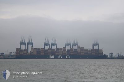
MSC ILARIA
Cargo A
Current Trip
| Time Travelled | 17 days |
|---|---|
| Remaining Time | --- |
| Distance Travelled | 7450.82 nm |
| Remaining Distance | --- |
| AVG Speed | 17.7 Knots |
| MAX Speed | 22.4 Knots |
| AVG Wind | 11.7 knots |
| MAX Wind | 28 knots |
| MIN Temp | 19.6°C / 67.28°F |
| MAX Temp | 28.6°C / 83.48°F |
| Draught | 16.6 m |
| Position Received | 3 d ago |
Current Position
| Longitude | --- |
|---|---|
| Latitude | --- |
| Status | Under way using engine |
| Speed | 18.1 Knots |
| Course | 322.6° |
| Area | South Atlantic Ocean |
| Station | T-AIS |
| Position Received | 3 d ago |
Info
Information
The current position of MSC ILARIA is in South Atlantic Ocean with coordinates -30.85065° / 15.06522° as reported on 2025-12-31 09:08 by AIS to our vessel tracker app. The vessel's current speed is 18.1 Knots and is heading at the port of SINES. The estimated time of arrival as calculated by MyShipTracking vessel tracking app is 2026-01-12 07:15 LT
The vessel MSC ILARIA (IMO: 9962586, MMSI: 636023378) is a Cargo A It's sailing under the flag of [LR] Liberia.
In this page you can find informations about the vessels current position, last detected port calls, and current voyage information. If the vessels is not in coverage by AIS you will find the latest position.
The current position of MSC ILARIA is detected by our AIS receivers and we are not responsible for the reliability of the data. The last position was recorded while the vessel was in Coverage by the Ais receivers of our vessel tracking app.
The current draught of MSC ILARIA as reported by AIS is 16.6 meters
Weather
| Temperature | 23.2°C / 73.76°F |
|---|---|
| Wind Speed | 13 knots |
| Direction | 150° SSE |
| Pressure | 1014.1 hPa |
| Humidity | 78.6 % |
| Cloud Coverage | 92 % |
Featured Company
Last Trips
Events
| Time | Event | Details | Position / Dest | Info |
|---|---|---|---|---|
| 2025-12-31 09:16 | Status Changed | Default Under way using engine |
-30.82178 / 15.03991
PTSIE
|
Speed: 18.1 kn Course: 322.6° |
| 2025-12-31 09:08 | Status Changed | Under way using engine Default |
-30.85065 / 15.06522
PTSIE
|
Speed: 18.1 kn Course: 323° |
| 2025-12-31 09:08 | OUT of Coverage |
-30.85065 / 15.06522
South Atlantic Ocean
PTSIE
|
Speed: 18.1 kn Course: 322.6° |
|
| 2025-12-31 09:00 | IN Coverage |
-30.85065 / 15.06522
South Atlantic Ocean
PTSIE
|
Speed: 18.1 kn Course: 322.6° |
|
| 2025-12-30 20:40 | Status Changed | Default Under way using engine |
-33.93464 / 17.80371
PTSIE
|
Speed: 18.1 kn Course: 324.3° |
| 2025-12-30 20:34 | OUT of Coverage |
-33.95791 / 17.82384
South Atlantic Ocean
PTSIE
|
Speed: 18.1 kn Course: 324.3° |
|
| 2025-12-30 19:12 | Status Changed | Under way using engine Default |
-34.28509 / 18.11737
PTSIE
|
Speed: 19.3 kn Course: 320° |
| 2025-12-30 19:07 | Status Changed | Default Under way using engine |
-34.30426 / 18.13575
PTSIE
|
Speed: 19.5 kn Course: 320° |
| 2025-12-30 19:00 | Status Changed | Under way using engine Default |
-34.33702 / 18.16921
PTSIE
|
Speed: 19.4 kn Course: 319° |
| 2025-12-30 18:52 | IN Coverage |
-34.33702 / 18.16921
South Atlantic Ocean
PTSIE
|
Speed: 19.5 kn Course: 320° |