
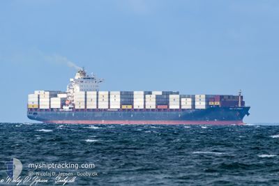
MSC GUERNSEY
Cargo
Current Trip
| Time Travelled | 12 h, 49 mins |
|---|---|
| Remaining Time | 1 day |
| Distance Travelled | 121.54 nm |
| Remaining Distance | 303.73 nm |
| AVG Speed | 12.2 Knots |
| MAX Speed | 13 Knots |
| AVG Wind | 5.2 knots |
| MAX Wind | 7.1 knots |
| MIN Temp | 3.9°C / 39.02°F |
| MAX Temp | 5.1°C / 41.18°F |
| Draught | 9.3 m |
| Position Received | Now |
Current Position
| Longitude | 25.25885° |
|---|---|
| Latitude | 59.87502° |
| Status | Under way using engine |
| Speed | 11.2 Knots |
| Course | 258.5° |
| Area | Gulf of Finland |
| Station | T-AIS |
| Position Received | Now |
Info
Information
The current position of MSC GUERNSEY is in Gulf of Finland with coordinates 59.87502° / 25.25885° as reported on 2024-05-02 08:09 by AIS to our vessel tracker app. The vessel's current speed is 11.2 Knots and is heading at the port of RIGA. The estimated time of arrival as calculated by MyShipTracking vessel tracking app is 2024-05-03 09:47 LT
The vessel MSC GUERNSEY (IMO: 9631876, MMSI: 255806368) is a Cargo It's sailing under the flag of [PT] Portugal.
In this page you can find informations about the vessels current position, last detected port calls, and current voyage information. If the vessels is not in coverage by AIS you will find the latest position.
The current position of MSC GUERNSEY is detected by our AIS receivers and we are not responsible for the reliability of the data. The last position was recorded while the vessel was in Coverage by the Ais receivers of our vessel tracking app.
The current draught of MSC GUERNSEY as reported by AIS is 9.3 meters
Weather
| Temperature | 5.2°C / 41.36°F |
|---|---|
| Wind Speed | 4 knots |
| Direction | 143° SE |
| Pressure | 1025.8 hPa |
| Humidity | 79.6 % |
| Cloud Coverage | 27 % |
Featured Company
Last Port Calls
| Port | Arrival | Departure | Time In Port |
|---|---|---|---|
| 2024-04-30 03:16 | 2024-05-01 19:21 | 1 d | |
| 2024-04-26 15:19 | 2024-04-27 03:35 | 12 h | |
| 2024-04-23 02:08 | 2024-04-24 14:17 | 1 d | |
| 2024-04-14 15:20 | 2024-04-16 09:04 | 1 d | |
| 2024-04-08 22:34 | 2024-04-10 05:12 | 1 d | |
| 2024-03-31 22:36 | 2024-04-02 09:01 | 1 d | |
| 2024-03-31 14:52 | 2024-03-31 22:34 | 7 h | |
| 2024-03-25 13:27 | 2024-03-27 04:04 | 1 d | |
| 2024-03-17 02:36 | 2024-03-18 20:48 | 1 d | |
| 2024-03-10 23:48 | 2024-03-12 12:07 | 1 d |
Most Visited Ports (Last year)
| Port | Arrivals | |
|---|---|---|
| 23 | ||
| 18 | ||
| 9 | ||
| 7 | ||
| 5 | ||
| 4 |
Last Trips
| Origin | Departure | Destination | Arrival | Distance | |
|---|---|---|---|---|---|
| 2024-04-27 05:35 | 2024-04-30 06:16 | 882.73 nm | |||
| 2024-04-24 16:17 | 2024-04-26 17:19 | 706.18 nm | |||
| 2024-04-16 12:04 | 2024-04-23 04:08 | 1768.21 nm | |||
| 2024-04-10 07:12 | 2024-04-14 18:20 | 1535.36 nm | |||
| 2024-04-02 12:01 | 2024-04-09 00:34 | 1784.74 nm | |||
| 2024-04-01 01:34 | 2024-04-01 01:36 | 1.62 nm | |||
| 2024-03-27 05:04 | 2024-03-31 17:52 | 1536.29 nm | |||
| 2024-03-18 23:48 | 2024-03-25 14:27 | 1753.91 nm | |||
| 2024-03-12 13:07 | 2024-03-17 05:36 | 1535.44 nm | |||
| 2024-03-06 23:27 | 2024-03-11 00:48 | 458.72 nm |
Events
| Time | Event | Details | Position / Dest | Info |
|---|---|---|---|---|
| 2024-05-02 08:06 | Change Sea Area | Estonian part of the Gulf of Finland Finnish part of the Gulf of Finland |
59.87648 / 25.27627
Gulf of Finland
RIGA
|
Speed: 11.3 kn Course: 261.5° |
| 2024-05-02 08:06 | Status Changed | Under way using engine Default |
59.87663 / 25.27830
RIGA
|
Speed: 11.3 kn Course: 262° |
| 2024-05-02 08:01 | Status Changed | Default Under way using engine |
59.87907 / 25.31122
RIGA
|
Speed: 11.4 kn Course: 262.5° |
| 2024-05-02 06:36 | Status Changed | Under way using engine Default |
59.92275 / 25.83210
RIGA
|
Speed: 11.4 kn Course: 255° |
| 2024-05-02 06:32 | Status Changed | Default Under way using engine |
59.92608 / 25.85742
RIGA
|
Speed: 11.4 kn Course: 255° |
| 2024-05-02 06:22 | Status Changed | Under way using engine Default |
59.93425 / 25.91842
RIGA
|
Speed: 11.4 kn Course: 256° |
| 2024-05-02 06:20 | Status Changed | Default Under way using engine |
59.93575 / 25.92963
RIGA
|
Speed: 11.5 kn Course: 254.4° |
| 2024-05-02 05:50 | Detected in Sea | Finnish part of the Gulf of Finland |
59.96118 / 26.11228
Gulf of Finland
RIGA
|
Speed: 11.5 kn Course: 253.9° |
| 2024-05-02 05:17 | Detected in Sea | Estonian part of the Gulf of Finland |
59.99160 / 26.32142
Gulf of Finland
RIGA
|
Speed: 12.3 kn Course: 254.8° |
| 2024-05-01 23:28 | ETA Changed | 2024/05/03 15:00 2024/05/03 16:05 |
60.06020 / 28.51197
RIGA
|
Speed: 12.8 kn Course: 278.7° |