
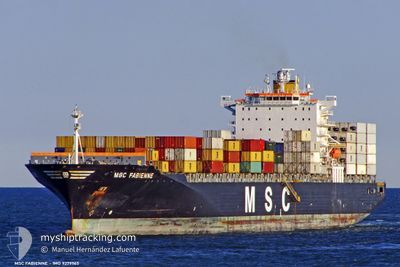
MSC FABIENNE
Container Ship
Current Trip
| Time Travelled | 3 days |
|---|---|
| Remaining Time | 18 h, 13 mins |
| Distance Travelled | 1580.02 nm |
| Remaining Distance | 342.60 nm |
| AVG Speed | 18.2 Knots |
| MAX Speed | 19.5 Knots |
| AVG Wind | 10.3 knots |
| MAX Wind | 22.5 knots |
| MIN Temp | 13.4°C / 56.12°F |
| MAX Temp | 18.3°C / 64.94°F |
| Draught | 13.2 m |
| Position Received | Now |
Current Position
| Longitude | --- |
|---|---|
| Latitude | --- |
| Status | Under way using engine |
| Speed | 18.8 Knots |
| Course | 267.3° |
| Area | Alboran Sea |
| Station | T-AIS |
| Position Received | Now |
Info
Information
The current position of MSC FABIENNE is in Alboran Sea with coordinates 36.22981° / -3.91714° as reported on 2024-12-14 03:27 by AIS to our vessel tracker app. The vessel's current speed is 18.8 Knots and is heading at the port of SINES. The estimated time of arrival as calculated by MyShipTracking vessel tracking app is 2024-12-14 21:41 LT
The vessel MSC FABIENNE (IMO: 9279965, MMSI: 354415000) is a Container Ship that was built in 2004 ( 20 years old ). It's sailing under the flag of [PA] Panama.
In this page you can find informations about the vessels current position, last detected port calls, and current voyage information. If the vessels is not in coverage by AIS you will find the latest position.
The current position of MSC FABIENNE is detected by our AIS receivers and we are not responsible for the reliability of the data. The last position was recorded while the vessel was in Coverage by the Ais receivers of our vessel tracking app.
The current draught of MSC FABIENNE as reported by AIS is 13.2 meters
Weather
| Temperature | 15.7°C / 60.26°F |
|---|---|
| Wind Speed | 6 knots |
| Direction | 48° NE |
| Pressure | 1026 hPa |
| Humidity | 67.8 % |
| Cloud Coverage | 68 % |
Featured Company
Last Port Calls
| Port | Arrival | Departure | Time In Port |
|---|---|---|---|
| 2024-12-09 18:48 | 2024-12-10 16:04 | 21 h | |
| 2024-12-08 05:20 | 2024-12-09 01:56 | 20 h | |
| 2024-12-06 17:06 | 2024-12-07 04:44 | 11 h | |
| 2024-12-03 13:32 | 2024-12-04 12:28 | 22 h | |
| 2024-11-29 21:37 | 2024-11-30 13:25 | 15 h | |
| 2024-11-26 02:44 | 2024-11-26 23:31 | 20 h | |
| 2024-11-23 03:53 | 2024-11-24 03:05 | 23 h | |
| 2024-11-21 01:51 | 2024-11-21 13:35 | 11 h | |
| 2024-11-19 07:17 | 2024-11-20 16:33 | 1 d | |
| 2024-11-15 13:19 | 2024-11-16 09:57 | 20 h |
Last Trips
| Origin | Departure | Destination | Arrival | Distance | |
|---|---|---|---|---|---|
| 2024-12-09 01:56 | 2024-12-09 18:48 | 211.81 nm | |||
| 2024-12-07 04:44 | 2024-12-08 05:20 | 100.68 nm | |||
| 2024-12-04 12:28 | 2024-12-06 17:06 | 846.66 nm | |||
| 2024-11-30 13:25 | 2024-12-03 13:32 | 1349.89 nm | |||
| 2024-11-26 23:31 | 2024-11-29 21:37 | 1141.19 nm | |||
| 2024-11-24 03:05 | 2024-11-26 02:44 | 306.14 nm | |||
| 2024-11-21 13:35 | 2024-11-23 03:53 | 381.93 nm | |||
| 2024-11-20 16:33 | 2024-11-21 01:51 | 133.56 nm | |||
| 2024-11-16 09:57 | 2024-11-19 07:17 | 620.37 nm | |||
| 2024-11-12 22:26 | 2024-11-15 13:19 | 965.26 nm |
Events
| Time | Event | Details | Position / Dest | Info |
|---|---|---|---|---|
| 2024-12-14 01:52 | Status Changed | Under way using engine Default |
36.30798 / -3.31326
PTSIE
|
Speed: 18.5 kn Course: 260° |
| 2024-12-14 01:45 | Status Changed | Default Under way using engine |
36.31381 / -3.27290
PTSIE
|
Speed: 18.5 kn Course: 260.2° |
| 2024-12-13 23:50 | ETA Changed | 2024/12/15 02:00 2024/12/15 06:00 |
36.39794 / -2.52459
PTSIE
|
Speed: 18.4 kn Course: 266.9° |
| 2024-12-13 23:34 | Status Changed | Under way using engine Default |
36.40210 / -2.44012
PTSIE
|
Speed: 18.7 kn Course: 262° |
| 2024-12-13 23:13 | Status Changed | Default Under way using engine |
36.41412 / -2.31008
PTSIE
|
Speed: 19.1 kn Course: 261.1° |
| 2024-12-13 23:06 | Change Sea Area | Spanish part of the Alboran Sea Maltese part of the Mediterranean Sea - Eastern Basin |
36.42007 / -2.26580
Alboran Sea
PTSIE
|
Speed: 19.1 kn Course: 261.1° |
| 2024-12-13 23:06 | Status Changed | Under way using engine Default |
36.42007 / -2.26580
PTSIE
|
Speed: 19.2 kn Course: 260° |
| 2024-12-13 23:06 | IN Coverage |
36.42007 / -2.26580
Alboran Sea
PTSIE
|
Speed: 19.1 kn Course: 261.1° |
|
| 2024-12-12 03:40 | Status Changed | Default Under way using engine |
36.49390 / 13.88802
PTSIE
|
Speed: 19.1 kn Course: 294.4° |
| 2024-12-12 03:33 | OUT of Coverage |
36.47826 / 13.93008
Mediterranean Sea - Eastern Basin
PTSIE
|
Speed: 19.1 kn Course: 294.4° |