
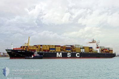
MSC ELA
Container Ship
Current Trip
| Time Travelled | 1 day |
|---|---|
| Remaining Time | --- |
| Distance Travelled | 544.11 nm |
| Remaining Distance | 96.17 nm |
| AVG Speed | 13.3 Knots |
| MAX Speed | 18.2 Knots |
| AVG Wind | 26.7 knots |
| MAX Wind | 35 knots |
| MIN Temp | -2.5°C / 27.5°F |
| MAX Temp | 21.8°C / 71.24°F |
| Draught | 10.3 m |
| Position Received | 1 d ago |
Current Position
| Longitude | --- |
|---|---|
| Latitude | --- |
| Status | Under way using engine |
| Speed | 12.6 Knots |
| Course | 121.4° |
| Area | North Atlantic Ocean |
| Station | T-AIS |
| Position Received | 1 d ago |
Info
Information
The current position of MSC ELA is in North Atlantic Ocean with coordinates 32.65841° / -79.67590° as reported on 2025-12-14 04:01 by AIS to our vessel tracker app. The vessel's current speed is 12.6 Knots and is heading at the port of NEW YORK. The estimated time of arrival as calculated by MyShipTracking vessel tracking app is 2025-12-15 20:30 LT
The vessel MSC ELA (IMO: 9282259, MMSI: 353934000) is a Container Ship that was built in 2004 ( 21 years old ). It's sailing under the flag of [PA] Panama.
In this page you can find informations about the vessels current position, last detected port calls, and current voyage information. If the vessels is not in coverage by AIS you will find the latest position.
The current position of MSC ELA is detected by our AIS receivers and we are not responsible for the reliability of the data. The last position was recorded while the vessel was in Coverage by the Ais receivers of our vessel tracking app.
The current draught of MSC ELA as reported by AIS is 10.3 meters
Weather
| Temperature | -0.8°C / 30.56°F |
|---|---|
| Wind Speed | 20 knots |
| Direction | 307° NW |
| Pressure | 1025.2 hPa |
| Humidity | 69.1 % |
| Cloud Coverage | 100 % |
Featured Company
Last Port Calls
| Port | Arrival | Departure | Time In Port |
|---|---|---|---|
| 2025-12-13 03:46 | 2025-12-13 22:16 | 18 h | |
| 2025-12-11 08:30 | 2025-12-11 21:20 | 12 h | |
| 2025-12-06 13:55 | 2025-12-07 08:19 | 18 h | |
| 2025-12-04 00:33 | 2025-12-05 05:41 | 1 d | |
| 2025-12-01 03:11 | 2025-12-02 13:25 | 1 d | |
| 2025-11-28 15:22 | 2025-11-29 09:45 | 18 h | |
| 2025-11-10 13:34 | 2025-11-11 08:28 | 18 h | |
| 2025-11-05 07:45 | 2025-11-09 10:55 | 4 d | |
| 2025-10-25 03:52 | 2025-10-25 21:57 | 18 h | |
| 2025-10-21 10:50 | 2025-10-21 21:18 | 10 h |
Most Visited Ports (Last year)
| Port | Arrivals | |
|---|---|---|
| 9 | ||
| 8 | ||
| 6 | ||
| 5 | ||
| 5 | ||
| 4 |
Last Trips
| Origin | Departure | Destination | Arrival | Distance | |
|---|---|---|---|---|---|
| 2025-12-11 21:20 | 2025-12-13 03:46 | 418.56 nm | |||
| 2025-12-07 08:19 | 2025-12-11 08:30 | 846.55 nm | |||
| 2025-12-05 05:41 | 2025-12-06 13:55 | 291.43 nm | |||
| 2025-12-02 13:25 | 2025-12-04 00:33 | 447.06 nm | |||
| 2025-11-29 09:45 | 2025-12-01 03:11 | 515.04 nm | |||
| 2025-11-11 08:28 | 2025-11-28 15:22 | 6102.45 nm | |||
| 2025-11-09 10:55 | 2025-11-10 13:34 | 368.74 nm | |||
| 2025-10-25 21:57 | 2025-11-05 07:45 | 4227.30 nm | |||
| 2025-10-21 21:18 | 2025-10-25 03:52 | 1191.05 nm | |||
| 2025-10-20 09:18 | 2025-10-21 10:50 | 291.88 nm |
Events
| Time | Event | Details | Position / Dest | Info |
|---|---|---|---|---|
| 2025-12-14 04:07 | Status Changed | Default Under way using engine |
32.65012 / -79.65932
US NYC
|
Speed: 12.6 kn Course: 121.4° |
| 2025-12-14 04:01 | OUT of Coverage |
32.65841 / -79.67590
North Atlantic Ocean
US NYC
|
Speed: 12.6 kn Course: 121.4° |
|
| 2025-12-14 03:45 | Status Changed | Under way using engine Default |
32.69286 / -79.74776
US NYC
|
Speed: 15.5 kn Course: 120° |
| 2025-12-14 03:43 | Status Changed | Default Under way using engine |
32.69625 / -79.75489
US NYC
|
Speed: 15.6 kn Course: 119.4° |
| 2025-12-14 03:42 | Status Changed | Under way using engine Default |
32.69921 / -79.76109
US NYC
|
Speed: 15.2 kn Course: 120° |
| 2025-12-14 03:31 | Status Changed | Default Under way using engine |
32.72082 / -79.80652
US NYC
|
Speed: 11.8 kn Course: 118.6° |
| 2025-12-14 03:25 | Status Changed | Under way using engine Default |
32.73166 / -79.82936
US NYC
|
Speed: 12.2 kn Course: 118° |
| 2025-12-14 03:23 | Status Changed | Default Under way using engine |
32.73457 / -79.83575
US NYC
|
Speed: 12.1 kn Course: 137° |
| 2025-12-14 03:16 | PORT DEPARTURE |
|
32.75027 / -79.85765
US NYC
|
Speed: 12.4 kn Course: 134° |
| 2025-12-14 01:57 | START Moving |
32.90467 / -79.95456
[US] CHARLESTON
|
Speed: 4.7 kn Course: 223° |