
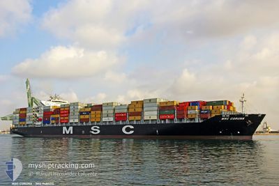
MSC CORUNA
Container Ship
Current Trip
| Time Travelled | 5 h, 11 mins |
|---|---|
| Remaining Time | 1 day |
| Distance Travelled | 56.38 nm |
| Remaining Distance | 366.53 nm |
| AVG Speed | 11.8 Knots |
| MAX Speed | 14.5 Knots |
| AVG Wind | 6.1 knots |
| MAX Wind | 7 knots |
| MIN Temp | 13°C / 55.4°F |
| MAX Temp | 19.5°C / 67.1°F |
| Draught | 9.7 m |
| Position Received | 1 h, 42 m ago |
Current Position
| Longitude | --- |
|---|---|
| Latitude | --- |
| Status | Under way using engine |
| Speed | 11.1 Knots |
| Course | 179.6° |
| Area | Gulf of Mexico |
| Station | T-AIS |
| Position Received | 1 h, 42 m ago |
Info
Information
The current position of MSC CORUNA is in Gulf of Mexico with coordinates 29.10078° / -94.42880° as reported on 2025-12-10 15:32 by AIS to our vessel tracker app. The vessel's current speed is 11.1 Knots and is heading at the port of NEW ORLEANS. The estimated time of arrival as calculated by MyShipTracking vessel tracking app is 2025-12-11 19:24 LT
The vessel MSC CORUNA (IMO: 9480215, MMSI: 256172000) is a Container Ship that was built in 2011 ( 14 years old ). It's sailing under the flag of [MT] Malta.
In this page you can find informations about the vessels current position, last detected port calls, and current voyage information. If the vessels is not in coverage by AIS you will find the latest position.
The current position of MSC CORUNA is detected by our AIS receivers and we are not responsible for the reliability of the data. The last position was recorded while the vessel was in Coverage by the Ais receivers of our vessel tracking app.
The current draught of MSC CORUNA as reported by AIS is 9.7 meters
Weather
| Temperature | 20.1°C / 68.18°F |
|---|---|
| Wind Speed | 5 knots |
| Direction | 258° WSW |
| Pressure | 1017 hPa |
| Humidity | 76.8 % |
| Cloud Coverage | --- |
Featured Company
Last Port Calls
| Port | Arrival | Departure | Time In Port |
|---|---|---|---|
| 2025-12-09 03:22 | 2025-12-10 06:03 | 1 d | |
| 2025-12-06 06:39 | 2025-12-07 09:14 | 1 d | |
| 2025-11-16 05:04 | 2025-11-17 05:18 | 1 d | |
| 2025-11-14 17:43 | 2025-11-15 08:47 | 15 h | |
| 2025-11-12 00:24 | 2025-11-13 11:24 | 1 d | |
| 2025-11-01 15:52 | 2025-11-02 11:56 | 21 h | |
| 2025-10-29 00:11 | 2025-10-29 19:33 | 19 h | |
| 2025-10-26 03:13 | 2025-10-26 20:11 | 16 h | |
| 2025-10-23 02:57 | 2025-10-23 20:12 | 17 h | |
| 2025-10-21 02:57 | 2025-10-22 00:02 | 21 h |
Most Visited Ports (Last year)
| Port | Arrivals | |
|---|---|---|
| 8 | ||
| 8 | ||
| 8 | ||
| 7 | ||
| 6 | ||
| 6 |
Last Trips
| Origin | Departure | Destination | Arrival | Distance | |
|---|---|---|---|---|---|
| 2025-12-07 09:14 | 2025-12-09 03:22 | 499.93 nm | |||
| 2025-11-17 05:18 | 2025-12-06 06:39 | 6003.47 nm | |||
| 2025-11-15 08:47 | 2025-11-16 05:04 | 275.91 nm | |||
| 2025-11-13 11:24 | 2025-11-14 17:43 | 120.15 nm | |||
| 2025-11-02 11:56 | 2025-11-12 00:24 | 4306.23 nm | |||
| 2025-10-29 19:33 | 2025-11-01 15:52 | 604.10 nm | |||
| 2025-10-26 20:11 | 2025-10-29 00:11 | 297.70 nm | |||
| 2025-10-23 20:12 | 2025-10-26 03:13 | 523.61 nm | |||
| 2025-10-22 00:02 | 2025-10-23 02:57 | 118.40 nm | |||
| 2025-10-12 04:36 | 2025-10-21 02:57 | 3703.43 nm |
Events
| Time | Event | Details | Position / Dest | Info |
|---|---|---|---|---|
| 2025-12-10 15:39 | Status Changed | Default Under way using engine |
29.07926 / -94.42831
USHOU>USMSY
|
Speed: 11.1 kn Course: 179.6° |
| 2025-12-10 15:32 | OUT of Coverage |
29.10078 / -94.42880
Gulf of Mexico
USHOU>USMSY
|
Speed: 11.1 kn Course: 179.6° |
|
| 2025-12-10 15:28 | Status Changed | Under way using engine Default |
29.11210 / -94.43038
USHOU>USMSY
|
Speed: 11.4 kn Course: 154° |
| 2025-12-10 15:27 | IN Coverage |
29.11161 / -94.43017
Gulf of Mexico
USHOU>USMSY
|
Speed: 11.3 kn Course: 159.9° |
|
| 2025-12-10 13:51 | Status Changed | Default Under way using engine |
29.33850 / -94.68511
USHOU>USMSY
|
Speed: 12.9 kn Course: 96.9° |
| 2025-12-10 13:44 | OUT of Coverage |
29.34522 / -94.71335
Gulf of Mexico
USHOU>USMSY
|
Speed: 12.9 kn Course: 96.9° |
|
| 2025-12-10 13:21 | Status Changed | Under way using engine Default |
29.36076 / -94.79500
USHOU>USMSY
|
Speed: 12.2 kn Course: 140° |
| 2025-12-10 13:19 | Status Changed | Default Under way using engine |
29.36632 / -94.80058
USHOU>USMSY
|
Speed: 12.2 kn Course: 152.1° |
| 2025-12-10 13:11 | Status Changed | Under way using engine Default |
29.39153 / -94.81393
USHOU>USMSY
|
Speed: 12.6 kn Course: 156° |
| 2025-12-10 13:03 | Status Changed | Default Under way using engine |
29.41779 / -94.82729
USHOU>USMSY
|
Speed: 11.9 kn Course: 158.2° |