
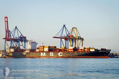
MSC CHANNE
Cargo C
Current Trip
PANAMA
| Time Travelled | 9 h, 57 mins |
|---|---|
| Remaining Time | --- |
| Distance Travelled | 177.13 nm |
| Remaining Distance | --- |
| AVG Speed | 15.1 Knots |
| MAX Speed | 20.5 Knots |
| AVG Wind | 7.7 knots |
| MAX Wind | 14 knots |
| MIN Temp | 27°C / 80.6°F |
| MAX Temp | 28.4°C / 83.12°F |
| Draught | 10.6 m |
| Position Received | 6 h, 51 m ago |
Current Position
| Longitude | --- |
|---|---|
| Latitude | --- |
| Status | Under way using engine |
| Speed | 19 Knots |
| Course | 178.2° |
| Area | North Pacific Ocean |
| Station | T-AIS |
| Position Received | 6 h, 51 m ago |
Info
Information
The current position of MSC CHANNE is in North Pacific Ocean with coordinates 8.24643° / -79.45244° as reported on 2024-12-15 17:16 by AIS to our vessel tracker app. The vessel's current speed is 19 Knots
The vessel MSC CHANNE (IMO: 9710438, MMSI: 255805864) is a Cargo C It's sailing under the flag of [PT] Portugal.
In this page you can find informations about the vessels current position, last detected port calls, and current voyage information. If the vessels is not in coverage by AIS you will find the latest position.
The current position of MSC CHANNE is detected by our AIS receivers and we are not responsible for the reliability of the data. The last position was recorded while the vessel was in Coverage by the Ais receivers of our vessel tracking app.
The current draught of MSC CHANNE as reported by AIS is 10.6 meters
Weather
| Temperature | 27.2°C / 80.96°F |
|---|---|
| Wind Speed | 9 knots |
| Direction | 8° N |
| Pressure | 1009 hPa |
| Humidity | 78.8 % |
| Cloud Coverage | 26 % |
Featured Company
Last Port Calls
| Port | Arrival | Departure | Time In Port |
|---|---|---|---|
| 2024-12-14 19:58 | 2024-12-15 09:11 | 13 h | |
| 2024-12-10 08:12 | 2024-12-11 23:40 | 1 d | |
| 2024-11-30 11:42 | 2024-12-01 19:01 | 1 d | |
| 2024-11-25 17:09 | 2024-11-27 03:35 | 1 d | |
| 2024-11-22 13:29 | 2024-11-25 01:25 | 2 d | |
| 2024-11-18 15:13 | 2024-11-20 23:36 | 2 d | |
| 2024-11-05 11:10 | 2024-11-06 17:31 | 1 d | |
| 2024-10-31 15:01 | 2024-11-01 06:13 | 15 h | |
| 2024-10-28 14:09 | 2024-10-28 14:13 | 3 m | |
| 2024-10-24 09:20 | 2024-10-24 10:14 | 53 m |
Most Visited Ports (Last year)
| Port | Arrivals | |
|---|---|---|
| 5 | ||
| 5 | ||
| 4 | ||
| 4 | ||
| 4 | ||
| 4 |
Last Trips
| Origin | Departure | Destination | Arrival | Distance | |
|---|---|---|---|---|---|
| 2024-12-11 23:40 | 2024-12-14 19:58 | 868.60 nm | |||
| 2024-12-01 19:01 | 2024-12-10 08:12 | 3557.91 nm | |||
| 2024-11-27 03:35 | 2024-11-30 11:42 | 1279.27 nm | |||
| 2024-11-25 01:25 | 2024-11-25 17:09 | 196.84 nm | |||
| 2024-11-20 23:36 | 2024-11-22 13:29 | 203.26 nm | |||
| 2024-11-06 17:31 | 2024-11-18 15:13 | 4444.15 nm | |||
| 2024-11-01 06:13 | 2024-11-05 11:10 | 951.63 nm | |||
| 2024-10-28 14:13 | 2024-10-31 15:01 | 779.13 nm | |||
| 2024-10-24 10:14 | 2024-10-28 14:09 | 325.64 nm | |||
| 2024-10-15 22:02 | 2024-10-24 09:20 | 972.54 nm |
Events
| Time | Event | Details | Position / Dest | Info |
|---|---|---|---|---|
| 2024-12-15 17:20 | Status Changed | Default Under way using engine |
8.22379 / -79.45179
PANAMA
|
Speed: 19 kn Course: 178.2° |
| 2024-12-15 17:16 | Status Changed | Under way using engine Default |
8.24643 / -79.45244
PANAMA
|
Speed: 19.2 kn Course: 178° |
| 2024-12-15 17:16 | OUT of Coverage |
8.24643 / -79.45244
North Pacific Ocean
|
Speed: 19 kn Course: 178.2° |
|
| 2024-12-15 16:42 | Status Changed | Default Under way using engine |
8.43281 / -79.45824
PANAMA
|
Speed: 19.3 kn Course: 180.1° |
| 2024-12-15 14:47 | Change Sea Area | Panamanian part of the North Pacific Ocean Panamanian part of the Caribbean Sea |
8.90628 / -79.53599
North Pacific Ocean
|
Speed: 7.2 kn Course: 142.3° |
| 2024-12-15 14:11 | PORT DEPARTURE |
|
8.95821 / -79.57277
PANAMA
|
Speed: 3.8 kn Course: 153° |
| 2024-12-15 14:09 | START Moving |
8.95951 / -79.57399
[PA] RODMAN
|
Speed: 3.3 kn Course: 139° |
|
| 2024-12-15 13:57 | Status Changed | Under way using engine Moored |
8.96055 / -79.57635
[PA] RODMAN
|
Speed: Course: 152° |
| 2024-12-15 13:01 | Status Changed | Moored Default |
8.96055 / -79.57640
[PA] RODMAN
|
Speed: Course: 152° |
| 2024-12-15 12:58 | Status Changed | Default Moored |
8.96059 / -79.57639
[PA] RODMAN
|
Speed: Course: 152° |