
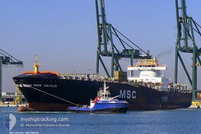
MSC CAITLIN II
Container Ship
Current Trip
| Trip Time | 1 day |
|---|---|
| Trip Distance | 465.57 nm |
| AVG Speed | 15 Knots |
| MAX Speed | 16.5 Knots |
| Draught | 8.1 m |
| AVG Wind | 6.6 knots |
| MAX Wind | 13 knots |
| MIN Temp | 13.6°C / 56.48°F |
| MAX Temp | 18.8°C / 65.84°F |
| Position Received | 15 h, 34 m ago |
Current Position
| Longitude | --- |
|---|---|
| Latitude | --- |
| Status | Under way using engine |
| Speed | 15.7 Knots |
| Course | 43.3° |
| Area | Mediterranean Sea - Eastern Basin |
| Station | T-AIS |
| Position Received | 15 h, 34 m ago |
Info
Information
The current position of MSC CAITLIN II is in Mediterranean Sea - Eastern Basin with coordinates 36.50807° / 35.85303° as reported on 2025-12-20 10:33 by AIS to our vessel tracker app. The vessel's current speed is 15.7 Knots and is currently inside the port of ISKENDERUN.
The vessel MSC CAITLIN II (IMO: 9169043, MMSI: 636018323) is a Container Ship that was built in 1998 ( 27 years old ). It's sailing under the flag of [LR] Liberia.
In this page you can find informations about the vessels current position, last detected port calls, and current voyage information. If the vessels is not in coverage by AIS you will find the latest position.
The current position of MSC CAITLIN II is detected by our AIS receivers and we are not responsible for the reliability of the data. The last position was recorded while the vessel was in Coverage by the Ais receivers of our vessel tracking app.
The current draught of MSC CAITLIN II as reported by AIS is 8.1 meters
Weather
| Temperature | 11.1°C / 51.98°F |
|---|---|
| Wind Speed | 9 knots |
| Direction | 95° E |
| Pressure | 1018.5 hPa |
| Humidity | 46.3 % |
| Cloud Coverage | 100 % |
Featured Company
Last Port Calls
| Port | Arrival | Departure | Time In Port |
|---|---|---|---|
| 2025-12-20 15:02 | |||
| 2025-12-18 12:34 | 2025-12-19 07:14 | 18 h | |
| 2025-12-16 20:01 | 2025-12-17 05:17 | 9 h | |
| 2025-12-15 17:22 | 2025-12-16 16:30 | 23 h | |
| 2025-12-13 08:57 | 2025-12-14 19:12 | 1 d | |
| 2025-12-11 13:40 | 2025-12-12 04:36 | 14 h | |
| 2025-12-08 17:08 | 2025-12-09 13:17 | 20 h | |
| 2025-12-06 10:34 | 2025-12-07 11:25 | 1 d | |
| 2025-12-03 06:05 | 2025-12-04 02:12 | 20 h | |
| 2025-11-30 16:50 | 2025-12-01 12:30 | 19 h |
Most Visited Ports (Last year)
| Port | Arrivals | |
|---|---|---|
| 11 | ||
| 11 | ||
| 10 | ||
| 9 | ||
| 9 | ||
| 6 |
Last Trips
| Origin | Departure | Destination | Arrival | Distance | |
|---|---|---|---|---|---|
| 2025-12-19 07:14 | 2025-12-20 15:02 | 465.57 nm | |||
| 2025-12-17 05:17 | 2025-12-18 12:34 | 172.79 nm | |||
| 2025-12-14 19:12 | 2025-12-16 20:01 | 190.47 nm | |||
| 2025-12-14 19:12 | 2025-12-15 17:22 | 160.02 nm | |||
| 2025-12-12 04:36 | 2025-12-13 08:57 | 87.53 nm | |||
| 2025-12-09 13:17 | 2025-12-11 13:40 | 656.24 nm | |||
| 2025-12-07 11:25 | 2025-12-08 17:08 | 275.41 nm | |||
| 2025-12-04 02:12 | 2025-12-06 10:34 | 743.40 nm | |||
| 2025-12-01 12:30 | 2025-12-03 06:05 | 490.09 nm | |||
| 2025-11-28 08:40 | 2025-11-30 16:50 | 383.66 nm |
Events
| Time | Event | Details | Position / Dest | Info |
|---|---|---|---|---|
| 2025-12-20 12:33 | STOP Moving |
36.68406 / 36.19605
[TR] ISKENDERUN
|
Speed: 0.2 kn Course: 67° |
|
| 2025-12-20 12:02 | PORT ARRIVAL |
|
36.67522 / 36.17733
[TR] ISKENDERUN
|
Speed: 5.2 kn Course: 56° |
| 2025-12-20 10:38 | Status Changed | Default Under way using engine |
36.52089 / 35.87013
EGEDK - TRISK
|
Speed: 15.7 kn Course: 43.3° |
| 2025-12-20 10:33 | OUT of Coverage |
36.50807 / 35.85303
Mediterranean Sea - Eastern Basin
EGEDK - TRISK
|
Speed: 15.7 kn Course: 43.3° |
|
| 2025-12-20 08:39 | Draught Changed | 8.1 10.6 |
36.14038 / 35.45849
EGEDK - TRISK
|
Speed: 15 kn Course: 38.3° |
| 2025-12-20 08:39 | Destination Changed | EGEDK - TRISK EGPSE - EGPSW |
36.14038 / 35.45849
EGEDK - TRISK
|
Speed: 15 kn Course: 38.3° |
| 2025-12-20 08:39 | ETA Changed | 2025/12/20 12:00 2025/12/15 06:00 |
36.14038 / 35.45849
EGEDK - TRISK
|
Speed: 15 kn Course: 38.3° |
| 2025-12-20 08:17 | Change Sea Area | Turkish part of the Mediterranean Sea - Eastern Basin Syrian part of the Mediterranean Sea - Eastern Basin |
36.07084 / 35.39343
Mediterranean Sea - Eastern Basin
|
Speed: 15 kn Course: 37.8° |
| 2025-12-20 08:16 | Status Changed | Under way using engine Default |
36.06717 / 35.38996
EGPSE - EGPSW
|
Speed: 15 kn Course: 38° |
| 2025-12-20 08:14 | Status Changed | Default Under way using engine |
36.06087 / 35.38398
EGPSE - EGPSW
|
Speed: 15 kn Course: 44.5° |