
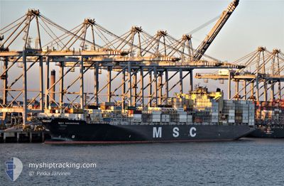
MSC ANCHORAGE
Container Ship
Current Trip
| Trip Time | 3 days |
|---|---|
| Trip Distance | 1476.65 nm |
| AVG Speed | 6.2 Knots |
| MAX Speed | 6.2 Knots |
| Draught | 9.7 m |
| AVG Wind | 16.2 knots |
| MAX Wind | 25 knots |
| MIN Temp | 15.8°C / 60.44°F |
| MAX Temp | 24.5°C / 76.1°F |
| Position Received | 2 m ago |
Current Position
| Longitude | --- |
|---|---|
| Latitude | --- |
| Status | Moored |
| Speed | |
| Course | 135° |
| Area | South Atlantic Ocean |
| Station | T-AIS |
| Position Received | 2 m ago |
Info
Information
The current position of MSC ANCHORAGE is in South Atlantic Ocean with coordinates -33.91268° / 18.45120° as reported on 2025-12-21 15:20 by AIS to our vessel tracker app. The vessel's current speed is 0 Knots and is currently inside the port of CAPE TOWN.
The vessel MSC ANCHORAGE (IMO: 9619440, MMSI: 636015666) is a Container Ship that was built in 2013 ( 12 years old ). It's sailing under the flag of [LR] Liberia.
In this page you can find informations about the vessels current position, last detected port calls, and current voyage information. If the vessels is not in coverage by AIS you will find the latest position.
The current position of MSC ANCHORAGE is detected by our AIS receivers and we are not responsible for the reliability of the data. The last position was recorded while the vessel was in Coverage by the Ais receivers of our vessel tracking app.
The current draught of MSC ANCHORAGE as reported by AIS is 9.7 meters
Weather
| Temperature | 27°C / 80.6°F |
|---|---|
| Wind Speed | 12 knots |
| Direction | 174° S |
| Pressure | 1005.7 hPa |
| Humidity | 52.9 % |
| Cloud Coverage | --- |
Featured Company
Last Port Calls
| Port | Arrival | Departure | Time In Port |
|---|---|---|---|
| 2025-12-19 08:33 | |||
| 2025-12-13 12:50 | 2025-12-15 08:37 | 1 d | |
| 2025-12-07 11:13 | 2025-12-10 14:59 | 3 d | |
| 2025-12-03 09:25 | 2025-12-05 18:45 | 2 d | |
| 2025-11-30 07:21 | 2025-12-01 19:05 | 1 d | |
| 2025-11-26 17:00 | 2025-11-27 16:57 | 23 h | |
| 2025-11-20 18:15 | 2025-11-23 21:00 | 3 d | |
| 2025-11-02 00:53 | 2025-11-03 09:10 | 1 d | |
| 2025-10-31 21:01 | 2025-11-01 23:31 | 1 d | |
| 2025-10-25 06:26 | 2025-10-28 00:31 | 2 d |
Most Visited Ports (Last year)
| Port | Arrivals | |
|---|---|---|
| 4 | ||
| 4 | ||
| 4 | ||
| 4 | ||
| 4 | ||
| 4 |
Last Trips
| Origin | Departure | Destination | Arrival | Distance | |
|---|---|---|---|---|---|
| 2025-12-15 09:37 | 2025-12-19 10:33 | 1476.65 nm | |||
| 2025-12-10 15:59 | 2025-12-13 13:50 | 1127.77 nm | |||
| 2025-12-05 19:45 | 2025-12-07 12:13 | 347.07 nm | |||
| 2025-12-01 20:05 | 2025-12-03 10:25 | 36.68 nm | |||
| 2025-11-27 17:57 | 2025-11-30 08:21 | 106.49 nm | |||
| 2025-11-23 22:00 | 2025-11-26 18:00 | 1057.35 nm | |||
| 2025-11-03 17:10 | 2025-11-20 19:15 | 7497.87 nm | |||
| 2025-11-02 07:31 | 2025-11-02 08:53 | 1.46 nm | |||
| 2025-10-28 08:31 | 2025-11-01 05:01 | 1455.55 nm | |||
| 2025-09-29 01:39 | 2025-10-25 14:26 | 9221.15 nm |
Events
| Time | Event | Details | Position / Dest | Info |
|---|---|---|---|---|
| 2025-12-19 08:56 | Status Changed | Moored Under way using engine |
-33.91267 / 18.45122
[ZA] CAPE TOWN
|
Speed: Course: 136° |
| 2025-12-19 08:49 | STOP Moving |
-33.91295 / 18.45080
[ZA] CAPE TOWN
|
Speed: 0.3 kn Course: 128° |
|
| 2025-12-19 08:33 | PORT ARRIVAL |
|
-33.89908 / 18.43672
[ZA] CAPE TOWN
|
Speed: 6.9 kn Course: 187° |
| 2025-12-19 08:00 | START Moving | 2.65 nm, North West of CAPE TOWN |
-33.87712 / 18.39939
ZACPT
|
Speed: 3.2 kn Course: 68° |
| 2025-12-19 07:56 | STOP Moving | 2.78 nm, North West of CAPE TOWN |
-33.87682 / 18.39607
ZACPT
|
Speed: Course: 81° |
| 2025-12-19 04:57 | START Moving | 11.88 nm, South West of ROBBEN ISLAND |
-33.88853 / 18.16613
ZACPT
|
Speed: 3.3 kn Course: 86° |
| 2025-12-19 04:09 | STOP Moving | 11.89 nm, North West of HOUT BAY |
-33.92343 / 18.16610
ZACPT
|
Speed: 0.3 kn Course: 162° |
| 2025-12-18 10:41 | Change Sea Area | South African part of the South Atlantic Ocean Namibian part of the South Atlantic Ocean |
-33.56351 / 17.95956
South Atlantic Ocean
ZACPT
|
Speed: 16.2 kn Course: 131.9° |
| 2025-12-18 10:41 | Draught Changed | 9.7 14.8 |
-33.56171 / 17.95715
ZACPT
|
Speed: 16.2 kn Course: 134.1° |
| 2025-12-18 10:41 | Destination Changed | ZACPT CGPNR |
-33.56171 / 17.95715
ZACPT
|
Speed: 16.2 kn Course: 134.1° |