
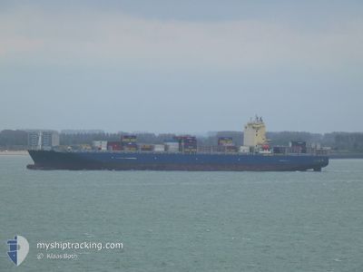
MSC ADONIS
Cargo A
Current Trip
| Time Travelled | 2 days |
|---|---|
| Remaining Time | --- |
| Distance Travelled | 942.14 nm |
| Remaining Distance | --- |
| AVG Speed | 16.1 Knots |
| MAX Speed | 17.9 Knots |
| AVG Wind | 15.7 knots |
| MAX Wind | 20 knots |
| MIN Temp | 24.2°C / 75.56°F |
| MAX Temp | 27.2°C / 80.96°F |
| Draught | 14 m |
| Position Received | 2 d ago |
Current Position
| Longitude | --- |
|---|---|
| Latitude | --- |
| Status | Moored |
| Speed | |
| Course | 98° |
| Area | Caribbean Sea |
| Station | T-AIS |
| Position Received | 2 d ago |
Info
Information
The current position of MSC ADONIS is in Caribbean Sea with coordinates 9.35088° / -79.90750° as reported on 2026-01-01 01:50 by AIS to our vessel tracker app. The vessel's current speed is 0 Knots and is heading at the port of RODMAN. The estimated time of arrival as calculated by MyShipTracking vessel tracking app is 2025-12-24 06:00 LT
The vessel MSC ADONIS (IMO: 9706310, MMSI: 636021251) is a Cargo A It's sailing under the flag of [LR] Liberia.
In this page you can find informations about the vessels current position, last detected port calls, and current voyage information. If the vessels is not in coverage by AIS you will find the latest position.
The current position of MSC ADONIS is detected by our AIS receivers and we are not responsible for the reliability of the data. The last position was recorded while the vessel was in Coverage by the Ais receivers of our vessel tracking app.
The current draught of MSC ADONIS as reported by AIS is 14 meters
Weather
| Temperature | 26.5°C / 79.7°F |
|---|---|
| Wind Speed | 12 knots |
| Direction | 103° ESE |
| Pressure | 1015 hPa |
| Humidity | 76.5 % |
| Cloud Coverage | 30 % |
Featured Company
Last Port Calls
| Port | Arrival | Departure | Time In Port |
|---|---|---|---|
| 2025-12-30 12:26 | 2025-12-31 23:35 | 1 d | |
| 2025-12-27 20:01 | 2025-12-28 21:31 | 1 d | |
| 2025-12-25 11:10 | 2025-12-27 06:46 | 1 d | |
| 2025-12-16 16:20 | 2025-12-17 04:35 | 12 h | |
| 2025-12-10 04:10 | 2025-12-11 05:10 | 1 d | |
| 2025-12-05 07:19 | 2025-12-06 16:42 | 1 d | |
| 2025-11-30 12:21 | 2025-12-02 02:29 | 1 d | |
| 2025-11-27 04:17 | 2025-11-29 19:52 | 2 d | |
| 2025-11-21 08:48 | 2025-11-22 06:10 | 21 h | |
| 2025-11-18 04:19 | 2025-11-19 20:34 | 1 d |
Last Trips
| Origin | Departure | Destination | Arrival | Distance | |
|---|---|---|---|---|---|
| 2025-12-28 21:31 | 2025-12-30 12:26 | 28.09 nm | |||
| 2025-12-27 06:46 | 2025-12-27 20:01 | 38.76 nm | |||
| 2025-12-17 04:35 | 2025-12-25 11:10 | 1621.21 nm | |||
| 2025-12-11 05:10 | 2025-12-16 16:20 | 1381.91 nm | |||
| 2025-12-06 16:42 | 2025-12-10 04:10 | 435.99 nm | |||
| 2025-12-02 02:29 | 2025-12-05 07:19 | 955.65 nm | |||
| 2025-11-29 19:52 | 2025-11-30 12:21 | 198.98 nm | |||
| 2025-11-22 06:10 | 2025-11-27 04:17 | 1231.19 nm | |||
| 2025-11-19 20:34 | 2025-11-21 08:48 | 410.49 nm | |||
| 2025-11-14 22:37 | 2025-11-18 04:19 | 1230.50 nm |
Events
| Time | Event | Details | Position / Dest | Info |
|---|---|---|---|---|
| 2026-01-01 04:35 | START Moving | 0.49 nm, North West of CRISTOBAL |
9.34952 / -79.91737
RODMAN PANAMA
|
Speed: 3.1 kn Course: 338° |
| 2026-01-01 04:35 | PORT DEPARTURE |
|
9.34952 / -79.91737
RODMAN PANAMA
|
Speed: 1.3 kn Course: 316° |
| 2026-01-01 01:56 | Status Changed | Default Moored |
9.35080 / -79.90750
[PA] CRISTOBAL
|
Speed: Course: 98° |
| 2026-01-01 01:50 | OUT of Coverage |
9.35088 / -79.90750
Caribbean Sea
[PA] CRISTOBAL
|
Speed: Course: 81.5° |
|
| 2026-01-01 00:38 | Status Changed | Moored Default |
9.35081 / -79.90748
[PA] CRISTOBAL
|
Speed: Course: 98° |
| 2026-01-01 00:26 | IN Coverage |
9.35081 / -79.90748
Caribbean Sea
[PA] CRISTOBAL
|
Speed: Course: 236.7° |
|
| 2025-12-30 17:53 | STOP Moving |
9.35082 / -79.90750
[PA] CRISTOBAL
|
Speed: Course: 98° |
|
| 2025-12-30 17:26 | PORT ARRIVAL |
|
9.34965 / -79.91419
[PA] CRISTOBAL
|
Speed: 5.3 kn Course: 151° |
| 2025-12-30 17:23 | Status Changed | Default Under way using engine |
9.35154 / -79.91801
RODMAN PANAMA
|
Speed: 5.6 kn Course: 180.4° |
| 2025-12-30 17:14 | OUT of Coverage |
9.36593 / -79.91957
Caribbean Sea
[PA] CRISTOBAL
|
Speed: 5.6 kn Course: 180.4° |