
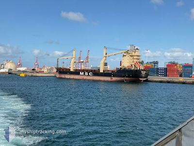
MSC ADA F
General Cargo
Current Trip
| Trip Time | 3 days |
|---|---|
| Trip Distance | 894.14 nm |
| AVG Speed | 8.7 Knots |
| MAX Speed | 8.7 Knots |
| Draught | 7.4 m |
| AVG Wind | 12.4 knots |
| MAX Wind | 22.7 knots |
| MIN Temp | 16.6°C / 61.88°F |
| MAX Temp | 22.4°C / 72.32°F |
| Position Received | 4 m ago |
Current Position
| Longitude | --- |
|---|---|
| Latitude | --- |
| Status | Moored |
| Speed | |
| Course | 138° |
| Area | South Atlantic Ocean |
| Station | T-AIS |
| Position Received | 4 m ago |
Info
Information
The current position of MSC ADA F is in South Atlantic Ocean with coordinates -33.90633° / 18.43105° as reported on 2025-12-11 05:14 by AIS to our vessel tracker app. The vessel's current speed is 0 Knots and is currently inside the port of CAPE TOWN.
The vessel MSC ADA F (IMO: 9190119, MMSI: 352493000) is a General Cargo that was built in 2000 ( 25 years old ). It's sailing under the flag of [PA] Panama.
In this page you can find informations about the vessels current position, last detected port calls, and current voyage information. If the vessels is not in coverage by AIS you will find the latest position.
The current position of MSC ADA F is detected by our AIS receivers and we are not responsible for the reliability of the data. The last position was recorded while the vessel was in Coverage by the Ais receivers of our vessel tracking app.
The current draught of MSC ADA F as reported by AIS is 7.4 meters
Weather
| Temperature | 20.3°C / 68.54°F |
|---|---|
| Wind Speed | 1 knots |
| Direction | 336° NNW |
| Pressure | 1008 hPa |
| Humidity | 55.9 % |
| Cloud Coverage | 52 % |
Featured Company
Last Trips
| Origin | Departure | Destination | Arrival | Distance | |
|---|---|---|---|---|---|
| 2025-12-06 21:09 | 2025-12-10 08:58 | 894.14 nm | |||
| 2025-12-02 19:18 | 2025-12-05 14:59 | 637.63 nm | |||
| 2025-11-30 15:42 | 2025-11-30 23:49 | 47.30 nm | |||
| 2025-10-07 22:35 | 2025-10-11 12:03 | 381.91 nm | |||
| 2025-09-10 21:35 | 2025-10-02 21:03 | 2646.72 nm |
Events
| Time | Event | Details | Position / Dest | Info |
|---|---|---|---|---|
| 2025-12-11 03:29 | Status Changed | Moored Under way using engine |
-33.90635 / 18.43103
[ZA] CAPE TOWN
|
Speed: Course: 138° |
| 2025-12-10 15:51 | Destination Changed | ZAELS ZACPT |
-33.90636 / 18.43107
[ZA] CAPE TOWN
|
Speed: Course: 138° |
| 2025-12-10 15:51 | ETA Changed | 2025/12/13 07:00 2025/12/09 15:00 |
-33.90636 / 18.43107
[ZA] CAPE TOWN
|
Speed: Course: 138° |
| 2025-12-10 07:18 | STOP Moving |
-33.90663 / 18.43077
[ZA] CAPE TOWN
|
Speed: Course: 135° |
|
| 2025-12-10 06:58 | PORT ARRIVAL |
|
-33.90035 / 18.43875
[ZA] CAPE TOWN
|
Speed: 5.8 kn Course: 194.6° |
| 2025-12-10 06:32 | START Moving | 2.59 nm, North West of CAPE TOWN |
-33.87175 / 18.41045
ZACPT
|
Speed: 3.2 kn Course: 114° |
| 2025-12-10 06:09 | STOP Moving | 2.67 nm, North West of CAPE TOWN |
-33.87273 / 18.40543
ZACPT
|
Speed: 0.2 kn Course: 144° |
| 2025-12-10 05:06 | Status Changed | Under way using engine Default |
-33.88850 / 18.21087
ZACPT
|
Speed: 4.3 kn Course: 220° |
| 2025-12-10 04:56 | Status Changed | Default Under way using engine |
-33.87968 / 18.22018
ZACPT
|
Speed: 4.7 kn Course: 220° |
| 2025-12-10 04:49 | Status Changed | Under way using engine Default |
-33.87365 / 18.22720
ZACPT
|
Speed: 5.2 kn Course: 224° |