
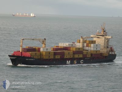
MSC ABIGAIL F
General Cargo
Current Trip
| Time Travelled | 2 days |
|---|---|
| Remaining Time | 1 day |
| Distance Travelled | 636.22 nm |
| Remaining Distance | 603.78 nm |
| AVG Speed | 12.6 Knots |
| MAX Speed | 15.1 Knots |
| AVG Wind | 16.8 knots |
| MAX Wind | 21 knots |
| MIN Temp | 4.4°C / 39.92°F |
| MAX Temp | 9°C / 48.2°F |
| Draught | 8.3 m |
| Position Received | 1 m ago |
Current Position
| Longitude | 11.39322° |
|---|---|
| Latitude | 56.30630° |
| Status | Under way using engine |
| Speed | 13.3 Knots |
| Course | 209.4° |
| Area | Kattegat |
| Station | T-AIS |
| Position Received | 1 m ago |
Info
Information
The current position of MSC ABIGAIL F is in Kattegat with coordinates 56.30630° / 11.39322° as reported on 2024-04-26 09:37 by AIS to our vessel tracker app. The vessel's current speed is 13.3 Knots and is heading at the port of MUUGA. The estimated time of arrival as calculated by MyShipTracking vessel tracking app is 2024-04-28 07:22 LT
The vessel MSC ABIGAIL F (IMO: 9330226, MMSI: 636019292) is a General Cargo that was built in 2006 ( 18 years old ). It's sailing under the flag of [LR] Liberia.
In this page you can find informations about the vessels current position, last detected port calls, and current voyage information. If the vessels is not in coverage by AIS you will find the latest position.
The current position of MSC ABIGAIL F is detected by our AIS receivers and we are not responsible for the reliability of the data. The last position was recorded while the vessel was in Coverage by the Ais receivers of our vessel tracking app.
The current draught of MSC ABIGAIL F as reported by AIS is 8.3 meters
Weather
| Temperature | 4.8°C / 40.64°F |
|---|---|
| Wind Speed | 19 knots |
| Direction | 107° ESE |
| Pressure | 1005.9 hPa |
| Humidity | 90.2 % |
| Cloud Coverage | 99 % |
Featured Company
Last Port Calls
| Port | Arrival | Departure | Time In Port |
|---|---|---|---|
| 2024-04-23 11:59 | 2024-04-24 09:12 | 21 h | |
| 2024-04-20 15:32 | 2024-04-21 21:53 | 1 d | |
| 2024-04-18 09:49 | 2024-04-19 11:44 | 1 d | |
| 2024-04-16 06:25 | 2024-04-16 16:57 | 10 h | |
| 2024-04-14 05:54 | 2024-04-15 06:22 | 1 d | |
| 2024-04-11 05:19 | 2024-04-11 08:18 | 2 h | |
| 2024-04-08 01:21 | 2024-04-08 21:12 | 19 h | |
| 2024-04-05 00:21 | 2024-04-06 05:08 | 1 d | |
| 2024-04-04 13:29 | 2024-04-04 22:21 | 8 h | |
| 2024-04-03 18:05 | 2024-04-04 08:13 | 14 h |
Last Trips
| Origin | Departure | Destination | Arrival | Distance | |
|---|---|---|---|---|---|
| 2024-04-21 23:53 | 2024-04-23 13:59 | 566.47 nm | |||
| 2024-04-19 13:44 | 2024-04-20 17:32 | 287.98 nm | |||
| 2024-04-16 19:57 | 2024-04-18 11:49 | 395.24 nm | |||
| 2024-04-15 09:22 | 2024-04-16 09:25 | 339.48 nm | |||
| 2024-04-11 10:18 | 2024-04-14 08:54 | 760.92 nm | |||
| 2024-04-08 23:12 | 2024-04-11 07:19 | 659.33 nm | |||
| 2024-04-06 07:08 | 2024-04-08 03:21 | 567.48 nm | |||
| 2024-04-05 00:21 | 2024-04-05 02:21 | 22.72 nm | |||
| 2024-04-04 10:13 | 2024-04-04 15:29 | 75.89 nm | |||
| 2024-04-01 23:54 | 2024-04-03 20:05 | 621.94 nm |
Events
| Time | Event | Details | Position / Dest | Info |
|---|---|---|---|---|
| 2024-04-26 03:49 | Change Sea Area | Danish part of the Kattegat Swedish part of the Kattegat |
57.45581 / 11.39153
Kattegat
EEMUG
|
Speed: 13.2 kn Course: 159.5° |
| 2024-04-26 03:34 | Change Sea Area | Swedish part of the Kattegat Danish part of the Kattegat |
57.50291 / 11.34979
Kattegat
EEMUG
|
Speed: 12.7 kn Course: 131.7° |
| 2024-04-26 01:49 | Change Sea Area | Danish part of the Kattegat Danish part of the Skaggerak |
57.77631 / 10.84762
Kattegat
EEMUG
|
Speed: 12.9 kn Course: 133.7° |
| 2024-04-26 00:54 | Destination Changed | EEMUG EETLL |
57.80712 / 10.48695
EEMUG
|
Speed: 13.2 kn Course: 90.4° |
| 2024-04-26 00:44 | ETA Changed | 2024/04/28 15:30 2024/04/28 06:00 |
57.80731 / 10.41698
EETLL
|
Speed: 13.2 kn Course: 89.6° |
| 2024-04-25 18:44 | Change Sea Area | Danish part of the Skaggerak Danish part of the North Sea |
57.32808 / 8.25954
Skaggerak
EETLL
|
Speed: 13.1 kn Course: 56.2° |
| 2024-04-25 12:56 | Status Changed | Under way using engine Default |
56.32527 / 6.91984
EETLL
|
Speed: 14.7 kn Course: 42° |
| 2024-04-25 12:42 | IN Coverage |
56.32527 / 6.91984
North Sea
EETLL
|
Speed: 14.7 kn Course: 40° |
|
| 2024-04-25 12:01 | Status Changed | Default Under way using engine |
56.15203 / 6.66390
EETLL
|
Speed: 14.4 kn Course: 39.4° |
| 2024-04-25 11:55 | OUT of Coverage |
56.13441 / 6.63774
North Sea
EETLL
|
Speed: 14.4 kn Course: 39.4° |