
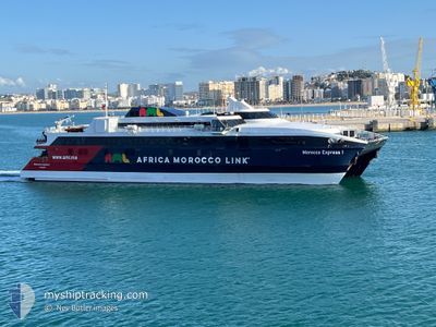
MOROCCO EXPRESS 1
High speed craft
Current Trip
| Trip Time | 3 h, 42 mins |
|---|---|
| Trip Distance | 49.69 nm |
| AVG Speed | 11.4 Knots |
| MAX Speed | 11.4 Knots |
| Draught | 3 m |
| AVG Wind | 8.1 knots |
| MAX Wind | 11.7 knots |
| MIN Temp | 11.9°C / 53.42°F |
| MAX Temp | 16.5°C / 61.7°F |
| Position Received | Now |
Current Position
| Longitude | --- |
|---|---|
| Latitude | --- |
| Status | Under way using engine |
| Speed | |
| Course | 82° |
| Area | Strait of Gibraltar |
| Station | T-AIS |
| Position Received | Now |
Info
Information
The current position of MOROCCO EXPRESS 1 is in Strait of Gibraltar with coordinates 36.17077° / -5.37863° as reported on 2025-12-13 16:26 by AIS to our vessel tracker app. The vessel's current speed is 0 Knots and is currently inside the port of CAMPAMENTO.
The vessel MOROCCO EXPRESS 1 (IMO: 9216171, MMSI: 210836000) is a High speed craft that was built in 2000 ( 25 years old ). It's sailing under the flag of [CY] Cyprus.
In this page you can find informations about the vessels current position, last detected port calls, and current voyage information. If the vessels is not in coverage by AIS you will find the latest position.
The current position of MOROCCO EXPRESS 1 is detected by our AIS receivers and we are not responsible for the reliability of the data. The last position was recorded while the vessel was in Coverage by the Ais receivers of our vessel tracking app.
The current draught of MOROCCO EXPRESS 1 as reported by AIS is 3 meters
Weather
| Temperature | 14.5°C / 58.1°F |
|---|---|
| Wind Speed | 18 knots |
| Direction | 97° E |
| Pressure | 1016 hPa |
| Humidity | 81 % |
| Cloud Coverage | 100 % |
Featured Company
Last Port Calls
| Port | Arrival | Departure | Time In Port |
|---|---|---|---|
| 2025-12-12 11:32 | |||
| 2025-12-11 23:00 | 2025-12-12 07:50 | 8 h | |
| 2025-12-11 21:23 | 2025-12-11 22:05 | 42 m | |
| 2025-12-11 19:20 | 2025-12-11 20:27 | 1 h | |
| 2025-12-11 17:20 | 2025-12-11 18:24 | 1 h | |
| 2025-12-11 15:14 | 2025-12-11 16:24 | 1 h | |
| 2025-12-11 13:08 | 2025-12-11 14:15 | 1 h | |
| 2025-12-11 11:02 | 2025-12-11 12:17 | 1 h | |
| 2025-12-11 09:19 | 2025-12-11 10:04 | 45 m | |
| 2025-12-09 23:01 | 2025-12-11 08:18 | 1 d |
Most Visited Ports (Last year)
| Port | Arrivals | |
|---|---|---|
| 841 | ||
| 691 | ||
| 5 | ||
| 2 |
Last Trips
| Origin | Departure | Destination | Arrival | Distance | |
|---|---|---|---|---|---|
| 2025-12-12 07:50 | 2025-12-12 11:32 | 49.69 nm | |||
| 2025-12-11 22:05 | 2025-12-11 23:00 | 17.45 nm | |||
| 2025-12-11 20:27 | 2025-12-11 21:23 | 16.28 nm | |||
| 2025-12-11 18:24 | 2025-12-11 19:20 | 18.58 nm | |||
| 2025-12-11 16:24 | 2025-12-11 17:20 | 16.45 nm | |||
| 2025-12-11 14:15 | 2025-12-11 15:14 | 18.58 nm | |||
| 2025-12-11 12:17 | 2025-12-11 13:08 | 16.16 nm | |||
| 2025-12-11 10:04 | 2025-12-11 11:02 | 17.77 nm | |||
| 2025-12-11 08:18 | 2025-12-11 09:19 | 17.12 nm | |||
| 2025-12-09 22:07 | 2025-12-09 23:01 | 17.69 nm |
Events
| Time | Event | Details | Position / Dest | Info |
|---|---|---|---|---|
| 2025-12-12 10:33 | STOP Moving |
36.17065 / -5.37872
[ES] CAMPAMENTO
|
Speed: 0.2 kn Course: 81° |
|
| 2025-12-12 10:32 | PORT ARRIVAL |
|
36.17065 / -5.37872
[ES] CAMPAMENTO
|
Speed: 0.7 kn Course: 82° |
| 2025-12-12 10:13 | Change Sea Area | Spanish part of the Strait of Gibraltar Gibraltarian part of the Strait of Gibraltar |
36.14945 / -5.39619
Strait of Gibraltar
TNG<=>TAR<=>TNG
|
Speed: 11.3 kn Course: 10.8° |
| 2025-12-12 09:34 | ETA Changed | 2025/12/12 09:00 2025/12/09 14:09 |
36.04498 / -5.33475
TNG<=>TAR<=>TNG
|
Speed: 10 kn Course: 295.4° |
| 2025-12-12 09:33 | Change Sea Area | Gibraltarian part of the Strait of Gibraltar Gibraltarian part of the Alboran Sea |
36.04498 / -5.33475
Strait of Gibraltar
TNG<=>TAR<=>TNG
|
Speed: 10 kn Course: 295.4° |
| 2025-12-12 09:15 | Change Sea Area | Gibraltarian part of the Alboran Sea Spanish part of the Alboran Sea |
36.03174 / -5.27546
Alboran Sea
|
Speed: 9.4 kn Course: 282.6° |
| 2025-12-12 08:37 | Change Sea Area | Spanish part of the Alboran Sea Gibraltarian part of the Alboran Sea |
36.00884 / -5.27228
Alboran Sea
|
Speed: 10.8 kn Course: 107.2° |
| 2025-12-12 08:32 | Change Sea Area | Gibraltarian part of the Alboran Sea Gibraltarian part of the Strait of Gibraltar |
36.01390 / -5.29198
Alboran Sea
|
Speed: 10.9 kn Course: 109° |
| 2025-12-12 08:21 | Change Sea Area | Gibraltarian part of the Strait of Gibraltar Spanish part of the Strait of Gibraltar |
36.02150 / -5.32931
Strait of Gibraltar
|
Speed: 10.8 kn Course: 94.5° |
| 2025-12-12 08:03 | Change Sea Area | Spanish part of the Strait of Gibraltar Moroccan part of the Strait of Gibraltar |
35.99702 / -5.39757
Strait of Gibraltar
|
Speed: 12.8 kn Course: 35.1° |