
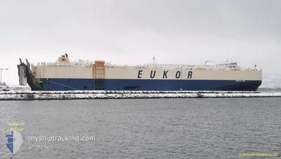
MORNING LYNN
Vehicles Carrier
Current Trip
USSSI>>USCHS
| Time Travelled | 7 days |
|---|---|
| Remaining Time | --- |
| Distance Travelled | 2746.08 nm |
| Remaining Distance | --- |
| AVG Speed | 14.4 Knots |
| MAX Speed | 18.4 Knots |
| AVG Wind | 15.3 knots |
| MAX Wind | 26 knots |
| MIN Temp | 4.5°C / 40.1°F |
| MAX Temp | 22.3°C / 72.14°F |
| Draught | 8.8 m |
| Position Received | 7 d ago |
Current Position
| Longitude | -79.51771° |
|---|---|
| Latitude | 32.67121° |
| Status | Under way using engine |
| Speed | 9.5 Knots |
| Course | 87.2° |
| Area | North Atlantic Ocean |
| Station | T-AIS |
| Position Received | 7 d ago |
Info
Information
The current position of MORNING LYNN is in North Atlantic Ocean with coordinates 32.67121° / -79.51771° as reported on 2024-04-30 01:32 by AIS to our vessel tracker app. The vessel's current speed is 9.5 Knots
The vessel MORNING LYNN (IMO: 9383429, MMSI: 370808000) is a Vehicles Carrier that was built in 2009 ( 15 years old ). It's sailing under the flag of [PA] Panama.
In this page you can find informations about the vessels current position, last detected port calls, and current voyage information. If the vessels is not in coverage by AIS you will find the latest position.
The current position of MORNING LYNN is detected by our AIS receivers and we are not responsible for the reliability of the data. The last position was recorded while the vessel was in Coverage by the Ais receivers of our vessel tracking app.
The current draught of MORNING LYNN as reported by AIS is 8.8 meters
Weather
| Temperature | 9.9°C / 49.82°F |
|---|---|
| Wind Speed | 4 knots |
| Direction | 20° NNE |
| Pressure | 1004.1 hPa |
| Humidity | 97.9 % |
| Cloud Coverage | 100 % |
Featured Company
Last Port Calls
| Port | Arrival | Departure | Time In Port |
|---|---|---|---|
| 2024-04-29 09:47 | 2024-04-29 23:58 | 14 h | |
| 2024-04-26 14:43 | 2024-04-28 21:50 | 2 d | |
| 2024-04-21 14:17 | 2024-04-22 18:48 | 1 d | |
| 2024-04-19 08:58 | 2024-04-19 21:49 | 12 h | |
| 2024-04-10 14:51 | 2024-04-12 01:47 | 1 d | |
| 2024-04-07 11:20 | 2024-04-10 01:27 | 2 d | |
| 2024-04-04 17:47 | 2024-04-05 22:33 | 1 d | |
| 2024-04-01 16:50 | 2024-04-03 16:06 | 1 d | |
| 2024-03-28 16:20 | 2024-03-31 17:19 | 3 d | |
| 2024-03-27 07:05 | 2024-03-27 17:29 | 10 h |
Most Visited Ports (Last year)
| Port | Arrivals | |
|---|---|---|
| 3 | ||
| 3 | ||
| 3 | ||
| 3 | ||
| 2 | ||
| 2 |
Last Trips
| Origin | Departure | Destination | Arrival | Distance | |
|---|---|---|---|---|---|
| 2024-04-28 17:50 | 2024-04-29 05:47 | 164.61 nm | |||
| 2024-04-22 14:48 | 2024-04-26 10:43 | 822.73 nm | |||
| 2024-04-19 18:49 | 2024-04-21 10:17 | 590.90 nm | |||
| 2024-04-12 02:47 | 2024-04-19 05:58 | 2662.09 nm | |||
| 2024-04-10 03:27 | 2024-04-10 15:51 | 204.64 nm | |||
| 2024-04-06 00:33 | 2024-04-07 13:20 | 580.80 nm | |||
| 2024-04-03 18:06 | 2024-04-04 19:47 | 403.29 nm | |||
| 2024-03-31 19:19 | 2024-04-01 18:50 | 339.98 nm | |||
| 2024-03-27 18:29 | 2024-03-28 17:20 | 152.22 nm | |||
| 2024-03-27 07:54 | 2024-03-27 08:05 | 0.37 nm |
Events
| Time | Event | Details | Position / Dest | Info |
|---|---|---|---|---|
| 2024-04-30 01:36 | Status Changed | Default Under way using engine |
32.67166 / -79.50333
USSSI>>USCHS
|
Speed: 9.5 kn Course: 87.2° |
| 2024-04-30 01:32 | OUT of Coverage |
32.67121 / -79.51771
North Atlantic Ocean
|
Speed: 9.5 kn Course: 87.2° |
|
| 2024-04-30 01:31 | Status Changed | Under way using engine Default |
32.67111 / -79.51991
USSSI>>USCHS
|
Speed: 9 kn Course: 87° |
| 2024-04-30 01:31 | IN Coverage |
32.67121 / -79.51771
North Atlantic Ocean
|
Speed: 9.5 kn Course: 87.2° |
|
| 2024-04-30 00:36 | Status Changed | Default Under way using engine |
32.66667 / -79.69334
USSSI>>USCHS
|
Speed: 15.7 kn Course: 119.9° |
| 2024-04-30 00:27 | OUT of Coverage |
32.68695 / -79.73585
North Atlantic Ocean
|
Speed: 15.7 kn Course: 119.9° |
|
| 2024-04-30 00:25 | Status Changed | Under way using engine Default |
32.68956 / -79.74118
USSSI>>USCHS
|
Speed: 15 kn Course: 118° |
| 2024-04-30 00:12 | Status Changed | Default Under way using engine |
32.71667 / -79.80167
USSSI>>USCHS
|
Speed: 14.6 kn Course: 120.7° |
| 2024-04-29 23:58 | PORT DEPARTURE |
|
32.74825 / -79.85516
USSSI>>USCHS
|
Speed: 13.3 kn Course: 135° |
| 2024-04-29 23:57 | Status Changed | Under way using engine Default |
32.75180 / -79.85922
[US] CHARLESTON
|
Speed: 11 kn Course: -1° |