
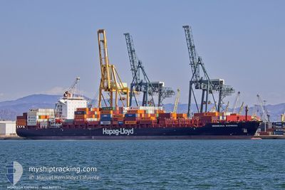
MOMBASA EXPRESS
Container Ship
Current Trip
| Time Travelled | 3 days |
|---|---|
| Remaining Time | --- |
| Distance Travelled | 1143.52 nm |
| Remaining Distance | --- |
| AVG Speed | 15 Knots |
| MAX Speed | 15 Knots |
| AVG Wind | 11.5 knots |
| MAX Wind | 36.3 knots |
| MIN Temp | -21.9°C / -7.42°F |
| MAX Temp | 4.8°C / 40.64°F |
| Draught | 9.6 m |
| Position Received | 3 d ago |
Current Position
| Longitude | --- |
|---|---|
| Latitude | --- |
| Status | Under way using engine |
| Speed | 12.5 Knots |
| Course | 50.9° |
| Area | North Atlantic Ocean |
| Station | T-AIS |
| Position Received | 3 d ago |
Info
Information
The current position of MOMBASA EXPRESS is in North Atlantic Ocean with coordinates 46.07758° / -73.02174° as reported on 2025-02-28 15:12 by AIS to our vessel tracker app. The vessel's current speed is 12.5 Knots and is heading at the port of TANGER MED. The estimated time of arrival as calculated by MyShipTracking vessel tracking app is 2025-03-11 03:00 LT
The vessel MOMBASA EXPRESS (IMO: 9495777, MMSI: 636092500) is a Container Ship that was built in 2013 ( 12 years old ). It's sailing under the flag of [LR] Liberia.
In this page you can find informations about the vessels current position, last detected port calls, and current voyage information. If the vessels is not in coverage by AIS you will find the latest position.
The current position of MOMBASA EXPRESS is detected by our AIS receivers and we are not responsible for the reliability of the data. The last position was recorded while the vessel was in Coverage by the Ais receivers of our vessel tracking app.
The current draught of MOMBASA EXPRESS as reported by AIS is 9.6 meters
Weather
| Temperature | 4.1°C / 39.38°F |
|---|---|
| Wind Speed | 18 knots |
| Direction | 294° WNW |
| Pressure | 1010.1 hPa |
| Humidity | 86.8 % |
| Cloud Coverage | 100 % |
Featured Company
Last Port Calls
| Port | Arrival | Departure | Time In Port |
|---|---|---|---|
| 2025-02-25 13:51 | 2025-02-28 07:38 | 2 d | |
| 2025-02-20 18:59 | 2025-02-21 19:39 | 1 d | |
| 2025-02-10 13:21 | 2025-02-10 19:59 | 6 h | |
| 2025-02-05 14:56 | 2025-02-05 21:33 | 6 h | |
| 2025-02-02 19:16 | 2025-02-03 03:05 | 7 h | |
| 2025-01-30 22:30 | 2025-01-31 20:14 | 21 h | |
| 2025-01-29 10:57 | 2025-01-30 17:17 | 1 d | |
| 2025-01-26 00:14 | 2025-01-26 20:36 | 20 h | |
| 2025-01-19 03:56 | 2025-01-19 07:30 | 3 h | |
| 2025-01-03 04:20 | 2025-01-09 07:58 | 6 d |
Last Trips
| Origin | Departure | Destination | Arrival | Distance | |
|---|---|---|---|---|---|
| 2025-02-21 19:39 | 2025-02-25 13:51 | 1278.82 nm | |||
| 2025-02-10 19:59 | 2025-02-20 18:59 | 3537.29 nm | |||
| 2025-02-05 21:33 | 2025-02-10 13:21 | 713.69 nm | |||
| 2025-02-03 03:05 | 2025-02-05 14:56 | 486.01 nm | |||
| 2025-01-31 20:14 | 2025-02-02 19:16 | 532.93 nm | |||
| 2025-01-30 17:17 | 2025-01-30 22:30 | 84.11 nm | |||
| 2025-01-26 20:36 | 2025-01-29 10:57 | 647.46 nm | |||
| 2025-01-19 07:30 | 2025-01-26 00:14 | 1182.09 nm | |||
| 2025-01-09 07:58 | 2025-01-19 03:56 | 3229.96 nm | |||
| 2024-12-30 13:03 | 2025-01-03 04:20 | 1320.23 nm |
Events
| Time | Event | Details | Position / Dest | Info |
|---|---|---|---|---|
| 2025-02-28 15:15 | Status Changed | Default Under way using engine |
46.08440 / -73.00969
CA MTR>MA PTM
|
Speed: 12.5 kn Course: 50.9° |
| 2025-02-28 15:12 | OUT of Coverage |
46.07758 / -73.02174
North Atlantic Ocean
CA MTR>MA PTM
|
Speed: 12.5 kn Course: 50.9° |
|
| 2025-02-28 12:44 | Draught Changed | 9.6 9.4 |
45.65124 / -73.47461
CA MTR>MA PTM
|
Speed: 13.2 kn Course: 29.7° |
| 2025-02-28 12:44 | Destination Changed | CA MTR>MA PTM CA SJB>CA MTR |
45.65124 / -73.47461
CA MTR>MA PTM
|
Speed: 13.2 kn Course: 29.7° |
| 2025-02-28 12:44 | ETA Changed | 2025/03/11 03:00 2025/02/24 22:00 |
45.65124 / -73.47461
CA MTR>MA PTM
|
Speed: 13.2 kn Course: 29.7° |
| 2025-02-28 12:38 | PORT DEPARTURE |
|
45.63216 / -73.48676
CA SJB>CA MTR
|
Speed: 11.9 kn Course: 23° |
| 2025-02-28 12:31 | Status Changed | Under way using engine Default |
45.61050 / -73.50140
[CA] MONTREAL
|
Speed: 11.1 kn Course: 1° |
| 2025-02-28 12:27 | Status Changed | Default Under way using engine |
45.59946 / -73.50391
[CA] MONTREAL
|
Speed: 10.2 kn Course: 9° |
| 2025-02-28 12:21 | Status Changed | Under way using engine Default |
45.58051 / -73.50172
[CA] MONTREAL
|
Speed: 10 kn Course: 22° |
| 2025-02-28 12:19 | Status Changed | Default Under way using engine |
45.57656 / -73.50388
[CA] MONTREAL
|
Speed: 4.2 kn Course: 56° |