
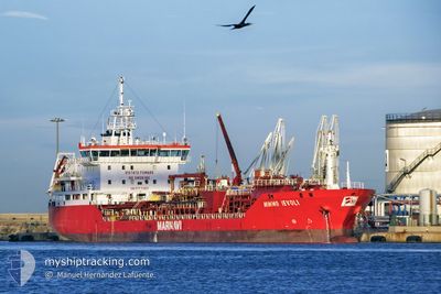
MIMMO IEVOLI
Oil/Chemical Tanker
Current Trip
| Time Travelled | 4 days |
|---|---|
| Remaining Time | 12 h, 25 mins |
| Distance Travelled | 1203.34 nm |
| Remaining Distance | 173.16 nm |
| AVG Speed | 11.2 Knots |
| MAX Speed | 14 Knots |
| AVG Wind | 14.1 knots |
| MAX Wind | 25.5 knots |
| MIN Temp | 12.9°C / 55.22°F |
| MAX Temp | 21.2°C / 70.16°F |
| Draught | 5.8 m |
| Position Received | 8 h, 0 m ago |
Current Position
| Longitude | --- |
|---|---|
| Latitude | --- |
| Status | Under way using engine |
| Speed | 10 Knots |
| Course | 173.6° |
| Area | Gulf of Suez |
| Station | T-AIS |
| Position Received | 8 h, 0 m ago |
Info
Information
The current position of MIMMO IEVOLI is in Gulf of Suez with coordinates 29.87403° / 32.55031° as reported on 2025-12-10 14:21 by AIS to our vessel tracker app. The vessel's current speed is 10 Knots and is heading at the port of PORT SAID. The estimated time of arrival as calculated by MyShipTracking vessel tracking app is 2025-12-11 12:47 LT
The vessel MIMMO IEVOLI (IMO: 9147746, MMSI: 247253200) is a Oil/Chemical Tanker that was built in 1998 ( 27 years old ). It's sailing under the flag of [IT] Italy.
In this page you can find informations about the vessels current position, last detected port calls, and current voyage information. If the vessels is not in coverage by AIS you will find the latest position.
The current position of MIMMO IEVOLI is detected by our AIS receivers and we are not responsible for the reliability of the data. The last position was recorded while the vessel was in Coverage by the Ais receivers of our vessel tracking app.
The current draught of MIMMO IEVOLI as reported by AIS is 5.8 meters
Weather
| Temperature | 17.9°C / 64.22°F |
|---|---|
| Wind Speed | 12 knots |
| Direction | 295° WNW |
| Pressure | 1018.4 hPa |
| Humidity | 56.9 % |
| Cloud Coverage | 1 % |
Featured Company
Last Port Calls
| Port | Arrival | Departure | Time In Port |
|---|---|---|---|
| 2025-12-10 06:49 | 2025-12-10 15:46 | 8 h | |
| 2025-12-05 16:25 | 2025-12-06 02:53 | 10 h | |
| 2025-12-01 10:19 | 2025-12-03 13:10 | 2 d | |
| 2025-11-21 17:47 | 2025-11-23 13:53 | 1 d | |
| 2025-11-18 19:00 | 2025-11-19 00:00 | 4 h | |
| 2025-11-09 23:32 | 2025-11-11 00:27 | 1 d | |
| 2025-11-07 07:56 | 2025-11-07 18:11 | 10 h | |
| 2025-11-04 17:00 | 2025-11-05 15:16 | 22 h | |
| 2025-10-31 13:48 | 2025-11-01 13:40 | 23 h | |
| 2025-10-28 09:48 | 2025-10-29 10:45 | 1 d |
Most Visited Ports (Last year)
| Port | Arrivals | |
|---|---|---|
| 10 | ||
| 10 | ||
| 6 | ||
| 4 | ||
| 4 | ||
| 3 |
Last Trips
| Origin | Departure | Destination | Arrival | Distance | |
|---|---|---|---|---|---|
| 2025-12-06 02:53 | 2025-12-10 06:49 | 1075.95 nm | |||
| 2025-12-03 13:10 | 2025-12-05 16:25 | 574.51 nm | |||
| 2025-11-23 13:53 | 2025-12-01 10:19 | 1263.52 nm | |||
| 2025-11-19 00:00 | 2025-11-21 17:47 | 809.52 nm | |||
| 2025-11-11 00:27 | 2025-11-18 19:00 | 1239.37 nm | |||
| 2025-11-07 18:11 | 2025-11-09 23:32 | 645.42 nm | |||
| 2025-11-05 15:16 | 2025-11-07 07:56 | 222.54 nm | |||
| 2025-11-01 13:40 | 2025-11-04 17:00 | 818.09 nm | |||
| 2025-10-29 10:45 | 2025-10-31 13:48 | 592.43 nm | |||
| 2025-10-25 18:16 | 2025-10-28 09:48 | 685.31 nm |
Events
| Time | Event | Details | Position / Dest | Info |
|---|---|---|---|---|
| 2025-12-10 14:28 | Status Changed | Default Under way using engine |
29.85458 / 32.55269
EGPSD
|
Speed: 10 kn Course: 173.6° |
| 2025-12-10 14:21 | OUT of Coverage |
29.87403 / 32.55031
Gulf of Suez
|
Speed: 10 kn Course: 173.6° |
|
| 2025-12-10 13:46 | Change Sea Area | Egyptian part of the Gulf of Suez Egyptian part of the Mediterranean Sea - Eastern Basin |
29.94524 / 32.57736
Gulf of Suez
|
Speed: 7.5 kn Course: 214.2° |
| 2025-12-10 13:46 | PORT DEPARTURE |
|
29.94524 / 32.57736
EGPSD
|
Speed: 7.5 kn Course: 215° |
| 2025-12-10 12:20 | Status Changed | Under way using engine Default |
30.14544 / 32.56985
[EG] SUEZ CANAL
|
Speed: 9 kn Course: 180° |
| 2025-12-10 12:15 | Status Changed | Default Under way using engine |
30.15666 / 32.56972
[EG] SUEZ CANAL
|
Speed: 9.5 kn Course: 179° |
| 2025-12-10 12:05 | Status Changed | Under way using engine Default |
30.18313 / 32.56868
[EG] SUEZ CANAL
|
Speed: 10.4 kn Course: 157° |
| 2025-12-10 11:48 | Status Changed | Default Under way using engine |
30.22833 / 32.54333
[EG] SUEZ CANAL
|
Speed: 10.6 kn Course: 148° |
| 2025-12-10 11:44 | Status Changed | Under way using engine Default |
30.23824 / 32.53838
[EG] SUEZ CANAL
|
Speed: 10.9 kn Course: 135° |
| 2025-12-10 11:39 | IN Coverage |
30.23824 / 32.53838
Mediterranean Sea - Eastern Basin
[EG] SUEZ CANAL
|
Speed: 10.6 kn Course: 145.5° |