
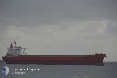
MG EXPLORER
Cargo
Current Trip
GOODS IS. AUS
| Time Travelled | 12 days |
|---|---|
| Remaining Time | --- |
| Distance Travelled | 3502.49 nm |
| Remaining Distance | --- |
| AVG Speed | 11.7 Knots |
| MAX Speed | 15 Knots |
| AVG Wind | 11.5 knots |
| MAX Wind | 25.8 knots |
| MIN Temp | 24.5°C / 76.1°F |
| MAX Temp | 29.9°C / 85.82°F |
| Draught | 7.6 m |
| Position Received | 1 d ago |
Current Position
| Longitude | 142.47246° |
|---|---|
| Latitude | -10.56673° |
| Status | Under way using engine |
| Speed | 12.2 Knots |
| Course | 121.5° |
| Area | Coral Sea |
| Station | T-AIS |
| Position Received | 1 d ago |
Info
Information
The current position of MG EXPLORER is in Coral Sea with coordinates -10.56673° / 142.47246° as reported on 2024-04-27 22:10 by AIS to our vessel tracker app. The vessel's current speed is 12.2 Knots
The vessel MG EXPLORER (IMO: 9767479, MMSI: 374832000) is a Cargo It's sailing under the flag of [PA] Panama.
In this page you can find informations about the vessels current position, last detected port calls, and current voyage information. If the vessels is not in coverage by AIS you will find the latest position.
The current position of MG EXPLORER is detected by our AIS receivers and we are not responsible for the reliability of the data. The last position was recorded while the vessel was in Coverage by the Ais receivers of our vessel tracking app.
The current draught of MG EXPLORER as reported by AIS is 7.6 meters
Weather
| Temperature | 25.5°C / 77.9°F |
|---|---|
| Wind Speed | 20 knots |
| Direction | 143° SE |
| Pressure | 1012.9 hPa |
| Humidity | 79.4 % |
| Cloud Coverage | 6 % |
Featured Company
Last Port Calls
| Port | Arrival | Departure | Time In Port |
|---|---|---|---|
| 2024-04-14 07:04 | 2024-04-17 01:01 | 2 d | |
| 2024-04-05 05:49 | 2024-04-07 00:25 | 1 d | |
| 2024-02-12 15:28 | 2024-02-22 04:52 | 9 d |
Most Visited Ports (Last year)
| Port | Arrivals | |
|---|---|---|
| 3 | ||
| 1 | ||
| 1 | ||
| 1 | ||
| 1 | ||
| 1 |
Last Trips
| Origin | Departure | Destination | Arrival | Distance | |
|---|---|---|---|---|---|
| 2024-04-07 07:25 | 2024-04-14 14:04 | 891.74 nm | |||
| 2024-02-22 01:52 | 2024-04-05 12:49 | 9615.09 nm | |||
| 2024-01-09 11:50 | 2024-02-12 12:28 | 8787.43 nm |
Events
| Time | Event | Details | Position / Dest | Info |
|---|---|---|---|---|
| 2024-04-27 22:12 | Status Changed | Default Under way using engine |
-10.56999 / 142.47783
GOODS IS. AUS
|
Speed: 12.2 kn Course: 121.5° |
| 2024-04-27 22:10 | OUT of Coverage |
-10.56673 / 142.47246
Coral Sea
GOODS IS. AUS
|
Speed: 12.2 kn Course: 121.5° |
|
| 2024-04-27 21:33 | Status Changed | Under way using engine Default |
-10.50022 / 142.36193
GOODS IS. AUS
|
Speed: 12.9 kn Course: 75° |
| 2024-04-27 21:12 | Status Changed | Default Under way using engine |
-10.49712 / 142.29002
GOODS IS. AUS
|
Speed: 12.8 kn Course: 74.7° |
| 2024-04-27 21:05 | Status Changed | Under way using engine Default |
-10.50378 / 142.26503
GOODS IS. AUS
|
Speed: 12.1 kn Course: 65° |
| 2024-04-27 20:24 | Status Changed | Default Under way using engine |
-10.55753 / 142.13805
GOODS IS. AUS
|
Speed: 12.2 kn Course: 95.8° |
| 2024-04-27 20:13 | Status Changed | Under way using engine Not under command |
-10.55586 / 142.09968
GOODS IS. AUS
|
Speed: 5.1 kn Course: 88.1° |
| 2024-04-27 19:41 | Status Changed | Not under command Default |
-10.56651 / 142.05252
GOODS IS. AUS
|
Speed: 5.8 kn Course: 87° |
| 2024-04-27 19:34 | Status Changed | Default Not under command |
-10.56714 / 142.04217
GOODS IS. AUS
|
Speed: 5.8 kn Course: 87.1° |
| 2024-04-27 19:32 | Destination Changed | GOODS IS. AUS AU ABP |
-10.56725 / 142.03887
GOODS IS. AUS
|
Speed: 5.9 kn Course: 87.8° |