
METEOR
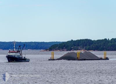
Tug
Current Trip
| Time Travelled | 4 days |
|---|---|
| Remaining Time | 13 h, 5 mins |
| Distance Travelled | 343.20 nm |
| Remaining Distance | 55.53 nm |
| AVG Speed | 3.9 Knots |
| MAX Speed | 5 Knots |
| AVG Wind | 14.6 knots |
| MAX Wind | 20.7 knots |
| MIN Temp | 3.9°C / 39.02°F |
| MAX Temp | 7.4°C / 45.32°F |
| Draught | 4.2 m |
| Position Received | 1 m ago |
Current Position
| Longitude | --- |
|---|---|
| Latitude | --- |
| Status | Restricted manoeuverability |
| Speed | 4 Knots |
| Course | 244° |
| Area | Baltic Sea |
| Station | T-AIS |
| Position Received | 1 m ago |
Info
Information
The current position of METEOR is in Baltic Sea with coordinates 54.84362° / 12.94665° as reported on 2025-12-17 16:54 by AIS to our vessel tracker app. The vessel's current speed is 4 Knots and is heading at the port of ROSTOCK. The estimated time of arrival as calculated by MyShipTracking vessel tracking app is 2025-12-18 07:00 LT
The vessel METEOR (IMO: 5233547, MMSI: 230934000) is a Tug that was built in 1960 ( 65 years old ). It's sailing under the flag of [FI] Finland.
In this page you can find informations about the vessels current position, last detected port calls, and current voyage information. If the vessels is not in coverage by AIS you will find the latest position.
The current position of METEOR is detected by our AIS receivers and we are not responsible for the reliability of the data. The last position was recorded while the vessel was in Coverage by the Ais receivers of our vessel tracking app.
The current draught of METEOR as reported by AIS is 4.2 meters
Weather
| Temperature | 6.8°C / 44.24°F |
|---|---|
| Wind Speed | 9 knots |
| Direction | 242° WSW |
| Pressure | 1015.1 hPa |
| Humidity | 77.3 % |
| Cloud Coverage | 77 % |
Featured Company
Last Port Calls
| Port | Arrival | Departure | Time In Port |
|---|---|---|---|
| 2025-12-11 00:09 | 2025-12-13 13:46 | 2 d | |
| 2025-12-06 13:44 | 2025-12-08 14:15 | 2 d | |
| 2025-11-18 10:03 | 2025-12-01 09:25 | 12 d | |
| 2025-11-11 15:39 | 2025-11-17 07:56 | 5 d | |
| 2025-11-01 10:32 | 2025-11-06 14:17 | 5 d | |
| 2025-10-15 07:49 | 2025-10-22 09:50 | 7 d | |
| 2025-10-08 08:05 | 2025-10-10 07:30 | 1 d | |
| 2025-10-03 11:19 | 2025-10-05 17:12 | 2 d |
Most Visited Ports (Last year)
| Port | Arrivals | |
|---|---|---|
| 6 | ||
| 4 | ||
| 4 | ||
| 4 | ||
| 3 | ||
| 3 |
Last Trips
| Origin | Departure | Destination | Arrival | Distance | |
|---|---|---|---|---|---|
| 2025-12-08 14:15 | 2025-12-11 00:09 | 278.57 nm | |||
| 2025-12-01 09:25 | 2025-12-06 13:44 | 307.76 nm | |||
| 2025-11-17 07:56 | 2025-11-18 10:03 | 152.49 nm | |||
| 2025-11-06 14:17 | 2025-11-11 15:39 | 551.10 nm | |||
| 2025-10-22 09:50 | 2025-11-01 10:32 | 929.90 nm | |||
| 2025-10-10 07:30 | 2025-10-15 07:49 | 638.68 nm | |||
| 2025-10-05 17:12 | 2025-10-08 08:05 | 287.98 nm | |||
| 2025-09-20 08:36 | 2025-10-03 11:19 | 944.64 nm |
Events
| Time | Event | Details | Position / Dest | Info |
|---|---|---|---|---|
| 2025-12-17 11:24 | Status Changed | Restricted manoeuverability Default |
54.96632 / 13.56803
ROSTOCK
|
Speed: 4.2 kn Course: 250° |
| 2025-12-17 11:18 | Status Changed | Default Restricted manoeuverability |
54.96867 / 13.58025
ROSTOCK
|
Speed: 4.3 kn Course: 251° |
| 2025-12-17 09:22 | Change Sea Area | German part of the Baltic Sea Swedish part of the Baltic Sea |
55.02016 / 13.78732
Baltic Sea
ROSTOCK
|
Speed: 4.1 kn Course: 250° |
| 2025-12-16 21:29 | Change Sea Area | Swedish part of the Baltic Sea Danish part of the Kattegat |
55.52022 / 14.77823
Baltic Sea
ROSTOCK
|
Speed: 3.9 kn Course: 239° |
| 2025-12-16 17:55 | Change Sea Area | Danish part of the Kattegat Swedish part of the Baltic Sea |
55.65500 / 15.19102
Kattegat
ROSTOCK
|
Speed: 4.6 kn Course: 229° |
| 2025-12-16 14:04 | Status Changed | Restricted manoeuverability Default |
55.81293 / 15.60973
ROSTOCK
|
Speed: 4 kn Course: 237° |
| 2025-12-16 14:02 | Status Changed | Default Restricted manoeuverability |
55.81403 / 15.61348
ROSTOCK
|
Speed: 4.4 kn Course: 237° |
| 2025-12-16 13:33 | ETA Changed | 2025/12/18 08:00 2025/12/17 12:00 |
55.83030 / 15.66677
ROSTOCK
|
Speed: 4.2 kn Course: 237° |
| 2025-12-16 13:12 | Status Changed | Restricted manoeuverability Default |
55.84320 / 15.70178
ROSTOCK
|
Speed: 4 kn Course: 236° |
| 2025-12-16 13:02 | IN Coverage |
55.84320 / 15.70178
Baltic Sea
ROSTOCK
|
Speed: 4.1 kn Course: 233° |