
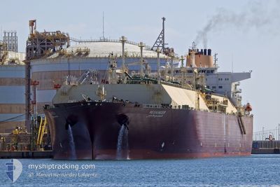
MESAIMEER
Lng Tanker
Current Trip
| Time Travelled | --- |
|---|---|
| Remaining Time | 7 days |
| Distance Travelled | 17008.51 nm |
| Remaining Distance | 2718.08 nm |
| AVG Speed | 15.4 Knots |
| MAX Speed | 18.7 Knots |
| AVG Wind | 11.4 knots |
| MAX Wind | 32.3 knots |
| MIN Temp | 6.4°C / 43.52°F |
| MAX Temp | 28.8°C / 83.84°F |
| Draught | 9.6 m |
| Position Received | 4 d ago |
Current Position
| Longitude | --- |
|---|---|
| Latitude | --- |
| Status | Under way using engine |
| Speed | 15 Knots |
| Course | 46.3° |
| Area | Indian Ocean |
| Station | T-AIS |
| Position Received | 4 d ago |
Info
Information
The current position of MESAIMEER is in Indian Ocean with coordinates -29.87640° / 32.22995° as reported on 2025-12-17 08:43 by AIS to our vessel tracker app. The vessel's current speed is 15 Knots and is heading at the port of RAS LAFFAN. The estimated time of arrival as calculated by MyShipTracking vessel tracking app is 2025-12-29 04:40 LT
The vessel MESAIMEER (IMO: 9337729, MMSI: 538003360) is a Lng Tanker that was built in 2009 ( 16 years old ). It's sailing under the flag of [MH] Marshall Is.
In this page you can find informations about the vessels current position, last detected port calls, and current voyage information. If the vessels is not in coverage by AIS you will find the latest position.
The current position of MESAIMEER is detected by our AIS receivers and we are not responsible for the reliability of the data. The last position was recorded while the vessel was in Coverage by the Ais receivers of our vessel tracking app.
The current draught of MESAIMEER as reported by AIS is 9.6 meters
Weather
| Temperature | 28.1°C / 82.58°F |
|---|---|
| Wind Speed | 4 knots |
| Direction | 65° ENE |
| Pressure | 1009.4 hPa |
| Humidity | 69.8 % |
| Cloud Coverage | 88 % |
Featured Company
Last Port Calls
| Port | Arrival | Departure | Time In Port |
|---|---|---|---|
| 2025-10-19 03:42 | 2025-10-20 05:48 | 1 d |
Most Visited Ports (Last year)
| Port | Arrivals | |
|---|---|---|
| 7 | ||
| 1 | ||
| 1 |
Last Trips
| Origin | Departure | Destination | Arrival | Distance | |
|---|---|---|---|---|---|
| 2025-09-27 14:36 | 2025-10-19 03:42 | 5249.73 nm |
Events
| Time | Event | Details | Position / Dest | Info |
|---|---|---|---|---|
| 2025-12-17 08:46 | Status Changed | Default Under way using engine |
-29.86754 / 32.24060
QARLF
|
Speed: 15 kn Course: 46.3° |
| 2025-12-17 08:43 | Detected in Sea | South African part of the Indian Ocean |
-29.87640 / 32.22995
Indian Ocean
QARLF
|
Speed: 15 kn Course: 46.3° |
| 2025-12-17 08:43 | OUT of Coverage |
-29.87640 / 32.22995
Indian Ocean
QARLF
|
Speed: 15 kn Course: 46.3° |
|
| 2025-12-17 08:41 | Status Changed | Under way using engine Default |
-29.88104 / 32.22439
QARLF
|
Speed: 14.8 kn Course: 46° |
| 2025-12-17 08:31 | IN Coverage |
-29.87640 / 32.22995
Indian Ocean
QARLF
|
Speed: 15 kn Course: 46.3° |
|
| 2025-12-17 07:51 | Status Changed | Default Under way using engine |
-30.02333 / 32.05333
QARLF
|
Speed: 14.8 kn Course: 46.2° |
| 2025-12-17 07:49 | Status Changed | Under way using engine Default |
-30.02865 / 32.04629
QARLF
|
Speed: 14.8 kn Course: 46° |
| 2025-12-15 06:48 | Status Changed | Default Under way using engine |
-35.14333 / 19.97833
QARLF
|
Speed: 16 kn Course: 93° |
| 2025-12-15 06:43 | OUT of Coverage |
-35.14233 / 19.95071
South Atlantic Ocean
QARLF
|
Speed: 16 kn Course: 93° |
|
| 2025-12-15 06:40 | Status Changed | Under way using engine Default |
-35.14171 / 19.93534
QARLF
|
Speed: 16.2 kn Course: 94° |