
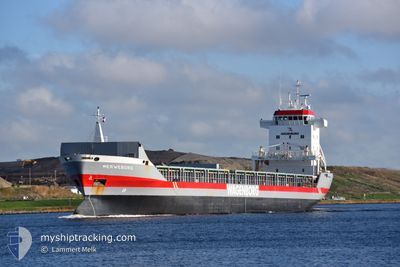
MERWEBORG
General Cargo
Current Trip
| Time Travelled | 14 h, 51 mins |
|---|---|
| Remaining Time | --- |
| Distance Travelled | 137.63 nm |
| Remaining Distance | --- |
| AVG Speed | 10.2 Knots |
| MAX Speed | 11.6 Knots |
| AVG Wind | 16.3 knots |
| MAX Wind | 27.8 knots |
| MIN Temp | 0.1°C / 32.18°F |
| MAX Temp | 2.7°C / 36.86°F |
| Draught | 4.9 m |
| Position Received | 7 h, 55 m ago |
Current Position
| Longitude | --- |
|---|---|
| Latitude | --- |
| Status | Under way using engine |
| Speed | 10.4 Knots |
| Course | 236.4° |
| Area | Gulf of Bothnia |
| Station | T-AIS |
| Position Received | 7 h, 55 m ago |
Info
Information
The current position of MERWEBORG is in Gulf of Bothnia with coordinates 63.53253° / 20.70206° as reported on 2025-03-04 21:11 by AIS to our vessel tracker app. The vessel's current speed is 10.4 Knots and is heading at the port of PARNU. The estimated time of arrival as calculated by MyShipTracking vessel tracking app is 2025-03-06 18:00 LT
The vessel MERWEBORG (IMO: 9142552, MMSI: 244860325) is a General Cargo that was built in 1997 ( 28 years old ). It's sailing under the flag of [NL] Netherlands.
In this page you can find informations about the vessels current position, last detected port calls, and current voyage information. If the vessels is not in coverage by AIS you will find the latest position.
The current position of MERWEBORG is detected by our AIS receivers and we are not responsible for the reliability of the data. The last position was recorded while the vessel was in Coverage by the Ais receivers of our vessel tracking app.
The current draught of MERWEBORG as reported by AIS is 4.9 meters
Weather
| Temperature | 2.7°C / 36.86°F |
|---|---|
| Wind Speed | 18 knots |
| Direction | 261° W |
| Pressure | 987.6 hPa |
| Humidity | 88.8 % |
| Cloud Coverage | 100 % |
Featured Company
Last Port Calls
| Port | Arrival | Departure | Time In Port |
|---|---|---|---|
| 2025-03-01 23:06 | 2025-03-04 16:16 | 2 d | |
| 2025-02-19 14:41 | 2025-02-21 22:29 | 2 d | |
| 2025-01-23 00:13 | 2025-01-30 18:49 | 7 d | |
| 2025-01-15 22:04 | 2025-01-17 18:47 | 1 d | |
| 2025-01-07 15:54 | 2025-01-13 15:19 | 5 d | |
| 2025-01-05 03:55 | 2025-01-05 23:08 | 19 h | |
| 2025-01-02 23:00 | 2025-01-05 03:45 | 2 d |
Most Visited Ports (Last year)
| Port | Arrivals | |
|---|---|---|
| 3 | ||
| 3 | ||
| 2 | ||
| 2 | ||
| 2 | ||
| 2 |
Last Trips
| Origin | Departure | Destination | Arrival | Distance | |
|---|---|---|---|---|---|
| 2025-02-21 22:29 | 2025-03-01 23:06 | 1984.75 nm | |||
| 2025-01-30 18:49 | 2025-02-19 14:41 | 2629.41 nm | |||
| 2025-01-17 18:47 | 2025-01-23 00:13 | 1178.62 nm | |||
| 2025-01-13 15:19 | 2025-01-15 22:04 | 516.81 nm | |||
| 2025-01-05 23:08 | 2025-01-07 15:54 | 229.65 nm | |||
| 2025-01-05 03:45 | 2025-01-05 03:55 | 1.34 nm | |||
| 2024-12-25 15:06 | 2025-01-02 23:00 | 1957.31 nm |
Events
| Time | Event | Details | Position / Dest | Info |
|---|---|---|---|---|
| 2025-03-04 21:18 | Status Changed | Default Under way using engine |
63.51714 / 20.68534
EEPRN
|
Speed: 10.4 kn Course: 236.4° |
| 2025-03-04 21:11 | OUT of Coverage |
63.53253 / 20.70206
Gulf of Bothnia
EEPRN
|
Speed: 10.4 kn Course: 236.4° |
|
| 2025-03-04 21:07 | Change Sea Area | Swedish part of the Gulf of Bothnia Finnish part of the Gulf of Bothnia |
63.53858 / 20.73147
Gulf of Bothnia
EEPRN
|
Speed: 10.9 kn Course: 245.6° |
| 2025-03-04 21:07 | Status Changed | Under way using engine Default |
63.53858 / 20.73147
EEPRN
|
Speed: 10.9 kn Course: 247° |
| 2025-03-04 20:58 | IN Coverage |
63.53858 / 20.73147
Gulf of Bothnia
EEPRN
|
Speed: 10.9 kn Course: 245.6° |
|
| 2025-03-04 14:42 | Status Changed | Default Under way using engine |
63.93658 / 22.94429
EEPRN
|
Speed: 11.4 kn Course: 341.9° |
| 2025-03-04 14:35 | OUT of Coverage |
63.92051 / 22.96860
Gulf of Bothnia
EEPRN
|
Speed: 11.4 kn Course: 341.9° |
|
| 2025-03-04 14:29 | Status Changed | Under way using engine Moored |
63.90303 / 22.98239
EEPRN
|
Speed: 11.5 kn Course: 340.5° |
| 2025-03-04 14:16 | PORT DEPARTURE |
|
63.86771 / 23.01344
EEPRN
|
Speed: 7 kn Course: 321° |
| 2025-03-04 14:12 | START Moving |
63.86356 / 23.02583
[FI] KOKKOLA
|
Speed: 4.7 kn Course: 302° |