
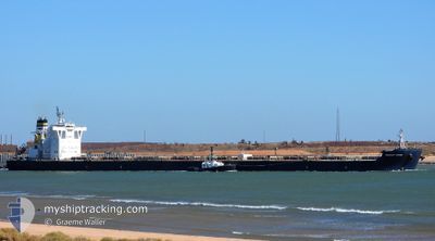
MERCHANT MARINER
Bulk Carrier
Current Trip
| Time Travelled | 2 days |
|---|---|
| Remaining Time | --- |
| Distance Travelled | 292.48 nm |
| Remaining Distance | --- |
| AVG Speed | 10 Knots |
| MAX Speed | 14.8 Knots |
| AVG Wind | 11.4 knots |
| MAX Wind | 20.8 knots |
| MIN Temp | 14.3°C / 57.74°F |
| MAX Temp | 24.3°C / 75.74°F |
| Draught | 18.2 m |
| Position Received | 21 d ago |
Current Position
| Longitude | 116.63946° |
|---|---|
| Latitude | -17.21952° |
| Status | Under way using engine |
| Speed | 10.1 Knots |
| Course | 351.5° |
| Area | Indian Ocean |
| Station | T-AIS |
| Position Received | 21 d ago |
Info
Information
The current position of MERCHANT MARINER is in Indian Ocean with coordinates -17.21952° / 116.63946° as reported on 2024-04-15 01:57 by AIS to our vessel tracker app. The vessel's current speed is 10.1 Knots and is heading at the port of QINGDAO. The estimated time of arrival as calculated by MyShipTracking vessel tracking app is 2024-04-30 08:00 LT
The vessel MERCHANT MARINER (IMO: 9522647, MMSI: 241721000) is a Bulk Carrier that was built in 2010 ( 14 years old ). It's sailing under the flag of [GR] Greece.
In this page you can find informations about the vessels current position, last detected port calls, and current voyage information. If the vessels is not in coverage by AIS you will find the latest position.
The current position of MERCHANT MARINER is detected by our AIS receivers and we are not responsible for the reliability of the data. The last position was recorded while the vessel was in Coverage by the Ais receivers of our vessel tracking app.
The current draught of MERCHANT MARINER as reported by AIS is 18.2 meters
Weather
| Temperature | 19.2°C / 66.56°F |
|---|---|
| Wind Speed | 6 knots |
| Direction | 312° NW |
| Pressure | 1013.2 hPa |
| Humidity | 84.8 % |
| Cloud Coverage | 74 % |
Featured Company
Most Visited Ports (Last year)
| Port | Arrivals | |
|---|---|---|
| 2 | ||
| 2 | ||
| 2 | ||
| 1 | ||
| 1 | ||
| 1 |
Events
| Time | Event | Details | Position / Dest | Info |
|---|---|---|---|---|
| 2024-05-06 02:52 | STOP Moving | 9.4 nm, East of ZHANGJIAGANG |
32.02784 / 120.58601
CN QDG
|
Speed: 0.3 kn Course: 310° |
| 2024-05-05 23:52 | START Moving | 4.2 nm, South East of NANTONG |
31.90422 / 120.88769
CN QDG
|
Speed: 5.4 kn Course: 329° |
| 2024-05-05 06:56 | STOP Moving | 4.76 nm, South East of NANTONG |
31.89786 / 120.89621
CN QDG
|
Speed: 0.2 kn Course: 332° |
| 2024-05-04 04:20 | START Moving | 1.65 nm, East of NINGBO |
29.95268 / 121.87694
CN QDG
|
Speed: 4.6 kn Course: 61° |
| 2024-05-03 15:56 | STOP Moving | 1.93 nm, East of NINGBO |
29.95235 / 121.88271
CN QDG
|
Speed: 0.2 kn Course: 268° |
| 2024-05-03 15:36 | PORT DEPARTURE |
|
29.94459 / 121.88147
CN QDG
|
Speed: 3.5 kn Course: 331° |
| 2024-05-03 15:32 | START Moving |
29.93948 / 121.88214
[CN] NINGBO
|
Speed: 3.5 kn Course: 331° |
|
| 2024-05-01 03:40 | PORT ARRIVAL |
|
29.93794 / 121.88399
[CN] NINGBO
|
Speed: Course: 269° |
| 2024-05-01 03:08 | STOP Moving | 1.99 nm, East of NINGBO |
29.93813 / 121.88419
CN QDG
|
Speed: 0.2 kn Course: 271° |
| 2024-04-30 21:04 | START Moving | 21.07 nm, South East of ZHOUSHAN |
29.73636 / 122.50517
CN QDG
|
Speed: 4 kn Course: 113° |