
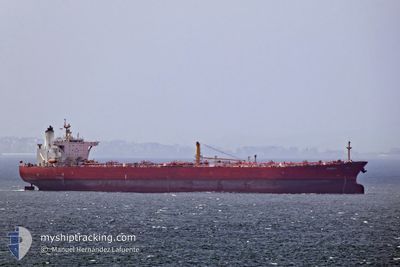
LUCIA
Crude Oil Tanker
Current Trip
| Trip Time | 31 days |
|---|---|
| Trip Distance | 9214.32 nm |
| AVG Speed | 12.7 Knots |
| MAX Speed | 12.7 Knots |
| Draught | 8.5 m |
| AVG Wind | 11.1 knots |
| MAX Wind | 29 knots |
| MIN Temp | 2.9°C / 37.22°F |
| MAX Temp | 29.8°C / 85.64°F |
| Position Received | 1 d ago |
Current Position
| Longitude | 29.33337° |
|---|---|
| Latitude | 60.02590° |
| Status | Under way using engine |
| Speed | 4.4 Knots |
| Course | 88° |
| Area | Gulf of Finland |
| Station | T-AIS |
| Position Received | 1 d ago |
Info
Information
The current position of LUCIA is in Gulf of Finland with coordinates 60.02590° / 29.33337° as reported on 2024-04-28 01:49 by AIS to our vessel tracker app. The vessel's current speed is 4.4 Knots and is currently inside the port of ST PETERSBURG.
The vessel LUCIA (IMO: 9250892, MMSI: 574005180) is a Crude Oil Tanker that was built in 2003 ( 21 years old ). It's sailing under the flag of [VN] Vietnam.
In this page you can find informations about the vessels current position, last detected port calls, and current voyage information. If the vessels is not in coverage by AIS you will find the latest position.
The current position of LUCIA is detected by our AIS receivers and we are not responsible for the reliability of the data. The last position was recorded while the vessel was in Coverage by the Ais receivers of our vessel tracking app.
The current draught of LUCIA as reported by AIS is 8.5 meters
Weather
| Temperature | 6°C / 42.8°F |
|---|---|
| Wind Speed | --- |
| Direction | 153° SSE |
| Pressure | 1028.9 hPa |
| Humidity | 67.3 % |
| Cloud Coverage | 93 % |
Featured Company
Last Port Calls
| Port | Arrival | Departure | Time In Port |
|---|---|---|---|
| 2024-04-28 07:20 | |||
| 2024-04-11 04:53 | 2024-04-11 14:19 | 9 h | |
| 2024-03-27 20:11 | |||
| 2024-03-13 02:11 | |||
| 2024-02-22 05:42 | 2024-02-22 14:39 | 8 h | |
| 2024-02-01 20:13 |
Most Visited Ports (Last year)
| Port | Arrivals | |
|---|---|---|
| 7 | ||
| 3 | ||
| 2 | ||
| 2 | ||
| 1 |
Last Trips
| Origin | Departure | Destination | Arrival | Distance | |
|---|---|---|---|---|---|
| 2024-03-28 01:41 | 2024-04-28 10:20 | 9214.32 nm | |||
| 2024-03-28 01:41 | 2024-04-11 06:53 | 4360.83 nm | |||
| 2024-02-01 23:13 | 2024-02-22 07:42 | 4775.06 nm |
Events
| Time | Event | Details | Position / Dest | Info |
|---|---|---|---|---|
| 2024-04-28 07:20 | PORT ARRIVAL |
|
59.88366 / 30.16675
[RU] ST PETERSBURG
|
Speed: 4.8 kn Course: 89° |
| 2024-04-28 01:55 | Status Changed | Default Under way using engine |
60.02634 / 29.34959
SANT_PETERBURG
|
Speed: 4.4 kn Course: 88° |
| 2024-04-28 01:49 | OUT of Coverage |
60.02590 / 29.33337
Gulf of Finland
|
Speed: 4.4 kn Course: 82.2° |
|
| 2024-04-28 01:12 | START Moving | 14.76 nm, North West of KRONSHTADT |
60.10573 / 29.32321
SANT_PETERBURG
|
Speed: 3.6 kn Course: 183° |
| 2024-04-28 01:03 | Status Changed | Under way using engine At anchor |
60.10934 / 29.32882
SANT_PETERBURG
|
Speed: 0.8 kn Course: 329° |
| 2024-04-28 00:48 | Status Changed | At anchor Default |
60.10637 / 29.33010
SANT_PETERBURG
|
Speed: 0.1 kn Course: 7° |
| 2024-04-28 00:20 | Status Changed | Default At anchor |
60.10612 / 29.32928
SANT_PETERBURG
|
Speed: Course: 4° |
| 2024-04-28 00:17 | Status Changed | At anchor Default |
60.10614 / 29.32936
SANT_PETERBURG
|
Speed: 0.1 kn Course: 0° |
| 2024-04-28 00:08 | Status Changed | Default At anchor |
60.10621 / 29.32961
SANT_PETERBURG
|
Speed: Course: 355° |
| 2024-04-28 00:02 | Status Changed | At anchor Default |
60.10623 / 29.32971
SANT_PETERBURG
|
Speed: Course: 357° |