
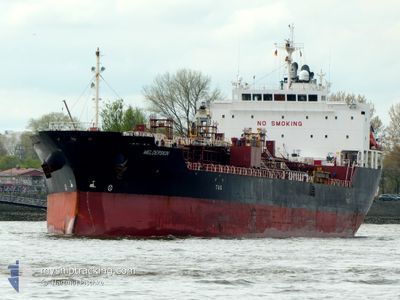
MELDERSKIN
Tanker
Current Trip
BALBO PANAMA
| Time Travelled | 14 days |
|---|---|
| Remaining Time | --- |
| Distance Travelled | 3598.81 nm |
| Remaining Distance | --- |
| AVG Speed | 11 Knots |
| MAX Speed | 15.5 Knots |
| AVG Wind | 12.9 knots |
| MAX Wind | 29.6 knots |
| MIN Temp | 19.7°C / 67.46°F |
| MAX Temp | 28.4°C / 83.12°F |
| Draught | 9.8 m |
| Position Received | 5 d ago |
Current Position
| Longitude | --- |
|---|---|
| Latitude | --- |
| Status | Under way using engine |
| Speed | 12 Knots |
| Course | 54° |
| Area | Caribbean Sea |
| Station | T-AIS |
| Position Received | 5 d ago |
Info
Information
The current position of MELDERSKIN is in Caribbean Sea with coordinates 17.06192° / -61.36509° as reported on 2025-02-25 20:13 by AIS to our vessel tracker app. The vessel's current speed is 12 Knots
The vessel MELDERSKIN (IMO: 9737577, MMSI: 257359000) is a Tanker It's sailing under the flag of [NO] Norway.
In this page you can find informations about the vessels current position, last detected port calls, and current voyage information. If the vessels is not in coverage by AIS you will find the latest position.
The current position of MELDERSKIN is detected by our AIS receivers and we are not responsible for the reliability of the data. The last position was recorded while the vessel was in Coverage by the Ais receivers of our vessel tracking app.
The current draught of MELDERSKIN as reported by AIS is 9.8 meters
Weather
| Temperature | 19.8°C / 67.64°F |
|---|---|
| Wind Speed | 13 knots |
| Direction | 92° E |
| Pressure | 1027 hPa |
| Humidity | 73.8 % |
| Cloud Coverage | 100 % |
Featured Company
Last Port Calls
| Port | Arrival | Departure | Time In Port |
|---|---|---|---|
| 2025-02-12 18:39 | 2025-02-16 02:39 | 3 d | |
| 2025-02-08 07:37 | 2025-02-08 14:13 | 6 h | |
| 2025-02-03 18:27 | 2025-02-06 00:12 | 2 d | |
| 2025-01-26 01:03 | 2025-01-28 21:43 | 2 d |
Most Visited Ports (Last year)
| Port | Arrivals | |
|---|---|---|
| 2 | ||
| 1 | ||
| 1 | ||
| 1 | ||
| 1 | ||
| 1 |
Last Trips
| Origin | Departure | Destination | Arrival | Distance | |
|---|---|---|---|---|---|
| 2025-02-08 14:13 | 2025-02-12 18:39 | 1010.84 nm | |||
| 2025-02-06 00:12 | 2025-02-08 07:37 | 691.38 nm | |||
| 2025-01-28 21:43 | 2025-02-03 18:27 | 855.16 nm | |||
| 2024-12-15 00:48 | 2025-01-26 01:03 | 9756.97 nm |
Events
| Time | Event | Details | Position / Dest | Info |
|---|---|---|---|---|
| 2025-02-25 20:15 | Status Changed | Default Under way using engine |
17.06723 / -61.35764
BALBO PANAMA
|
Speed: 12 kn Course: 54° |
| 2025-02-25 20:13 | Status Changed | Under way using engine Default |
17.06192 / -61.36509
BALBO PANAMA
|
Speed: 11.9 kn Course: 53° |
| 2025-02-25 20:13 | OUT of Coverage |
17.06192 / -61.36509
Caribbean Sea
|
Speed: 12 kn Course: 54° |
|
| 2025-02-25 19:46 | Status Changed | Default Under way using engine |
17.01113 / -61.43903
BALBO PANAMA
|
Speed: 11.5 kn Course: 56° |
| 2025-02-25 17:07 | Change Sea Area | Antigua and Barbuda part of the Caribbean Sea Montserrat part of the Caribbean Sea |
16.74072 / -61.85540
Caribbean Sea
|
Speed: 11 kn Course: 56° |
| 2025-02-25 16:15 | Status Changed | Under way using engine Default |
16.63488 / -61.97994
BALBO PANAMA
|
Speed: 10.9 kn Course: 48° |
| 2025-02-25 16:11 | Status Changed | Default Under way using engine |
16.62573 / -61.99043
BALBO PANAMA
|
Speed: 10.8 kn Course: 48.6° |
| 2025-02-25 14:46 | Status Changed | Under way using engine Default |
16.47247 / -62.20145
BALBO PANAMA
|
Speed: 11.6 kn Course: 73° |
| 2025-02-25 14:46 | IN Coverage |
16.47247 / -62.20145
Caribbean Sea
|
Speed: 11.1 kn Course: 66.5° |
|
| 2025-02-25 12:44 | OUT of Coverage |
16.34874 / -62.58636
Caribbean Sea
|
Speed: 11 kn Course: 70° |