
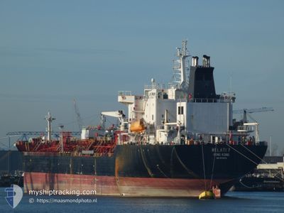
MELATI 7
Chemical Tanker
Current Trip
| Time Travelled | 29 days |
|---|---|
| Remaining Time | 1 day |
| Distance Travelled | 6546.38 nm |
| Remaining Distance | 331.27 nm |
| AVG Speed | 11.2 Knots |
| MAX Speed | 11.2 Knots |
| AVG Wind | 9.4 knots |
| MAX Wind | 27.7 knots |
| MIN Temp | 17.7°C / 63.86°F |
| MAX Temp | 31.3°C / 88.34°F |
| Draught | 10.4 m |
| Position Received | 1 m ago |
Current Position
| Longitude | 8.26710° |
|---|---|
| Latitude | 38.45724° |
| Status | Under way using engine |
| Speed | 12 Knots |
| Course | 301.9° |
| Area | Mediterranean Sea - Western Basin |
| Station | T-AIS |
| Position Received | 1 m ago |
Info
Information
The current position of MELATI 7 is in Mediterranean Sea - Western Basin with coordinates 38.45724° / 8.26710° as reported on 2024-05-13 05:13 by AIS to our vessel tracker app. The vessel's current speed is 12 Knots and is heading at the port of BARCELONA. The estimated time of arrival as calculated by MyShipTracking vessel tracking app is 2024-05-14 11:13 LT
The vessel MELATI 7 (IMO: 9172272, MMSI: 477293800) is a Chemical Tanker that was built in 2000 ( 24 years old ). It's sailing under the flag of [HK] Hong Kong.
In this page you can find informations about the vessels current position, last detected port calls, and current voyage information. If the vessels is not in coverage by AIS you will find the latest position.
The current position of MELATI 7 is detected by our AIS receivers and we are not responsible for the reliability of the data. The last position was recorded while the vessel was in Coverage by the Ais receivers of our vessel tracking app.
The current draught of MELATI 7 as reported by AIS is 10.4 meters
Weather
| Temperature | 18.3°C / 64.94°F |
|---|---|
| Wind Speed | 16 knots |
| Direction | 86° E |
| Pressure | 1014.2 hPa |
| Humidity | 83.1 % |
| Cloud Coverage | 19 % |
Featured Company
Last Port Calls
| Port | Arrival | Departure | Time In Port |
|---|---|---|---|
| 2024-05-08 07:53 | 2024-05-08 16:27 | 8 h | |
| 2024-04-12 01:25 | 2024-04-14 05:16 | 2 d | |
| 2024-04-03 18:25 | 2024-04-05 07:09 | 1 d | |
| 2024-03-21 20:59 |
Most Visited Ports (Last year)
| Port | Arrivals | |
|---|---|---|
| 6 | ||
| 3 | ||
| 2 | ||
| 2 | ||
| 2 | ||
| 1 |
Last Trips
| Origin | Departure | Destination | Arrival | Distance | |
|---|---|---|---|---|---|
| 2024-04-14 05:16 | 2024-05-08 07:53 | 5182.59 nm | |||
| 2024-04-05 07:09 | 2024-04-12 01:25 | 1597.10 nm | |||
| 2024-03-21 20:59 | 2024-04-03 18:25 | 3234.94 nm |
Events
| Time | Event | Details | Position / Dest | Info |
|---|---|---|---|---|
| 2024-05-13 04:49 | Status Changed | Under way using engine Default |
38.41534 / 8.35493
ES BCN
|
Speed: 11.9 kn Course: 299° |
| 2024-05-13 04:27 | Status Changed | Default Under way using engine |
38.37977 / 8.43398
ES BCN
|
Speed: 12 kn Course: 294° |
| 2024-05-13 04:04 | Detected in Sea | Italian part of the Mediterranean Sea - Western Basin |
38.35077 / 8.52288
Mediterranean Sea - Western Basin
ES BCN
|
Speed: 12.1 kn Course: 290° |
| 2024-05-13 04:04 | Status Changed | Under way using engine Default |
38.35077 / 8.52288
ES BCN
|
Speed: 12.1 kn Course: 291° |
| 2024-05-13 03:51 | IN Coverage |
38.35077 / 8.52288
Mediterranean Sea - Western Basin
ES BCN
|
Speed: 12.1 kn Course: 290° |
|
| 2024-05-13 00:35 | Status Changed | Default Under way using engine |
38.07319 / 9.31921
ES BCN
|
Speed: 12.1 kn Course: 293° |
| 2024-05-13 00:24 | OUT of Coverage |
38.05808 / 9.36212
Mediterranean Sea - Western Basin
ES BCN
|
Speed: 12.1 kn Course: 293° |
|
| 2024-05-12 23:50 | Status Changed | Under way using engine Default |
38.01094 / 9.49330
ES BCN
|
Speed: 12.3 kn Course: 295° |
| 2024-05-12 23:43 | Status Changed | Default Under way using engine |
38.00142 / 9.51942
ES BCN
|
Speed: 12.3 kn Course: 292.9° |
| 2024-05-12 23:27 | Status Changed | Under way using engine Default |
37.97791 / 9.58418
ES BCN
|
Speed: 12.2 kn Course: 293° |