
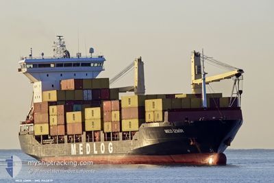
MED IZMIR
Container Ship
Current Trip
| Time Travelled | 2 days |
|---|---|
| Remaining Time | --- |
| Distance Travelled | 503.78 nm |
| Remaining Distance | --- |
| AVG Speed | 10.9 Knots |
| MAX Speed | 12.8 Knots |
| AVG Wind | 12 knots |
| MAX Wind | 23.3 knots |
| MIN Temp | 12.7°C / 54.86°F |
| MAX Temp | 19.2°C / 66.56°F |
| Draught | 8 m |
| Position Received | 1 d ago |
Current Position
| Longitude | --- |
|---|---|
| Latitude | --- |
| Status | Under way using engine |
| Speed | 12.6 Knots |
| Course | 138.9° |
| Area | Mediterranean Sea - Eastern Basin |
| Station | T-AIS |
| Position Received | 1 d ago |
Info
Information
The current position of MED IZMIR is in Mediterranean Sea - Eastern Basin with coordinates 34.99258° / 34.21290° as reported on 2025-12-09 06:39 by AIS to our vessel tracker app. The vessel's current speed is 12.6 Knots
The vessel MED IZMIR (IMO: 9143879, MMSI: 271051138) is a Container Ship that was built in 1998 ( 27 years old ). It's sailing under the flag of [TR] Turkey.
In this page you can find informations about the vessels current position, last detected port calls, and current voyage information. If the vessels is not in coverage by AIS you will find the latest position.
The current position of MED IZMIR is detected by our AIS receivers and we are not responsible for the reliability of the data. The last position was recorded while the vessel was in Coverage by the Ais receivers of our vessel tracking app.
The current draught of MED IZMIR as reported by AIS is 8 meters
Weather
| Temperature | 18.8°C / 65.84°F |
|---|---|
| Wind Speed | 14 knots |
| Direction | 318° NW |
| Pressure | 1017.9 hPa |
| Humidity | 68.7 % |
| Cloud Coverage | 7 % |
Featured Company
Last Port Calls
| Port | Arrival | Departure | Time In Port |
|---|---|---|---|
| 2025-12-08 00:53 | 2025-12-08 09:13 | 8 h | |
| 2025-12-03 11:34 | 2025-12-05 10:17 | 1 d | |
| 2025-11-29 17:26 | 2025-11-30 01:06 | 7 h | |
| 2025-11-28 13:27 | 2025-11-29 08:55 | 19 h | |
| 2025-11-26 07:14 | 2025-11-26 12:50 | 5 h | |
| 2025-11-24 17:41 | 2025-11-25 11:44 | 18 h | |
| 2025-11-23 16:24 | 2025-11-24 08:12 | 15 h | |
| 2025-11-21 09:52 | 2025-11-22 03:37 | 17 h | |
| 2025-11-19 08:23 | 2025-11-19 15:32 | 7 h | |
| 2025-11-18 07:56 | 2025-11-19 00:00 | 16 h |
Most Visited Ports (Last year)
| Port | Arrivals | |
|---|---|---|
| 18 | ||
| 13 | ||
| 10 | ||
| 10 | ||
| 9 | ||
| 9 |
Last Trips
| Origin | Departure | Destination | Arrival | Distance | |
|---|---|---|---|---|---|
| 2025-12-05 10:17 | 2025-12-08 00:53 | 695.93 nm | |||
| 2025-11-30 01:06 | 2025-12-03 11:34 | 692.34 nm | |||
| 2025-11-29 08:55 | 2025-11-29 17:26 | 68.54 nm | |||
| 2025-11-26 12:50 | 2025-11-28 13:27 | 138.24 nm | |||
| 2025-11-25 11:44 | 2025-11-26 07:14 | 201.25 nm | |||
| 2025-11-24 08:12 | 2025-11-24 17:41 | 105.44 nm | |||
| 2025-11-22 03:37 | 2025-11-23 16:24 | 438.09 nm | |||
| 2025-11-19 15:32 | 2025-11-21 09:52 | 402.80 nm | |||
| 2025-11-19 00:00 | 2025-11-19 08:23 | 68.09 nm | |||
| 2025-11-15 21:40 | 2025-11-18 07:56 | 659.72 nm |
Events
| Time | Event | Details | Position / Dest | Info |
|---|---|---|---|---|
| 2025-12-10 11:33 | STOP Moving | 5.56 nm, North of EL DEKHEILA |
31.23279 / 29.76615
EGALY
|
Speed: 0.3 kn Course: -1° |
| 2025-12-09 06:43 | Status Changed | Default Under way using engine |
34.98102 / 34.22467
EGALY
|
Speed: 12.6 kn Course: 138.9° |
| 2025-12-09 06:39 | OUT of Coverage |
34.99258 / 34.21290
Mediterranean Sea - Eastern Basin
EGALY
|
Speed: 12.6 kn Course: 138.9° |
|
| 2025-12-09 05:17 | Status Changed | Under way using engine At anchor |
35.15066 / 33.95745
EGALY
|
Speed: 4.4 kn Course: 92° |
| 2025-12-09 05:17 | START Moving | 1.22 nm, North East of FAMAGUSTA |
35.15066 / 33.95745
EGALY
|
Speed: 5.2 kn Course: 88.7° |
| 2025-12-09 03:41 | Status Changed | At anchor Default |
35.15190 / 33.95468
EGALY
|
Speed: Course: -1° |
| 2025-12-09 03:32 | Status Changed | Default At anchor |
35.15167 / 33.95334
EGALY
|
Speed: Course: 511° |
| 2025-12-09 03:11 | Status Changed | At anchor Default |
35.15199 / 33.95477
EGALY
|
Speed: Course: 128° |
| 2025-12-09 02:50 | Status Changed | Default At anchor |
35.15208 / 33.95481
EGALY
|
Speed: Course: 511° |
| 2025-12-09 01:35 | Status Changed | At anchor Default |
35.15239 / 33.95509
EGALY
|
Speed: Course: -1° |