
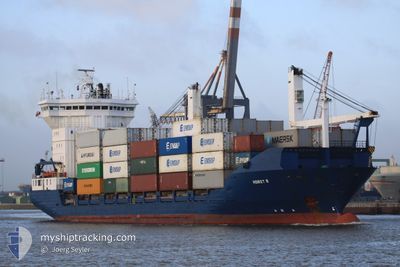
MC HUNTER
Container Ship
Current Trip
| Trip Time | 3 days |
|---|---|
| Trip Distance | 524.05 nm |
| AVG Speed | 9.5 Knots |
| MAX Speed | 11.1 Knots |
| Draught | 6.7 m |
| AVG Wind | 7 knots |
| MAX Wind | 15.2 knots |
| MIN Temp | 25.9°C / 78.62°F |
| MAX Temp | 31.6°C / 88.88°F |
| Position Received | 3 d ago |
Current Position
| Longitude | 120.70238° |
|---|---|
| Latitude | 14.42163° |
| Status | Under way using engine |
| Speed | 10 Knots |
| Course | 224.1° |
| Area | South China Sea |
| Station | T-AIS |
| Position Received | 3 d ago |
Info
Information
The current position of MC HUNTER is in South China Sea with coordinates 14.42163° / 120.70238° as reported on 2024-05-30 05:23 by AIS to our vessel tracker app. The vessel's current speed is 10 Knots and is currently inside the port of CAGAYAN DE ORO.
The vessel MC HUNTER (IMO: 9065297, MMSI: 548321500) is a Container Ship that was built in 1994 ( 30 years old ). It's sailing under the flag of [PH] Philippines.
In this page you can find informations about the vessels current position, last detected port calls, and current voyage information. If the vessels is not in coverage by AIS you will find the latest position.
The current position of MC HUNTER is detected by our AIS receivers and we are not responsible for the reliability of the data. The last position was recorded while the vessel was in Coverage by the Ais receivers of our vessel tracking app.
The current draught of MC HUNTER as reported by AIS is 6.7 meters
Weather
| Temperature | 25.6°C / 78.08°F |
|---|---|
| Wind Speed | 4 knots |
| Direction | 151° SSE |
| Pressure | 1010.4 hPa |
| Humidity | 82.6 % |
| Cloud Coverage | 100 % |
Featured Company
Last Port Calls
| Port | Arrival | Departure | Time In Port |
|---|---|---|---|
| 2024-06-02 15:08 | |||
| 2024-05-29 18:37 | 2024-05-30 11:35 | 16 h | |
| 2024-05-22 17:52 | 2024-05-23 09:24 | 15 h | |
| 2024-05-19 05:52 | 2024-05-19 20:00 | 14 h | |
| 2024-05-15 17:12 | 2024-05-16 11:36 | 18 h | |
| 2024-05-11 09:12 | 2024-05-12 04:57 | 19 h | |
| 2024-05-08 15:11 | 2024-05-09 12:16 | 21 h | |
| 2024-05-07 06:55 | 2024-05-08 00:37 | 17 h | |
| 2024-05-04 19:11 | 2024-05-05 15:02 | 19 h | |
| 2024-05-01 13:57 | 2024-05-02 13:29 | 23 h |
Most Visited Ports (Last year)
| Port | Arrivals | |
|---|---|---|
| 42 | ||
| 21 | ||
| 15 | ||
| 13 |
Last Trips
| Origin | Departure | Destination | Arrival | Distance | |
|---|---|---|---|---|---|
| 2024-05-30 11:35 | 2024-06-02 15:08 | 524.05 nm | |||
| 2024-05-23 09:24 | 2024-05-29 18:37 | 508.93 nm | |||
| 2024-05-19 20:00 | 2024-05-22 17:52 | 528.26 nm | |||
| 2024-05-16 11:36 | 2024-05-19 05:52 | 505.31 nm | |||
| 2024-05-12 04:57 | 2024-05-15 17:12 | 514.79 nm | |||
| 2024-05-09 12:16 | 2024-05-11 09:12 | 343.58 nm | |||
| 2024-05-08 00:37 | 2024-05-08 15:11 | 62.37 nm | |||
| 2024-05-05 15:02 | 2024-05-07 06:55 | 348.22 nm | |||
| 2024-05-02 13:29 | 2024-05-04 19:11 | 332.44 nm | |||
| 2024-04-28 20:50 | 2024-05-01 13:57 | 397.90 nm |
Events
| Time | Event | Details | Position / Dest | Info |
|---|---|---|---|---|
| 2024-06-02 07:14 | STOP Moving |
8.49475 / 124.66349
[PH] CAGAYAN DE ORO
|
Speed: 0.3 kn Course: 179° |
|
| 2024-06-02 07:08 | PORT ARRIVAL |
|
8.49481 / 124.66369
[PH] CAGAYAN DE ORO
|
Speed: 1.3 kn Course: 191° |
| 2024-06-01 17:42 | START Moving | 3.46 nm, South West of CEBU |
10.24985 / 123.88721
TALISAY CEBU
|
Speed: 7.5 kn Course: 129° |
| 2024-05-31 21:57 | STOP Moving | 4.15 nm, South West of CEBU |
10.24989 / 123.86986
TALISAY CEBU
|
Speed: Course: 130° |
| 2024-05-30 05:30 | Status Changed | Default Under way using engine |
14.40857 / 120.68927
TALISAY CEBU
|
Speed: 10 kn Course: 224.1° |
| 2024-05-30 05:23 | Status Changed | Under way using engine Default |
14.42163 / 120.70238
TALISAY CEBU
|
Speed: 10 kn Course: 224° |
| 2024-05-30 05:23 | OUT of Coverage |
14.42163 / 120.70238
South China Sea
TALISAY CEBU
|
Speed: 10 kn Course: 224.1° |
|
| 2024-05-30 04:30 | Status Changed | Default Under way using engine |
14.52344 / 120.81224
TALISAY CEBU
|
Speed: 9.9 kn Course: 231.7° |
| 2024-05-30 04:26 | Status Changed | Under way using engine Default |
14.52963 / 120.82033
TALISAY CEBU
|
Speed: 9.8 kn Course: 233° |
| 2024-05-30 04:18 | Status Changed | Default Under way using engine |
14.54401 / 120.83933
TALISAY CEBU
|
Speed: 9.8 kn Course: 225.8° |