
MAYERA
Cargo
Current Trip
AALTER
| Time Travelled | 4 days |
|---|---|
| Remaining Time | --- |
| Distance Travelled | 117.69 nm |
| Remaining Distance | --- |
| AVG Speed | 6.1 Knots |
| MAX Speed | 7.1 Knots |
| AVG Wind | 12.4 knots |
| MAX Wind | 15 knots |
| MIN Temp | 7.2°C / 44.96°F |
| MAX Temp | 14.1°C / 57.38°F |
| Draught | 2.3 m |
| Position Received | 1 d ago |
Current Position
| Longitude | --- |
|---|---|
| Latitude | --- |
| Status | Under way using engine |
| Speed | 0.1 Knots |
| Course | --- |
| Area | North Sea |
| Station | T-AIS |
| Position Received | 1 d ago |
Info
Information
The current position of MAYERA is in North Sea with coordinates 52.27458° / 7.61128° as reported on 2025-12-11 18:12 by AIS to our vessel tracker app. The vessel's current speed is 0.1 Knots
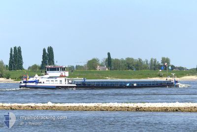
The vessel MAYERA (MMSI: 211147040) is a Cargo It's sailing under the flag of [DE] Germany.
In this page you can find informations about the vessels current position, last detected port calls, and current voyage information. If the vessels is not in coverage by AIS you will find the latest position.
The current position of MAYERA is detected by our AIS receivers and we are not responsible for the reliability of the data. The last position was recorded while the vessel was in Coverage by the Ais receivers of our vessel tracking app.
The current draught of MAYERA as reported by AIS is 2.3 meters
Weather
| Temperature | 6.4°C / 43.52°F |
|---|---|
| Wind Speed | 6 knots |
| Direction | 204° SSW |
| Pressure | 1021.6 hPa |
| Humidity | 92.7 % |
| Cloud Coverage | 51 % |
Featured Company
Last Port Calls
| Port | Arrival | Departure | Time In Port |
|---|---|---|---|
| 2025-12-08 10:45 | 2025-12-08 11:04 | 19 m | |
| 2025-12-05 16:25 | 2025-12-07 16:25 | 2 d | |
| 2025-11-30 18:17 | 2025-12-05 12:51 | 4 d | |
| 2025-11-29 16:00 | 2025-11-30 10:35 | 18 h | |
| 2025-11-28 08:02 | 2025-11-29 09:20 | 1 d | |
| 2025-11-27 15:20 | 2025-11-27 16:35 | 1 h | |
| 2025-11-27 13:23 | 2025-11-27 15:06 | 1 h | |
| 2025-11-16 08:25 | 2025-11-18 06:48 | 1 d | |
| 2025-11-15 22:07 | 2025-11-16 06:09 | 8 h | |
| 2025-11-14 13:11 | 2025-11-15 12:45 | 23 h |
Last Trips
| Origin | Departure | Destination | Arrival | Distance | |
|---|---|---|---|---|---|
| 2025-12-07 16:25 | 2025-12-08 10:45 | 58.77 nm | |||
| 2025-12-05 12:51 | 2025-12-05 16:25 | 8.52 nm | |||
| 2025-11-30 10:35 | 2025-11-30 18:17 | 65.10 nm | |||
| 2025-11-29 09:20 | 2025-11-29 16:00 | 64.89 nm | |||
| 2025-11-27 16:35 | 2025-11-28 08:02 | 8.31 nm | |||
| 2025-11-27 15:06 | 2025-11-27 15:20 | 0.17 nm | |||
| 2025-11-18 06:48 | 2025-11-27 13:23 | 192.94 nm | |||
| 2025-11-16 06:09 | 2025-11-16 08:25 | 12.97 nm | |||
| 2025-11-15 12:45 | 2025-11-15 22:07 | 93.52 nm | |||
| 2025-11-12 14:48 | 2025-11-14 13:11 | 41.04 nm |
Events
| Time | Event | Details | Position / Dest | Info |
|---|---|---|---|---|
| 2025-12-11 18:12 | OUT of Coverage |
52.27458 / 7.61128
North Sea
AALTER
|
Speed: 0.1 kn Course: 159.9° |
|
| 2025-12-11 17:41 | Status Changed | Under way using engine Default |
52.27459 / 7.61125
AALTER
|
Speed: 0.1 kn Course: -1° |
| 2025-12-11 17:31 | Status Changed | Default Under way using engine |
52.27458 / 7.61127
AALTER
|
Speed: 0.1 kn Course: 511° |
| 2025-12-11 16:01 | IN Coverage |
52.27459 / 7.61129
North Sea
AALTER
|
Speed: 0.1 kn Course: 171.9° |
|
| 2025-12-09 13:52 | OUT of Coverage |
51.64870 / 6.78043
North Sea
AALTER
|
Speed: 1.3 kn Course: 83.4° |
|
| 2025-12-09 13:42 | IN Coverage |
51.64863 / 6.78008
North Sea
AALTER
|
Speed: Course: 70.9° |
|
| 2025-12-09 12:39 | OUT of Coverage |
51.64296 / 6.71851
North Sea
AALTER
|
Speed: 5.6 kn Course: 84° |
|
| 2025-12-09 11:54 | START Moving | 1.6 nm, South East of WESEL |
51.62792 / 6.61904
AALTER
|
Speed: 3.1 kn Course: 110.9° |
| 2025-12-09 11:12 | IN Coverage |
51.63051 / 6.61137
North Sea
AALTER
|
Speed: 0.5 kn Course: 278.2° |
|
| 2025-12-09 09:05 | OUT of Coverage |
51.63263 / 6.60755
North Sea
AALTER
|
Speed: 2.9 kn Course: 143.9° |